Lava Beds National Monument
The earth here is hollow. Beneath the sagebrush and juniper of northeastern California, nearly 700 caves wind through solidified rivers of basalt, a subterranean maze created when molten rock drained from cooling lava tubes tens of thousands of years ago. Lava Beds National Monument preserves not only this geological wonder but also the haunting memory of the Modoc War, when 53 warriors held off U.S. Army forces that outnumbered them ten to one for months, using these same caves and crevices as fortress walls.
Fire Written in Stone
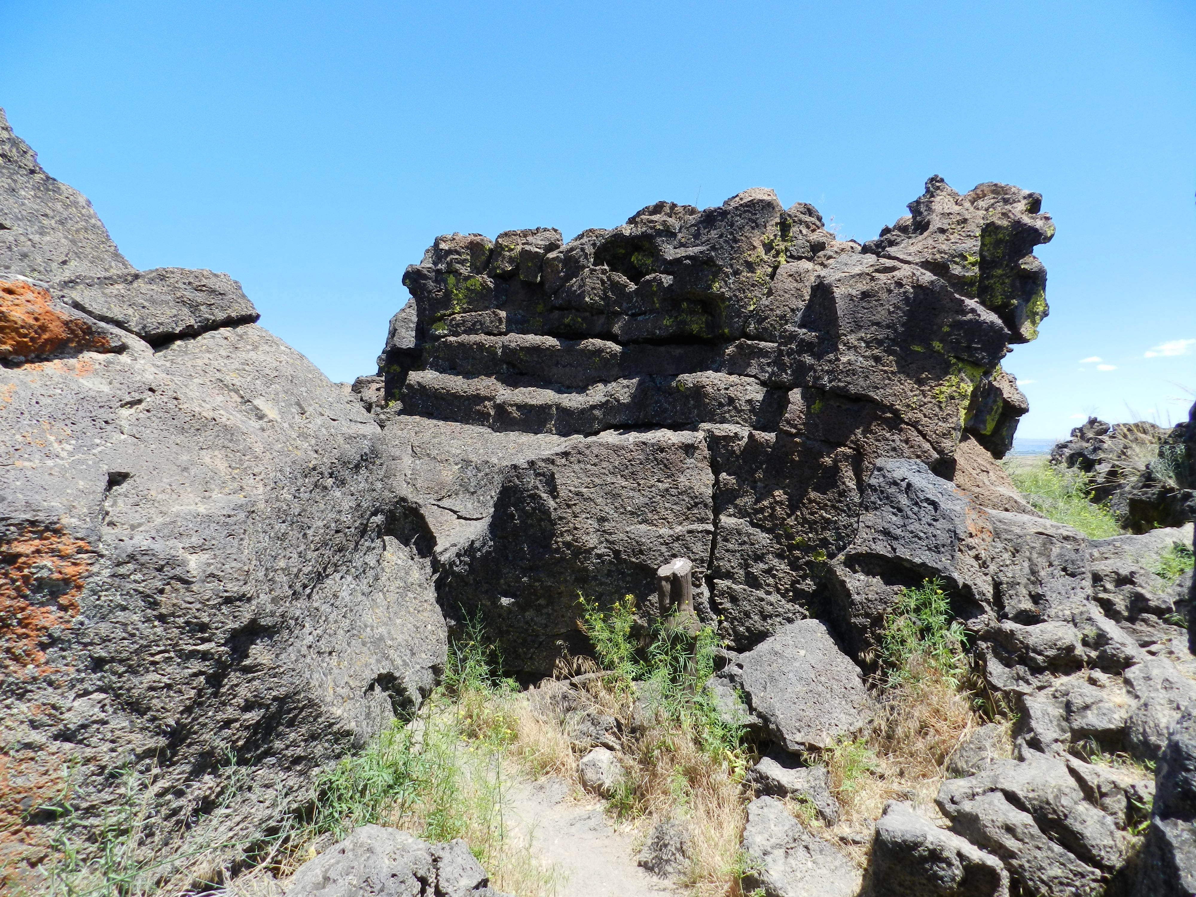
The Medicine Lake volcano has shaped this landscape through half a million years of intermittent eruptions. Rocks visible today span an astonishing age range: two-million-year-old volcanic tuff exposed at Gillem Bluff in the northwest corner, and basalt barely 1,100 years old at the Callahan Flow in the southwest. The most dramatic features emerged between 30,000 and 40,000 years ago, when liquid basalt flowing from Mammoth and Modoc Craters covered 70 percent of what is now monument land. As lava at temperatures reaching 2000 degrees Fahrenheit moved down gentle slopes, the outer layers cooled and hardened while the molten core continued flowing, eventually draining out to leave behind hollow tubes. Weather and gravity have since punched holes in these ceilings every few hundred feet, creating the entrances to almost 700 individual caves.
A Hidden Ecosystem
Step into Valentine Cave, formed from a lower-viscosity flow 11,000 years ago, and the world transforms. Smooth walls curve overhead in darkness, while perennial ice formations glitter in the beam of a flashlight. Fourteen species of bats make these caves home, along with Rocky Mountain rubber boas, tree frogs, and sword ferns that could never survive in the dry desert above. Scientists study the ancient ice here for clues about climate change, while explorers map passages ranging from cathedral-sized chambers to narrow crawlways where helmets scrape against sharp lava rock. Above ground, the monument spans three distinct habitats: ponderosa pine forest at the highest elevations, juniper woodland in the middle, and sagebrush grassland stretching north to the wetlands of Tulelake Wildlife Refuge.
Ghosts of the Stronghold
The caves hold more than geological wonder. In 1872, the Modoc people, forced from their ancestral lands onto the Klamath Reservation, returned home under the leadership of Kintpuash, known to the Army as Captain Jack. When soldiers came to remove them, the Modoc fled south to the lava beds. Here, amid the jumbled black rock and hidden crevices, 53 warriors and their families withstood siege by over a thousand troops for seven months. Captain Jack's Stronghold, the fortified cave network at the heart of this resistance, still bears the name of the leader who knew every fissure and passage of this tortured landscape. The Modoc War was one of the costliest frontier wars in American history, and the only one in which a U.S. general was killed in combat.
Cones, Chimneys, and Craters
The surface tells its own volcanic stories. Cinder cones dot the landscape, formed when high-pressure eruptions blew fountains of lava into the air; the cooling cinders fell back around the vents to build steep-sided hills. Schonchin Butte offers the only cinder cone trail, climbing to views across the entire monument. Spatter cones rose differently, built by thick blobs of lava lobbed from vents, creating formations like Black Crater. At Fleener Chimneys, hollow tubes plunge 150 feet into the earth where lava once emerged. And Mammoth Crater stands as perhaps the most dramatic surface feature: once a lake of molten rock so vast it overflowed rather than erupted, sending highly fluid basalt miles northward and leaving behind an enormous empty bowl.
Into the Darkness
The caves range from easy strolls to serious expeditions. Some passages have smooth floors and high ceilings, perfect for families. Others require duck-walking, crawling, and careful navigation through sharp-edged lava; helmets and kneepads become essential gear. The visitor center loans flashlights and sells bump caps, along with detailed cave maps for those venturing into the more complex systems. Above ground, the monument sits in remote high desert, the nearest towns being Tulelake twelve miles away and Klamath Falls fifty-six miles north. No surface water exists in the park. This is a landscape that demands preparation, rewards curiosity, and remembers everything, from the first drops of molten basalt to the footsteps of those who made these caves their final stand.
From the Air
Located at 41.77 degrees N, 121.52 degrees W in the volcanic highlands of northeastern California. The monument covers 46,560 acres at elevations between 4,000 and 5,700 feet. Nearest airports include Klamath Falls Airport (KLMT) 56 miles north and Alturas Municipal Airport (KAAT) 63 miles southeast. From cruising altitude, look for the distinctive dark lava flows contrasting with surrounding vegetation, and the circular shapes of cinder cones. Best visibility in summer; winter brings snow that closes southern access routes.