Ile d'Orleans
The Huron called it Minigo -- Enchantress -- and the name has never stopped being accurate. Ile d'Orleans sits in the St. Lawrence River just five kilometers east of Quebec City, a 34-kilometer ribbon of farmland, stone churches, and roadside strawberry stands that has quietly anchored French-Canadian identity since the 1530s. When Jacques Cartier stepped ashore near what is now the village of Saint-Francois in 1535, he found wild grapes so thick he named the place Ile de Bascuz, after Bacchus. The vines are mostly gone, but the island's intoxicating quality remains.
Where the River Changes
Ile d'Orleans marks a geological and hydrological boundary in the St. Lawrence. At the island's northeastern point, fresh river water begins to mix with the incoming Atlantic tide, creating the divide between the river's freshwater upper reach and the brackish estuary that stretches to the Gulf. The island itself is 34 kilometers long and 8 kilometers wide at its broadest, with rolling hills, small valleys, and gentle crests that climb to about 150 meters at Sainte-Petronille and Saint-Laurent in the south. Six municipalities ring the island: Sainte-Famille, Saint-Francois-de-l'Ile-d'Orleans, Saint-Jean-de-l'Ile-d'Orleans, Saint-Laurent-de-l'Ile-d'Orleans, Sainte-Petronille, and Saint-Pierre-de-l'Ile-d'Orleans. A National Historic Site of Canada, the island holds over 600 recognized heritage buildings.
The Garden of Quebec
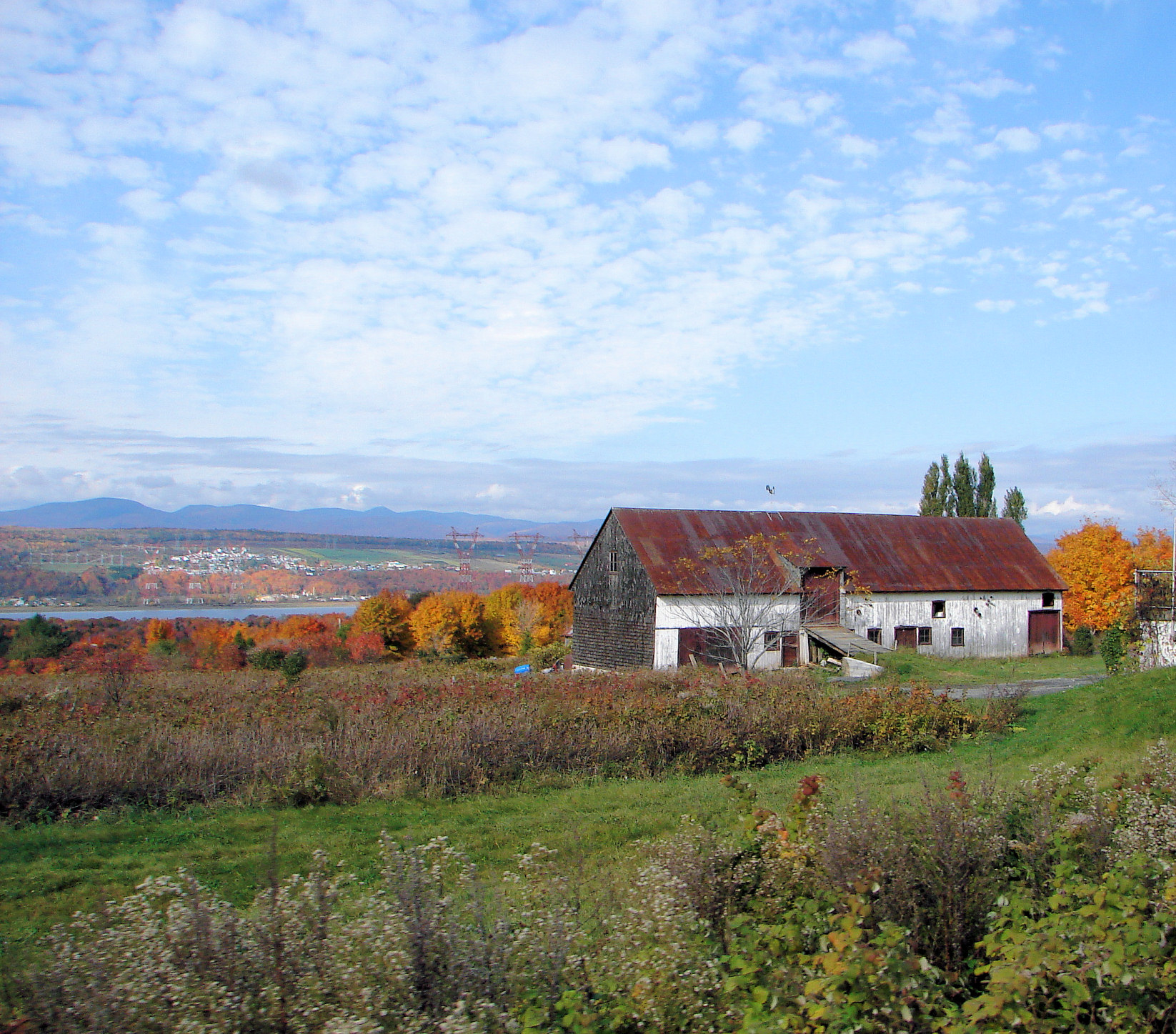
Agriculture has driven the island's economy since the first French settlers cleared fields here in the seventeenth century, and it still does. Known locally as the "Garden of Quebec," the island is famous for its strawberries, apples, potatoes, and a growing number of wineries. Sugar maple stands yield maple syrup that islanders have produced for generations. The old trades of fishing and boat building have faded, but in their place a flourishing tourism industry has grown around the island's food culture and pastoral scenery. Bed-and-breakfast inns, regional cuisine restaurants, roadside fruit stands, art galleries, and craft shops line Route 368, the single provincial highway that crosses the bridge from Beauport and circles the island's perimeter. Daytrippers and cyclists from Quebec City are a constant summer presence.
Roots of a Nation
Few places in North America can claim a deeper connection to French-Canadian origins. The island was one of the first parts of Quebec to be colonized by the French, and a large percentage of French Canadians can trace their ancestry to its early residents. Settlers arrived mainly from the Normandy and Poitou regions of France, drawn by the island's fertile soil. They organized it under the seigneurial system of New France, a pattern still visible in the landscape: houses clustered close together near the road, with long, narrow fields stretching behind them toward the interior. In 1661, the first parish of Sainte-Famille was founded. By 1685, the island had 1,205 mostly French inhabitants. The island has been described as "the microcosm of traditional Quebec and the birthplace of francophones in North America" -- a claim supported by the sheer density of its heritage architecture and the unbroken chain of families who have worked its land for over 350 years.
Stone, War, and Memory
The island's built heritage tells its own story. Jean Mauvide, a surgeon for the King of France, constructed the Manoir Mauvide-Genest in 1734 as his residence, a manor house that stands today as one of the finest examples of New France domestic architecture. In 1759, the manor served a very different purpose: British General James Wolfe occupied it when his forces took control of the island shortly before the Battle of the Plains of Abraham during the Seven Years' War. That moment -- when the island passed from French to British hands -- marked a turning point not just for Ile d'Orleans but for the entire continent. Today, the island's stone farmhouses, heritage churches, and seigneurial field patterns remain largely intact, offering a window into a world that elsewhere was long ago paved over.
From the Air
Located at 46.92N, 70.98W in the St. Lawrence River, immediately east of Quebec City. From the air, the island is unmistakable: a long, narrow oval of green farmland surrounded by the wide river channel. Look for the Ile d'Orleans Bridge connecting the western tip to Beauport on the north shore. Montmorency Falls is visible on the mainland just west of the bridge. The island's patchwork of long, narrow seigneurial fields is clearly visible from altitude. Nearest airports: CYQB (Quebec City Jean Lesage International, 15 km west). Best viewed at 3,000-5,000 ft AGL to appreciate the island's full length and its position in the river.