LeBreton Flats
The story of LeBreton Flats begins with an act of eavesdropping. In 1820, Lieutenant John LeBreton - War of 1812 veteran and early settler of Nepean Township - overheard Lord Dalhousie, the Governor General, explaining that the planned Rideau Canal would run from Dow's Lake to the Chaudière Falls, crossing a stretch of flat land along the Ottawa River. LeBreton bought that land for 499 pounds. He then offered to sell it back to Dalhousie for 3,000. The Governor General was so furious that he rerouted the entire canal to Entrance Bay - a longer, more expensive path that required additional locks. As consolation, Dalhousie purchased the neighbouring hill called Barracks Hill. That hill became Parliament Hill. LeBreton's land speculation had, quite accidentally, determined the layout of Canada's capital.
The Swindler's Defence
LeBreton vigorously denied the swindler label that followed him for the rest of his life. He claimed to have been making offers to acquire land along the flats as early as 1818, well before the canal was approved or any route revealed. He had purchased the property at a public auction, he insisted, and he was simply one of the few people to grasp its commercial value. LeBreton presented Dalhousie with a lengthy written defence against the allegations. Dalhousie 'somewhat peremptorily dismissed' it, cementing the legend of LeBreton as a speculator. Whether villain or visionary, the man left his name on a neighbourhood that would cycle through boom, bust, fire, demolition, contamination, and ambitious rebirth over the next two centuries.
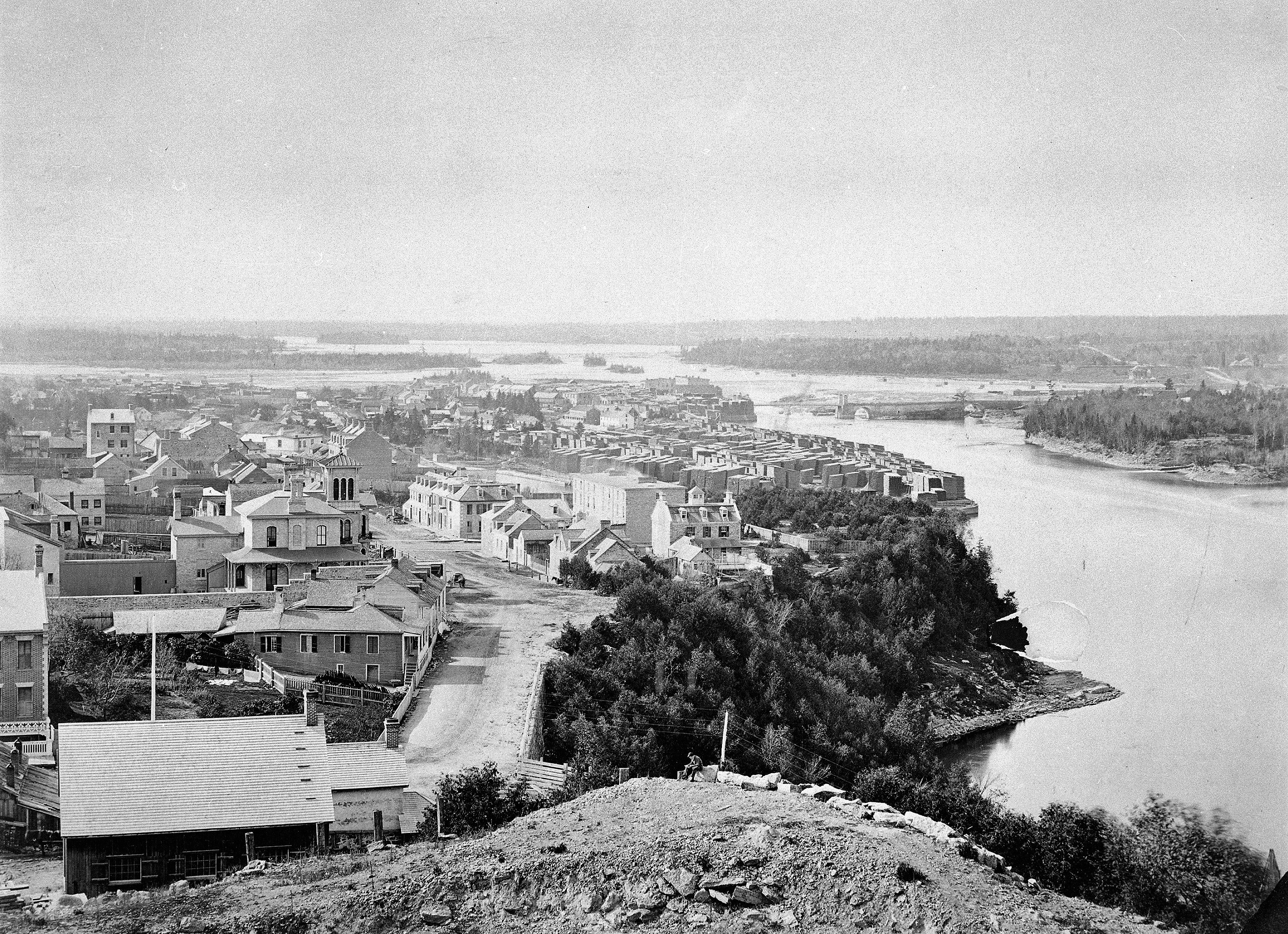
Ashes and Lumber Barons
By mid-century, LeBreton Flats had become a working-class community serving the sawmills on nearby Chaudière and Victoria Islands. Rail lines brought industry; hotels and taverns sprang up alongside workers' housing and the homes of lumber barons. Then came the Great Fire of 1900. Starting across the river in Hull, the blaze leapt the Ottawa River by way of the enormous stacks of piled lumber on the islands. The fire destroyed the neighbourhood, leaving many residents homeless. LeBreton Flats was rebuilt, but the social order shifted. The lumber barons retreated uphill into the city proper above the escarpment. The workers stayed behind on the flats, and the neighbourhood settled into a quieter, grittier existence for the next sixty years.
The Forty-Year Void
In the 1960s, the government expropriated LeBreton Flats for redevelopment. Ottawa Valley artist Ralph Wallace Burton captured the vanishing neighbourhood in a series of oil sketches, painting 'just ahead of the demolition crews.' His works now hang in Ottawa City Hall. What followed the demolition was nothing. Disputes over land use and soil contamination from decades of industrial activity left the cleared land vacant for over forty years. In winter, the city used the empty expanse as a dumping ground for snow removed from Ottawa streets. The melting snowpiles leached contaminants into the already-polluted soil, making the problem worse. Three levels of government owned parcels of the land, and consolidation under the National Capital Commission took years. By the 2006 census, the neighbourhood's population had fallen to 57 people.
A Neighbourhood Reborn
Redevelopment finally began with the opening of the Canadian War Museum in May 2005, followed by the National Holocaust Monument. The O-Train Line 1 light rail arrived in 2019, with Pimisi station providing transit access. Condominiums appeared, and the population climbed from 57 in 2006 to 620 by 2016. The annual Ottawa Bluesfest music festival fills the flats each July with ten days of international performances. A 5-metre-long sculpture of a roadkill crow, made from recycled tires and installed by the NCC in 2023, provoked public debate that proved the neighbourhood was alive enough to argue about public art. The most ambitious plans involve the Ottawa Senators, who reached a land sale agreement in August 2025 with the NCC for a new downtown arena. Meanwhile, Pooley's Bridge - built in 1873 and Ottawa's oldest bridge - still stands as a heritage stone arch pedestrian crossing, a quiet survivor connecting the neighbourhood's industrial past to its complicated future.
From the Air
Located at 45.42°N, 75.71°W on the south bank of the Ottawa River, LeBreton Flats is the large open area visible immediately west of Parliament Hill. The Canadian War Museum's distinctive angular roofline is a key landmark. The Portage Bridge crosses the river at the northern edge. The neighbourhood's flat terrain, bounded by the Ottawa River to the north and west (widening into Nepean Bay), is clearly distinguishable from altitude. Ottawa/Macdonald-Cartier International Airport (CYOW) is approximately 10 km to the south. The adjacent Chaudière Falls and islands are visible just to the northwest.