Leeuwarden Achter de Hoven railway station
Ten. That was the average daily ridership at Leeuwarden Achter de Hoven, the least-used railway station in the entire Dutch national network. Not ten thousand. Not ten in each direction. Ten people, total, boarding or alighting per day, at a stop that the official NS rail map did not bother to draw. Trains served the place three times on weekdays only: one westbound to Leeuwarden in the morning, two eastbound to Groningen in the afternoon. There was no ticket machine. The platform sign existed only on the screen of the OV-chipkaart card reader. On 31 August 2018, the last train pulled away. By the end of 2019, the platforms had been pulled apart and hauled off, and a small footnote in Dutch railway history closed for good.
Why Anyone Built It
The station opened on 5 July 1915 to serve an industrial pocket on the eastern edge of Leeuwarden, a place where factory workers needed a way in and out. The Harlingen-to-Nieuweschans line ran right through. It made sense at the time. Then came the Second World War. On 19 May 1940, eleven days after the German invasion of the Netherlands began, the station was shut. It stayed closed for fourteen years. On 3 October 1954, it reopened, quieter than before, to serve a neighborhood that had already shifted its rhythms - more cars, fewer commuters arriving by rail, no buses dropping off at the door.
A Stop with Almost No Reason to Stop
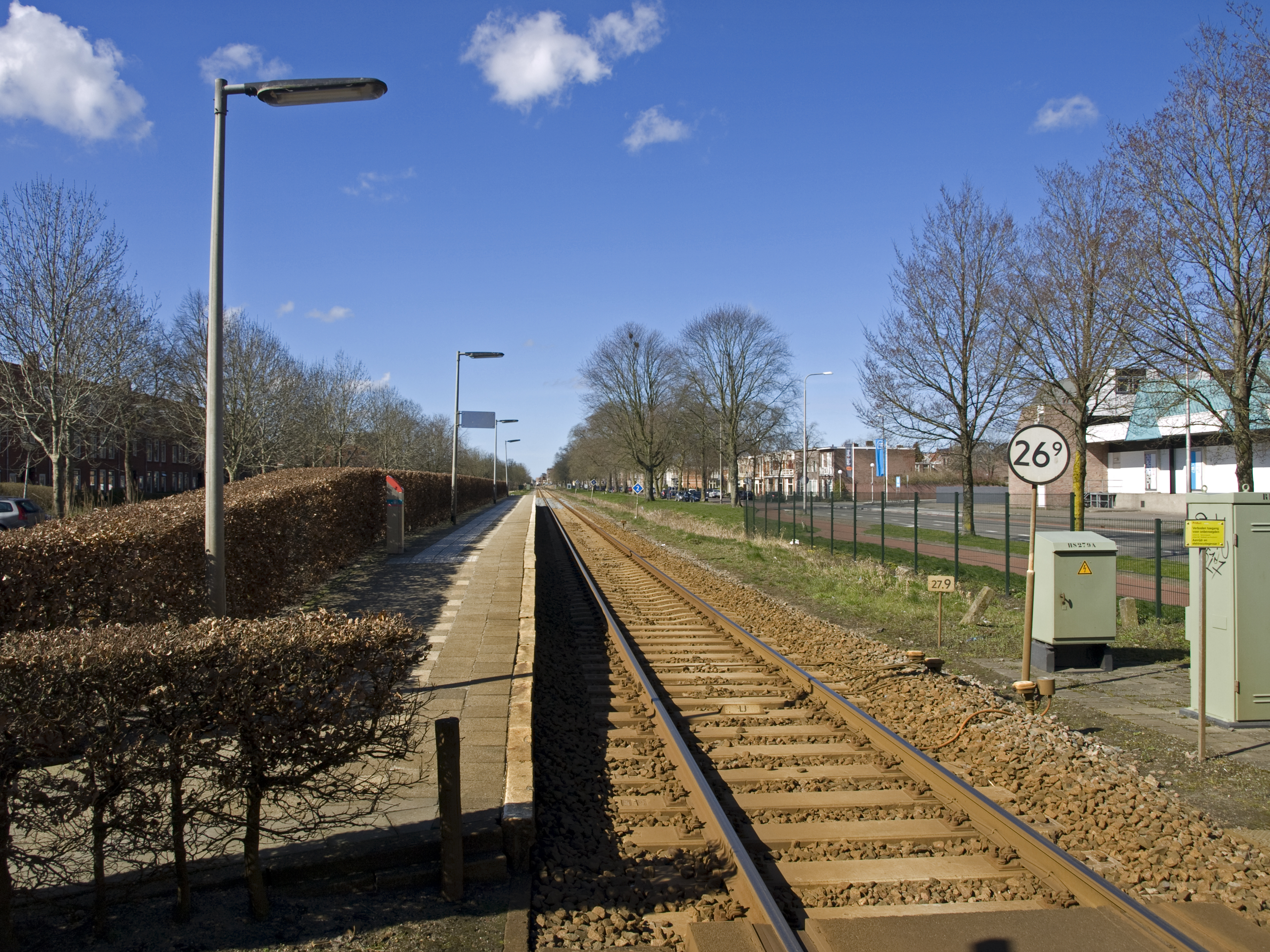
By the 2010s, the station's strangeness had become structural. The line had only one track, but somehow two platforms - one set in a bayonet offset hundreds of meters down the rails, with a level crossing at Julianastraat and another that ran through the FrieslandCampina dairy plant. Trains had to cross active roads to reach the eastern platform. There were no nearby houses. No bus stopped within a useful distance. The only shelter was on the eastern side. Tactile paving was installed on both platforms to guide blind passengers - though it is unclear how many blind passengers had ever found their way to a station the rail map did not show.
The Quiet Ten
Ten passengers a day. Who were they? The article does not say, and after closure there is no easy way to find out. Probably a handful of FrieslandCampina employees who lived in Groningen and came to work at the dairy plant. Maybe a couple of office workers in the nearby industrial buildings. Perhaps a regular or two who had used the station for decades and never switched to the bus or car. Whoever they were, they were the loneliest commuters in the Dutch rail system - boarding at a halt with no name on the map, no ticket machine, no staff, just a card reader and a wind-scoured platform beside an active dairy factory. The trains came when scheduled. The riders climbed aboard. The Netherlands, for ten people, still had a railway.
Closure by Improvement
What killed Achter de Hoven was, ironically, a plan to make the Groningen-to-Leeuwarden line better. In 2013 the provinces of Friesland and Groningen agreed to add more passenger trains between the two cities. Faster service required getting rid of the obstacles that slowed trains down - including a stop that virtually nobody used and whose level crossings forced trains to creep across active industrial roadways. In 2017 Arriva announced the station would close after 3 September 2018. Trains kept running through the spot after that date, of course, but no longer slowed for it. At the end of 2019, contractors arrived. The platforms came up. The shelters came down. The OV-chipkaart readers were removed. What was left was just a stretch of single track running between a dairy plant and an industrial park - the way it would have looked, more or less, if the station had never been built at all.
The Map Was Always Right
The NS national rail map had stopped showing Achter de Hoven years before its actual closure. The cartographers had simply decided the place did not warrant the ink. In hindsight, they were ahead of the schedule. The station became, for a few years, a curiosity for Dutch rail enthusiasts - the stop that officially existed but had been silently delisted, a sort of railway ghost holding on in service of its ten daily passengers. When it finally went, it went quietly, the way it had always operated. The last passengers boarded. The trains kept running. Nobody waved goodbye, because there was nobody on the platform to do the waving.
From the Air
Site located at 53.1989 N, 5.8164 E, in the industrial eastern edge of Leeuwarden, Friesland. The former station footprint sat along the Harlingen-Nieuweschans rail corridor, immediately adjacent to the FrieslandCampina dairy complex. From the air today, you can still trace the track and the cleared platform sites between Julianastraat and the dairy. Central Leeuwarden lies 2 km to the west. Nearest airports: Leeuwarden Air Base (ICAO: EHLW), 6 km northwest; Drachten Airfield (ICAO: EHDR), 20 km southeast. Best viewed from 1,500 feet AGL with industrial rooftops as reference.