Lenapehoking
Manhattan means "island of many hills." Rockaway means "a sandy place." Hackensack, Passaic, Raritan, Maspeth, Gowanus -- the syllables roll off the tongues of commuters who rarely consider where the words came from. They are Lenape. The language of the people who lived here for thousands of years before Henry Hudson sailed up the river that now carries his name instead of theirs. Lenapehoking -- Lenapehokink in the original Lenape -- translates to "in the land of the Lenape," and it once stretched from western Connecticut to Delaware, encompassing the territory adjacent to the Delaware and lower Hudson river valleys and the hill-and-ridge country between them. The word itself was largely unknown to English speakers until 1970, when a Lenape elder named Nora Thompson Dean shared it with conservationist Theodore Cornu. Today it appears in land acknowledgments across New York institutions, a small act of linguistic restoration for a homeland that was taken by force.
The Real People
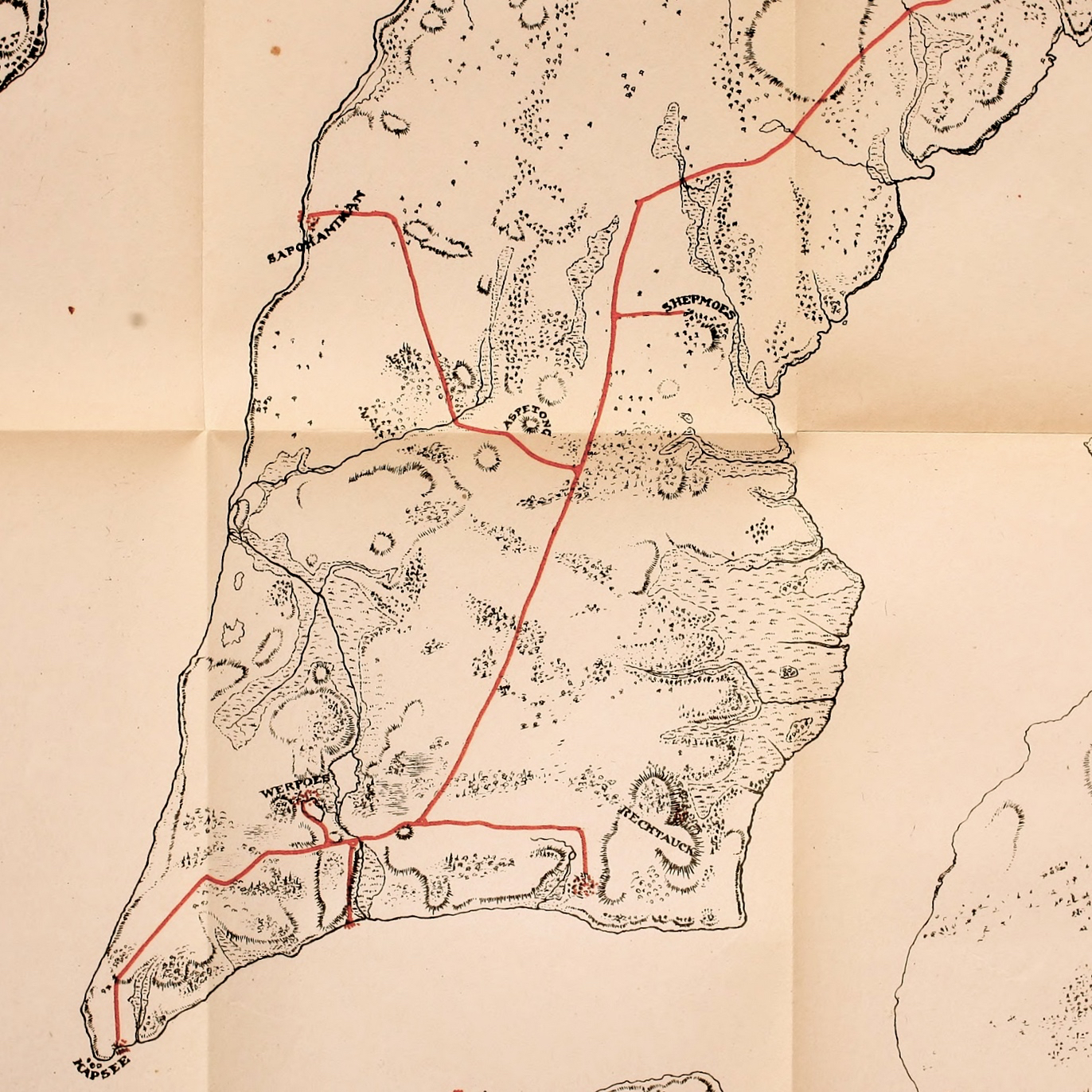
The name Lenape means "real person" or "original person," a construction seen in the endonyms of their Algonquian relatives across the Northeast. The second element of Lenapehoking, hoki, derives from the Proto-Algonquian word for "land" -- the same root found in the Cree word Nitaskinan and the Ojibwe word aki. The suffix -nk is locative, meaning "in" or "at." At the time of European contact in the sixteenth and seventeenth centuries, the Lenape homeland ran along the Atlantic coast, encompassing the river valleys, coastal plains, and ridgelines of what would become four states. They were relatives of the Algonquian nations whose territories extended from beyond the Saint Lawrence River through all of New England. A 1610 map shows the name Manahata on both sides of what was then called the Mauritius River.
The Names That Remained
European colonization depopulated the Lenape through disease and displacement, but their language proved more durable than their presence. Across the New York metropolitan area, Lenape words survive as the names of neighborhoods, waterways, and geographic features. Gowanus comes from the sachem of the Canarsee band who lived along the creek. Maspeth was a Rockaway band settlement along Maspeth Creek. Ossining derives from a local tribal name meaning "stone upon stone." In New Jersey, Kittatinny means "great hill" or "endless mountain." In Pennsylvania, the names grow even more evocative: Cocalico means "where the snakes collect in dens to pass the winter." Perkasie means "where the hickory nuts were cracked." Conshohocken, according to Nora Thompson Dean, means "elegant land." These are not relics. They are words spoken daily by millions of people who have inherited a Lenape geography without knowing it.
Dispossession
Beginning in the seventeenth century, European colonists settled across Lenapehoking. The Dutch purchased Manhattan in the transaction that became American legend -- though what the Lenape understood by that exchange remains debated. The concurrent introduction of Eurasian infectious diseases devastated Lenape populations, and colonial encroachment steadily eroded their control over the land. By the eighteenth and nineteenth centuries, the United States government forcibly removed the Lenape westward, ultimately to Oklahoma and other locations far from their ancestral home. The displacement was total. A people whose territory had encompassed the most densely developed corridor in North America were pushed to reservations a thousand miles away.
Nations That Endure
Today, Lenape nations control lands in Oklahoma (the Delaware Nation and the Delaware Tribe of Indians), Wisconsin (the Stockbridge-Munsee Community), and Ontario, Canada (the Munsee-Delaware Nation, the Moravian of the Thames First Nation, and the Delaware of Six Nations). They are not historical artifacts. They are living nations with governments, cultural programs, and members who maintain the Lenape language that named the places where twelve million people now live. The Lenape Talking Dictionary, an online resource developed in collaboration with linguists, preserves pronunciations and definitions. Nora Thompson Dean, who shared the word Lenapehoking with the wider world in 1970, was a fluent speaker and elder of the Delaware Tribe -- one of the last people to grow up speaking Lenape as a first language.
A Word Reclaimed
The term Lenapehoking has gained widespread use in recent literature on the Lenape and in land acknowledgments at New York cultural institutions. It appears in museum exhibits, university statements, and public ceremonies -- a word that was nearly lost now spoken in the buildings that stand on the land it describes. Whether land acknowledgments amount to meaningful recognition or comfortable symbolism is a question the Lenape themselves continue to raise. But the word endures. Beneath the concrete and asphalt of the world's most famous skyline, beneath the subway tunnels and fiber-optic cables, the geography is still Lenapehoking. Pearl Street in lower Manhattan was named for the Lenape shell middens that once lined the shore. The island of many hills remains, even if the hills have been leveled and the people who named them were forced to leave.
From the Air
Lenapehoking encompassed the entire region visible from a flight over the New York metropolitan area -- from western Connecticut to Delaware, including the Hudson and Delaware river valleys. The coordinates center on northern New Jersey near the Hackensack River at 40.89N, 74.05W. From altitude, the full extent of the former Lenape homeland is visible: Manhattan, the Palisades, the Meadowlands, Staten Island, Long Island, and the New Jersey coastline. Nearby airports: Teterboro (KTEB), Newark Liberty (KEWR), LaGuardia (KLGA), JFK (KJFK). Best appreciated at 5,000-10,000 ft AGL for the panoramic scope of the territory.