Leon Viejo
The founder of Leon lost his head in its main square. Francisco Hernandez de Cordoba established the city on June 15, 1524, on the southwestern shore of Lake Xolotlan, in the shadow of the volcano Momotombo. Two years later, governor Pedrarias Davila -- his own lieutenant -- had him decapitated in the Plaza Mayor. It was a fitting beginning for a city that would endure earthquakes, eruptions, political murder, and finally abandonment, before Momotombo buried it under centuries of ash and volcanic stone. The ruins were not found again until 1967.
A City Built on Older Ground
When the Spaniards arrived, the area they chose for their settlement was already home to the Imabite people, a Chorotega indigenous community of roughly 15,000. Archaeological excavations at the cathedral's main altar have uncovered burial evidence that complicates the colonial narrative considerably. Seven pre-Hispanic burials were found beneath the cathedral floor, some at depths between 60 and 180 centimeters below the Spanish occupation layer. One skeleton -- a woman between 25 and 30, laid facing Momotombo volcano -- showed evidence of cranial trepanation, a surgical procedure. Her spade-shaped incisors identified her as indigenous. The Spaniards, it appears, did not merely settle alongside the native community. They built their most important religious structure directly on top of a site that already held meaning for the people who were there first.
Obsidian and Trade Routes
The archaeological record at Leon Viejo revealed 175 lithic artifacts at the cathedral site alone. Eighty-three fragments of obsidian prismatic knives were identified, the raw material traced to sources across Central America: Ixtepeque in Guatemala, El Chayal in El Salvador, and Guinope in Honduras. Chalcedony arrowheads, quartz fragments with anthropomorphic carvings, and 2,239 ceramic remains -- including polychrome Managua ware, Usulutan negative pottery, and monochrome vessels bearing fabric impressions -- painted a picture of a thriving pre-Hispanic trade network. The Imabite settlement was no backwater. It was a node in a commercial web that stretched hundreds of kilometers, exchanging obsidian, ceramics, and finished tools with communities throughout the isthmus.
Momotombo's Long Burial
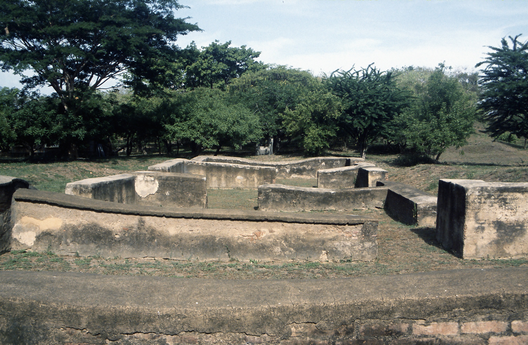
Leon Viejo suffered from seismic activity throughout its existence, but the earthquakes of 1594 and 1610 proved decisive. The 1610 quake did not destroy the city outright. Instead, the settlers held a referendum and voted to relocate about 20 miles west to the site of present-day Leon. The old city was left behind, and Momotombo slowly buried it. Ash, volcanic stone, and lake sediments covered the colonial grid over the following centuries. Three monasteries -- La Merced, San Pedro, and San Francisco -- disappeared beneath the accumulation. When the ruins were rediscovered in 1967 and excavations began the next year, archaeologists found a city laid out on the standard Spanish colonial grid, with the Plaza Mayor at its center and 16 partially restorable structures on the surrounding streets. Leon Viejo occupies roughly 800 by 500 meters.
The Only Unaltered Colonial City
What makes Leon Viejo irreplaceable is precisely its abandonment. Every other sixteenth-century colonial city in the Americas has been rebuilt, expanded, or modernized over the centuries. Leon Viejo was frozen in time -- the only such city that has never suffered urban planning alterations. This uniqueness became the central argument in Nicaragua's successful petition for UNESCO World Heritage status, granted in 2000. Preservation has not been easy. Tropical Storm Alleta damaged the walls in 1982. Hurricane Joan struck in 1988. Hurricane Mitch in 1998 affected an estimated 40 percent of the site, damaging houses, the La Merced convent, and the fortress known as La Fortaleza. The ruins endure the same geological forces that drove the original settlers away, but now the Nicaraguan Institute of Culture, rather than colonial administrators, decides whether to stay.
From the Air
Located at 12.40N, 86.62W on the southwestern shore of Lake Managua (Lake Xolotlan), directly south of the volcano Momotombo. The conical shape of Momotombo (1,297 meters) is a dramatic visual landmark from any altitude. The archaeological site lies in flat terrain between the volcano and the lakeshore. Best viewed from 3,000-6,000 feet AGL approaching from the south or east, where both the ruins and the volcano-lake relationship are visible. Nearest airport: Augusto C. Sandino International (MNMG) in Managua, approximately 35 nm southeast.