Liathach
The quartzite on Liathach's summit contains worm burrows. Not metaphorical worms, not geological metaphors -- actual fossilized tubes, called pipe rock, left by burrowing organisms roughly 500 million years ago in the sediment of a shallow Cambrian sea. Those burrows now sit at over 1,000 metres above sea level, atop sandstone that is twice as old again, on a foundation of Lewisian gneiss that formed nearly three billion years ago. Liathach is a mountain that wears its geological history on its face, and that history spans most of the time life has existed on Earth.
A Billion Years, Layer by Layer
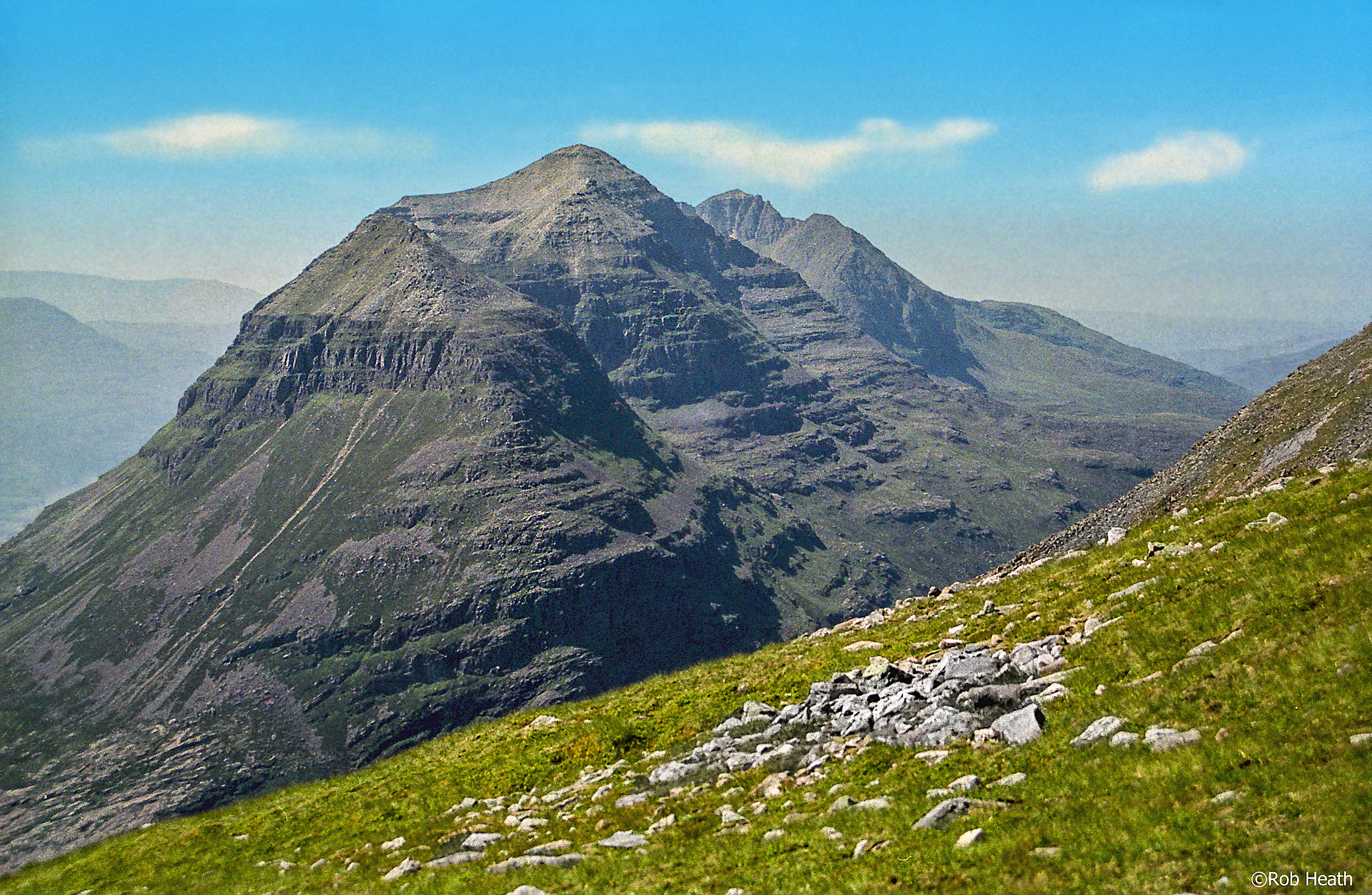
The Torridonian sandstone that forms Liathach's massive terraced flanks was laid down approximately one billion years ago as sediment in ancient river deltas and lakebeds. It sits unconformably on Lewisian gneiss, some of the oldest rock in Europe, creating a contact zone where a gap of nearly two billion years separates one layer from the next. Above the sandstone, a thin cap of Cambrian quartzite -- the pale grey rock visible at the summit ridgeline -- represents a much later period when this landscape lay beneath a shallow tropical sea. The effect from the air is striking: dark reddish-brown terraces of ancient sandstone sweeping upward to pale, almost white summits. Liathach's name, from the Gaelic for 'the grey one,' refers to this quartzite cap, though from most angles the mountain appears anything but grey.
The Teeth of the Ridge
Liathach stretches for roughly seven kilometres above Glen Torridon, presenting an unbroken wall that rises over 900 metres from the valley floor. The mountain has two Munro summits: Spidean a' Choire Leith at 1,055 metres and Mullach an Rathain at 1,024 metres. Between them lies Am Fasarinen, a series of pinnacles whose Gaelic name translates as 'the Teeth.' The traverse of these pinnacles is one of the most exposed scrambles on the Scottish mainland -- a narrow ridge with steep drops on both sides and no easy escape route once committed. The Northern Pinnacles, a separate ridge of towers descending from Mullach an Rathain, were first climbed in 1894 and remain a serious mountaineering proposition. Liathach is not a mountain that tolerates casual ambition. In winter conditions, the traverse becomes a full-scale mountaineering expedition, with corniced edges and verglas-coated rock demanding rope, axes, and experience.
Torridonian Sculpture
What gives Liathach its distinctive terraced appearance is the differential erosion of the Torridonian sandstone. Harder beds resist weathering and form the prominent horizontal ledges visible across the mountain's flanks, while softer layers erode more quickly, creating the stepped profile. Ice ages carved the corries that bite into both sides of the ridge, and meltwater sculpted the steep gullies that score the mountain's face. The result is a mountain that looks built rather than formed -- as though some vast hand stacked enormous blocks of dark red stone and then left them to weather. Glen Torridon itself was gouged by glaciers flowing westward to the sea, leaving a U-shaped valley that makes Liathach's scale apparent in a way that photographs consistently fail to capture. Standing at the roadside in Glen Torridon, the mountain fills the entire northern sky, its summit a kilometre above your head.
From the Air
Liathach is located at 57.56°N, 5.46°W in the Torridon Hills of northwest Scotland. The mountain's seven-kilometre ridge runs roughly east-west above Glen Torridon, with the terraced sandstone flanks clearly visible from the air. The pale quartzite summit cap provides a visual contrast against the dark red sandstone. Upper Loch Torridon lies to the west. Nearest airports: Inverness (EGPE) approximately 50 nm to the east; Stornoway (EGPO) approximately 45 nm to the northwest.