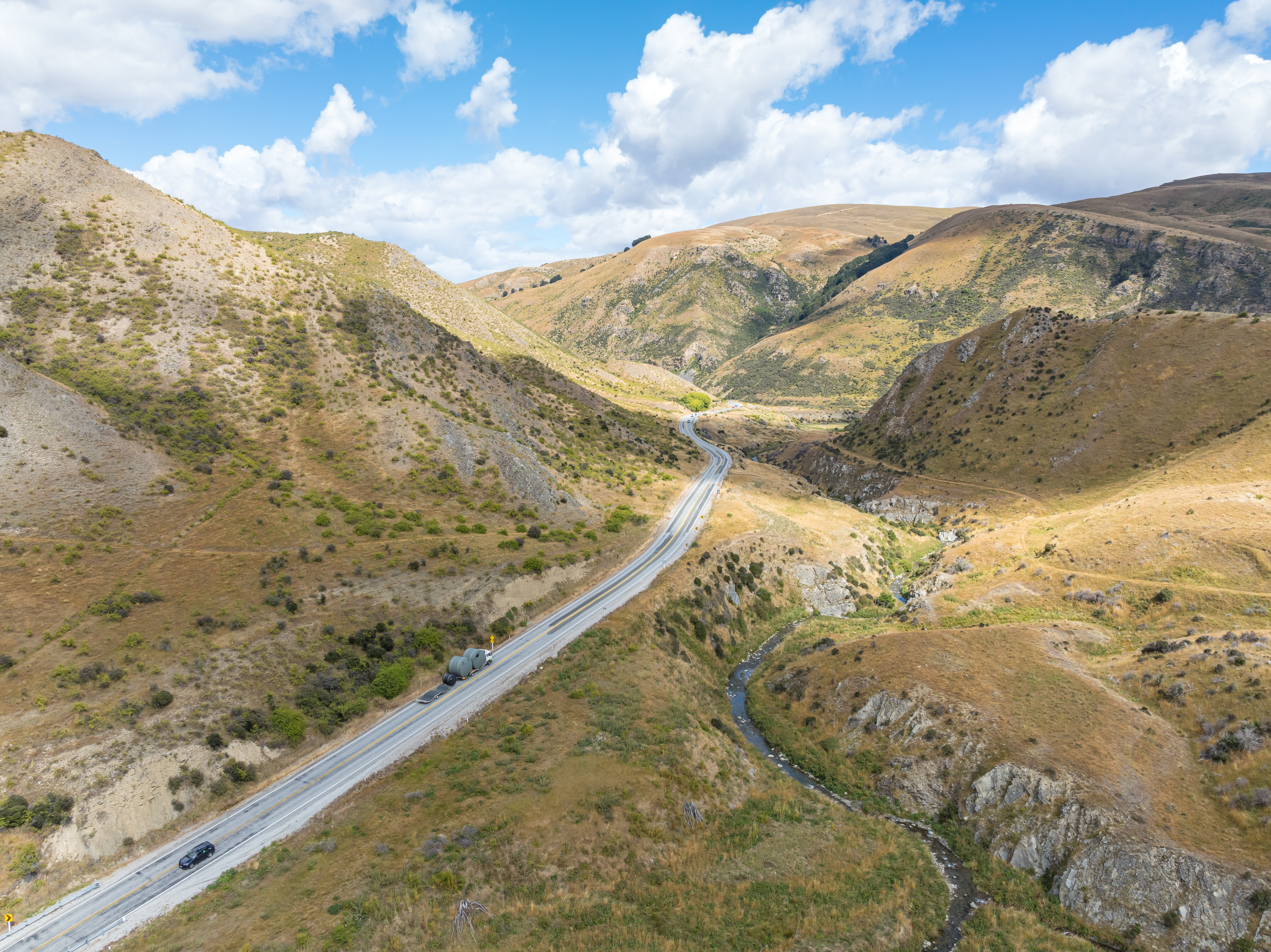
Lindis Pass
No cellphone signal reaches the Lindis Pass. At 971 metres, on the highest stretch of highway anywhere on the South Island, you cross into a silence that most travellers in New Zealand never encounter. State Highway 8 threads between the Lindis and Ahuriri River valleys here, connecting Central Otago to the Mackenzie Basin through country that feels stripped down to its essentials: tawny tussock, wind-scoured rock, and sky that seems to go on forever.
The Road Between Two Worlds
The Lindis Pass sits at the boundary between regions, and crossing it feels like moving between climates. To the south lies Cromwell, 78 kilometres and about 55 minutes of driving away in Central Otago, a landscape of vineyards and stone fruit orchards. To the north lies Omarama, just 32 kilometres distant, gateway to Canterbury's Mackenzie Basin with its impossibly turquoise glacier-fed lakes. The pass is the second highest point on New Zealand's entire state highway network, surpassed only by the Desert Road on State Highway 1 in the central North Island. Yet despite its elevation, the Lindis is not considered an alpine pass. It sits in the dry interior of the South Island, where summers bake hot and winter brings not just snow but persistent black ice that has made the road notorious.
A Grassland Kingdom
Snow tussock dominates every slope visible from the pass, its golden blades catching the light in ways that shift constantly with the weather. This is not the dense bush of New Zealand's wetter regions but a landscape of openness, where the horizon tilts and rolls with the contours of the hills. On nearby Longslip Mountain, which rises to 1,494 metres, buttercups of the species Ranunculus haastii bloom in profusion. The pass harbours its own community of native species. Karearea, the New Zealand falcon, hunts across the tussock slopes, while pihoihoi, the New Zealand pipit, works the ground below. Spotted skinks bask on sun-warmed rocks. Drop lower into the beech forests and shrublands that fringe the pass, and the birdlife changes: piwakawaka, the fantail, flits through the understory alongside riroriro, the grey warbler, and the diminutive tititipounamu, the rifleman, New Zealand's smallest bird.
Danger in the Silence
The beauty of the Lindis Pass comes with a warning. Vehicle crashes have occurred here with troubling regularity, and the absence of cellphone coverage compounds the danger. When an accident happens on this isolated stretch, rescue services may not learn of it for some time. A web camera was installed in 2018 to help traffic controllers and maintenance crews monitor conditions, and in 2013 the New Zealand Transport Agency upgraded the highway with wire-rope safety barriers, improved signage, and electronic speed warnings. These are practical responses to a road that demands respect, particularly in winter when snow and ice can transform the pass from a scenic drive into something far more treacherous.
Crossing Point
For Ngai Tahu, the South Island's principal iwi, this country between the Lindis and Ahuriri valleys was part of a wider network of seasonal routes through the interior. The tussocklands were not empty space but a living pantry and pathway, and the pass itself a natural crossing point between the coastal regions and the interior basins. Today's travellers follow in the grooves of much older journeys. The monument at the pass summit, erected in 1971, commemorates a different kind of arrival: a hundred years since red deer were first released in Otago. The deer now roam the same slopes the native birds patrol, a reminder that the Lindis is a landscape shaped by many hands and many intentions, layered over centuries.
From the Air
Located at 44.59S, 169.65E. The pass is a prominent terrain gap between the Lindis and Ahuriri River valleys at 971 m elevation. From the air, the tussock grasslands appear golden-brown against surrounding hills. The nearest airport is Omarama Airfield (NZOA), approximately 32 km to the northeast. Cromwell Aerodrome is to the south. Be aware of mountain weather conditions and turbulence in the valley corridors. Best viewed at 3,000-5,000 ft AGL for terrain context.