Lofotodden National Park
From the air, the southern end of Moskenesøya looks like something unfinished -- a jagged blade of rock thrust into the Norwegian Sea, its western edge shredded into peaks that drop vertically into surf. This is Lofotodden National Park, established on June 22, 2018, making it Norway's youngest national park. At just 99 square kilometers, it is also one of the country's smallest. But what it lacks in area it compensates for in drama. The park protects the southernmost section of Lofotenveggen -- the "Lofoten Wall" -- a 160-kilometer mountain range that forms the spine of the entire archipelago, visible from the mainland as a seemingly impenetrable curtain of stone rising from the sea.
Volcanic Bones
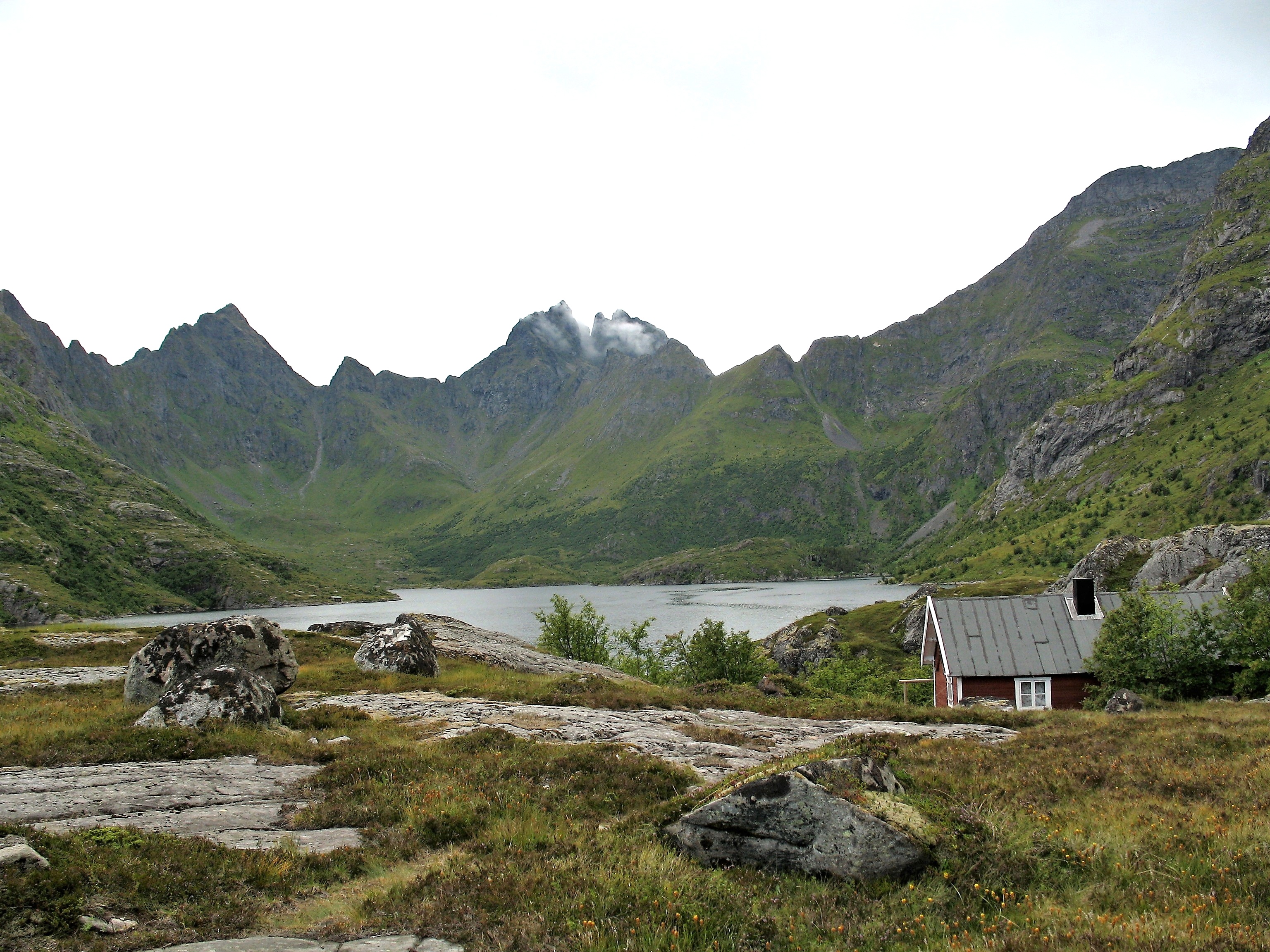
The geology here is ancient and violent. The jagged massif is composed of volcanic rocks and granite, shaped by ice ages that carved cirques, sharpened ridges, and gouged valleys down to the waterline. Hermannsdalstinden, the park's highest point at 1,029 meters, is also the highest peak on Moskenesøya -- not an enormous mountain by global standards, but its rise is nearly vertical from sea level, which makes it feel immense. The terrain is relentlessly rugged. Rock faces drop into fjords on the east and crash into open ocean on the west. Between the peaks, small lakes sit in glacially scooped bowls, their water reflecting whatever mood the Arctic sky chooses. The landscape resists easy passage; trails exist, but the rocky ground demands attention, and weather can shift from clear to whiteout within an hour.
Beaches at the Edge of the World
The park's most startling feature is the contrast between its savage peaks and its beaches. On the western coast, Kvalvika Beach spreads fine white sand beneath towering cliffs, its water an improbable shade of turquoise that belongs more to the Caribbean than the Arctic Circle. Bunesstranda, accessible only by hiking trail or boat, is similarly paradoxical: pristine white sand enclosed by dark rock walls, with the open Atlantic stretching to the horizon. Horseid Beach offers the same surreal palette in a more secluded setting. These are not gentle shores. The surf can be fierce, the water temperature barely tolerable even in summer, and the approaches require real effort on foot. But that effort is precisely what preserves them. Kvalvika and Ryten -- a viewpoint peak overlooking the beach -- rank among the most popular hiking destinations in all of Lofoten, drawing visitors willing to earn their views.
The Youngest Park
Lofotodden's protection came relatively late. The park was formally established by royal decree in June 2018, and Climate and Environment Minister Ola Elvestuen officially opened it on June 9, 2019. Of the park's 99 square kilometers, approximately 13 square kilometers are sea area, reflecting Norway's growing recognition that marine ecosystems deserve the same protection as terrestrial ones. The park spans two municipalities -- Moskenes and Flakstad -- and sits entirely on the outer, western side of Moskenesøya, facing the full force of the North Atlantic. For hikers, the terrain offers everything from accessible day walks to demanding multi-day crossings of the mountain range. For the rest of us, it is best appreciated from above: the saw-toothed ridge of the Lofoten Wall running north to south, the white crescents of sand on the western shore, and the infinite gradations of blue where mountain, sky, and sea meet at the edge of the known world.
From the Air
Located at 68.02°N, 13.02°E on the western coast of Moskenesøya, the southernmost major island in the Lofoten archipelago. The Lofoten Wall mountain range is a spectacular visual feature from cruising altitude -- a continuous ridge of peaks running north-south. White sand beaches on the western shore (Kvalvika, Bunes, Horseid) are visible as bright crescents against dark rock. Nearest airports: Leknes Airport (ENLK) approximately 50 km northeast, Bodø Airport (ENBO) on the mainland. Recommended viewing altitude: 5,000-10,000 ft for the full mountain range panorama, 2,000-3,000 ft for beach and coastline detail. Weather can be highly variable; clear days offer extraordinary visibility.