Los Glaciares National Park
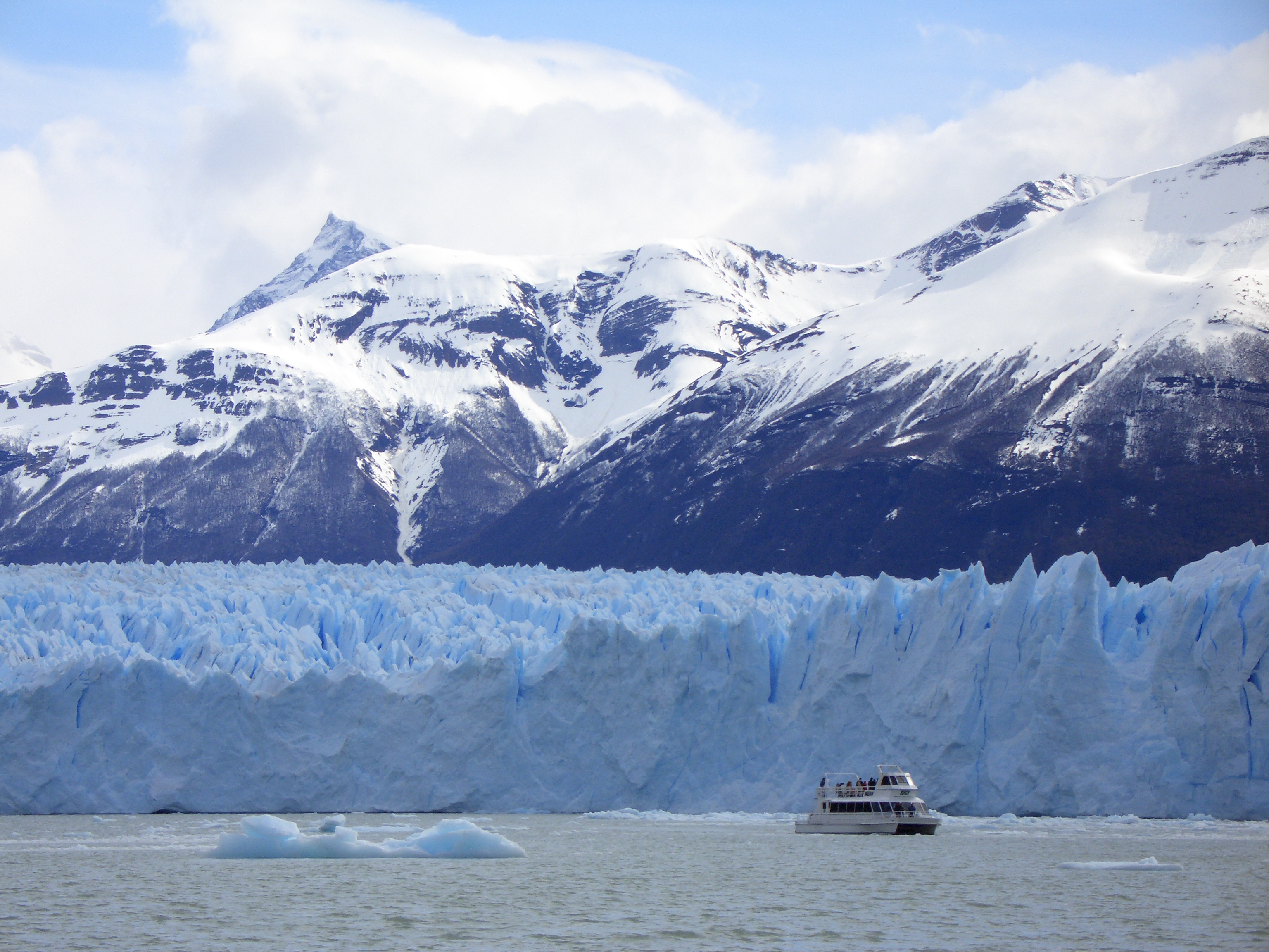
The crack sounds like a rifle shot, echoing across the milky water. Then comes the rumble, deep and prolonged, as a wall of ice the size of an apartment building peels away from Perito Moreno Glacier and crashes into Lago Argentino. The spray rises, the wave rolls outward, and the berg - suddenly blue, impossibly blue - bobs in the grey water. This happens every few minutes here, all day, every day. Perito Moreno is one of fewer than a dozen glaciers on Earth that are still advancing, pushing forward at two meters per day, calving with theatrical violence that draws thousands of visitors to stand on the viewing platforms and simply watch. Behind it rises the Southern Patagonian Ice Field, feeding forty glaciers in a park that covers more than 4,000 square kilometers of ice, water, and jagged Andean peaks.
The Advancing Giant
Most of the world's glaciers are in retreat, shrinking as the climate warms. Perito Moreno defies the trend. Scientists debate exactly why - the depth of the lake, the shape of the valley, the particular dynamics of ice flow - but the result is unmistakable: a five-kilometer-wide wall of ice that grinds forward into Lago Argentino, periodically damming the Rico arm of the lake until the pressure builds and the dam bursts in a spectacular rupture.
The viewing platforms face the glacier's northern flank, close enough to feel the cold breath of 30,000 years of compressed snow. Walkways descend through lenga forest to water level, where ice towers overhead, fractured and groaning. The face rises 60 meters above the lake, but that's just the visible portion - another 120 meters lurk beneath the surface. When a chunk calves, the splash can reach the platforms. No one complains.
The Hidden Giants
Perito Moreno gets the crowds, but it's not even the largest glacier in the park. That honor belongs to Upsala, a 60-kilometer river of ice that can only be reached by boat. The journey from Puerto Bandera weaves through a maze of icebergs - some tabular and white, others sculpted by wind and water into impossible shapes, many glowing with that deep glacial blue that results from centuries of compression squeezing out air bubbles.
Spegazzini, Onelli, Agassini - the glaciers of Lago Argentino's northern arm cascade from the ice field in frozen waterfalls. Boat tours thread between the bergs, engines cutting to let passengers hear the silence, broken only by the crack and groan of moving ice. These are among the most accessible glaciers in the world, yet they feel utterly remote, utterly wild.
The Granite Towers
The park's northern section belongs to a different world entirely. Here, where Lago Viedma meets the Andes, the granite spires of Mount Fitz Roy and Cerro Torre rise like shattered cathedrals into the Patagonian sky. Fitz Roy - 3,405 meters of near-vertical rock - draws climbers from around the world who wait for weeks in El Chaltén for a weather window that may never come.
The Tehuelche people called it El Chaltén - 'the smoking mountain' - because clouds so often wreath its summit. The name transferred to the village below, founded in 1985 and now Argentina's self-declared 'trekking capital.' The trails here are free to walk, winding through lenga forest to miradores that reveal the peaks in their full drama - assuming the weather cooperates. In Patagonia, that's never a given.
Life at the Edge
The park's ecosystem sits at the boundary between the lush temperate rainforests of Chile and the dry Patagonian steppe. The result is a sub-Antarctic forest of southern beech - lenga and ñire - that blazes gold and red in autumn. Calafate bushes dot the lower slopes, their blue berries the source of local legend: eat one, they say, and you're guaranteed to return to Patagonia.
Condors ride the thermals above the peaks, their three-meter wingspans dwarfing everything else that flies. Huemul - the endangered Patagonian deer that graces Argentina's coat of arms - hide in the forest's shadows. Pumas prowl the park's edges. And in the lakes, the icebergs carry their own temporary ecosystems: bacteria, algae, entire micro-worlds frozen in time and slowly melting back into the water.
Two Ways In
El Calafate is the gateway to the glaciers - a town that has grown from a frontier outpost into a proper tourist destination with an airport, hotels, and restaurants serving cordero patagónico (Patagonian lamb) with views of Lago Argentino. From here, day trips reach Perito Moreno by paved road and the other glaciers by boat.
El Chaltén guards the northern gate - smaller, rougher, more obviously a town built for hikers. The trails start from the village edge; no entrance fee, no vehicle needed, just boots and weather gear. The bus from Calafate takes three hours on a road that crossed through nothing but steppe and the occasional guanaco. The isolation is the point. This is the deep south, closer to Antarctica than to Buenos Aires, and despite the crowds at Perito Moreno, it still feels like the end of the world.
From the Air
Located at 50.0°S, 73.0°W in Santa Cruz Province, Argentina, along the Chilean border. The Southern Patagonian Ice Field dominates the western portion - the third largest ice mass on Earth after Antarctica and Greenland. Key landmarks from altitude: Perito Moreno Glacier (50.5°S, 73.0°W) is a distinctive white tongue extending into milky-blue Lago Argentino; Mount Fitz Roy (49.3°S, 73.0°W) rises as a dramatic granite spire, often cloud-capped. Lago Argentino and Lago Viedma are the two major lakes - both distinctive milky turquoise from glacial flour. El Calafate airport (FTE) is the main access point, 80km east of Perito Moreno. El Chaltén has no airport. Weather is notoriously changeable - expect strong westerly winds, rapid cloud formation around peaks, and limited visibility windows. Best conditions often early morning before winds build.