Los Llanos Region, Venezuela
Every year the same transformation plays out across the Venezuelan Llanos: plains that baked under dry-season sun disappear beneath a shallow sheet of water, turning nearly 65,000 square kilometers of Guarico State and the even larger expanse of Apure into something between a lake and a landscape. Capybaras wade through what was pasture. Anacondas glide across what was road. The Orinoco crocodile, one of the most critically endangered reptilians on Earth, surfaces in rivers that only months earlier had shrunk to muddy channels. This is Los Llanos, one of Venezuela's nine administrative regions, where the rhythm of wet and dry governs everything from cattle drives to the course of the rivers themselves.
Resistance Before the Ranches
Spanish colonizers arrived in the Llanos of Guarico slowly, with permanent settlement only gaining traction in the 17th and 18th centuries. They did not find empty grassland. The cacique Chiparara organized Carib and Otomac groups to mount a sustained counter-attack against colonial forces, exploiting the terrain that the Spanish found baffling: flat, featureless, and prone to seasonal floods that made military campaigns miserable. After the indigenous resistance was broken around 1653, the Carib and Otomac groups either retreated southward or were gradually assimilated. Guarico then became a stage for a different kind of conflict. After independence, civil wars raked through the region throughout the 19th century. The state became a province in 1856, an independent state in 1864, was dissolved in 1898, and regained its autonomy in 1899, its borders with Aragua not formally fixed until a protocol signed in 1933.
Two Plains, Two Worlds
The Llanos are not as uniform as they appear from a distance. The high plains, pressed against the Andean foothills, sit on rich soil suited for cultivation. The low plains, below 100 meters above sea level, are a different proposition entirely. During the rainy season they flood comprehensively, and the rivers that cross them run parallel to one another, shifting course with a frequency that confounds mapmakers. Sand dunes, driven by dry-season winds, rearrange themselves enough to redirect rivers, a geological restlessness that keeps the landscape perpetually in draft form. The Apure River threads through the western plains from west to east, fed from the north by the Uribante, Sarare, Caparo, and a dozen other tributaries. To the south and east, the Meta, Cinaruco, Capanaparo, and Arauca rivers make their own way toward the Orinoco.
Cattle Country, Oil's Shadow
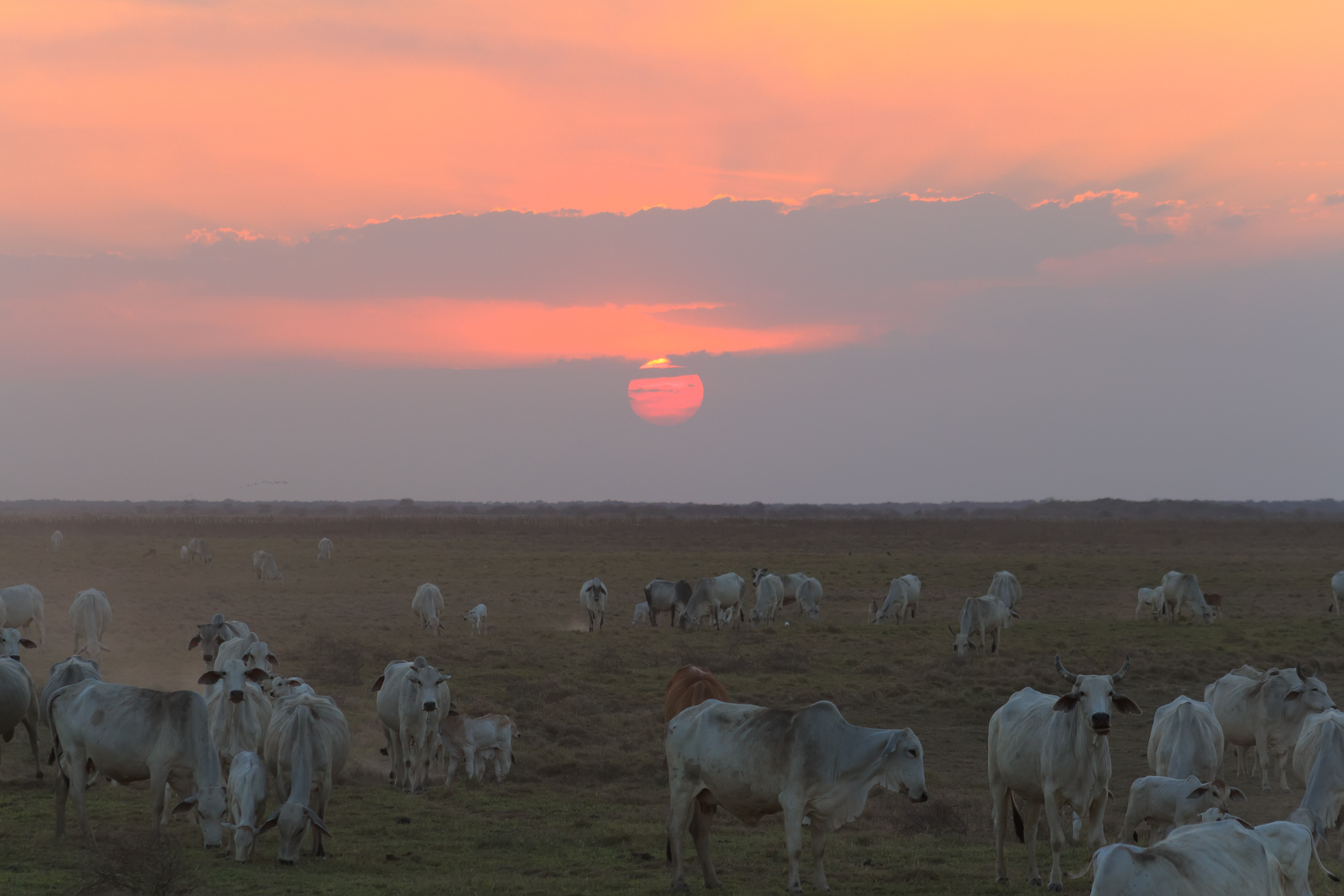
Before 1917, when oil exploitation began to reshape Venezuela's economy, the Llanos region was the agricultural engine of the nation. Cattle, pigs, and goats moved across grasslands managed by llaneros, the cowboys whose horsemanship and toughness became part of Venezuelan national identity. The oil boom pulled workers toward the cities, and the rural exodus diminished the Llanos' national economic weight. But the region never abandoned its vocation. Apure alone concentrates about 30 percent of the country's cattle, despite having only 11 percent of its land in active production. The economy here remains overwhelmingly pastoral and agricultural, with tourism a minor addition. It is one of the most sparsely populated regions in Venezuela, a fact that preserves both its character and its wildlife.
The Wild Menagerie
What the Llanos lack in human density they compensate for in animal abundance. Giant anteaters patrol the savanna on clawed feet, their elongated snouts probing termite mounds. Anacondas, among the largest snakes in the world, are common enough that ranch hands treat sightings as routine. The Orinoco crocodile, pushed to the edge of extinction, persists in the region's rivers. Guarico's Morros de San Juan rise abruptly from the plains, limestone towers that harbor their own microecosystems. Guatopo National Park, straddling the border with Miranda State, protects a swath of cloud forest that seems to belong to a different country than the open grasslands surrounding it. From the air, the Llanos present a paradox: a landscape that looks empty but teems with life concentrated along watercourses and seasonal wetlands.
From the Air
Centered near 7.88°N, 67.47°W. The Llanos Region covers a vast flat expanse across central Venezuela, best visible from above 20,000 feet. During the wet season (May-November), widespread flooding creates a distinctive silver-and-green patchwork. The Morros de San Juan limestone towers in Guarico are a notable visual landmark. Nearest airports include SVSR (San Fernando de Apure) and SVCS (Calabozo). The Apure River is traceable as a winding line from west to east.