Louisbourg Lighthouse
Four lighthouses have stood on this point. The first was Canada's first lighthouse, period -- a stone tower completed in 1734 to guide ships into the Fortress of Louisbourg. It lasted only two years before fire destroyed its lantern, was repaired, then was shattered by British cannon fire during two sieges. The second, a square wooden tower with a black stripe, burned in 1923. The replacement, built that same year and lit in early 1924, still stands. Each replacement inherited the same problem: Lighthouse Point juts into the North Atlantic at a spot where fog, wind, and war have conspired against permanence for nearly three centuries.
The Light That Launched Two Sieges
Construction of the first lighthouse began in 1730, part of the infrastructure supporting the massive Fortress of Louisbourg. When completed in 1734, it was the first lighthouse built in what would become Canada. A fire in 1736 destroyed the lantern, but the stone tower survived, and a replacement lantern was installed in 1738. The lighthouse's strategic importance became brutally clear during the Siege of 1745, when British colonial forces recognized that Lighthouse Point commanded the fortress approaches. Once captured, the point became a gun battery location from which besiegers could bombard the French defenses. The same tactical calculation applied during the 1758 siege -- the lighthouse's elevated position made it the key to reducing the fortress. British artillery damaged the tower badly during that final assault, and after the British demolished the fortress itself, they abandoned the lighthouse too. Its stone ruins, visible to this day, mark where Canada's relationship with coastal navigation began.
A Century of Darkness
For more than 80 years after the British abandoned the site, no light guided ships past this treacherous stretch of Cape Breton coastline. It was not until 1842 that the government of Nova Scotia built a replacement: a large, square wooden lighthouse supported by a massive masonry base, distinguished by a black stripe on its exterior. This second tower incorporated the keeper's dwelling into the base of the light, a practical arrangement for a posting that demanded year-round habitation in a punishing climate. A fog horn building was added in 1902, acknowledging what any mariner already knew -- visibility off Louisbourg is as much a threat as the rocks themselves. This lighthouse served for about 80 years before fire, the same enemy that had crippled the first tower, destroyed it completely on June 2, 1923. The masonry foundation remains visible today, excavated and stabilized by Parks Canada archaeologists, a layer in the archaeological record of a point that keeps building and losing its beacons.
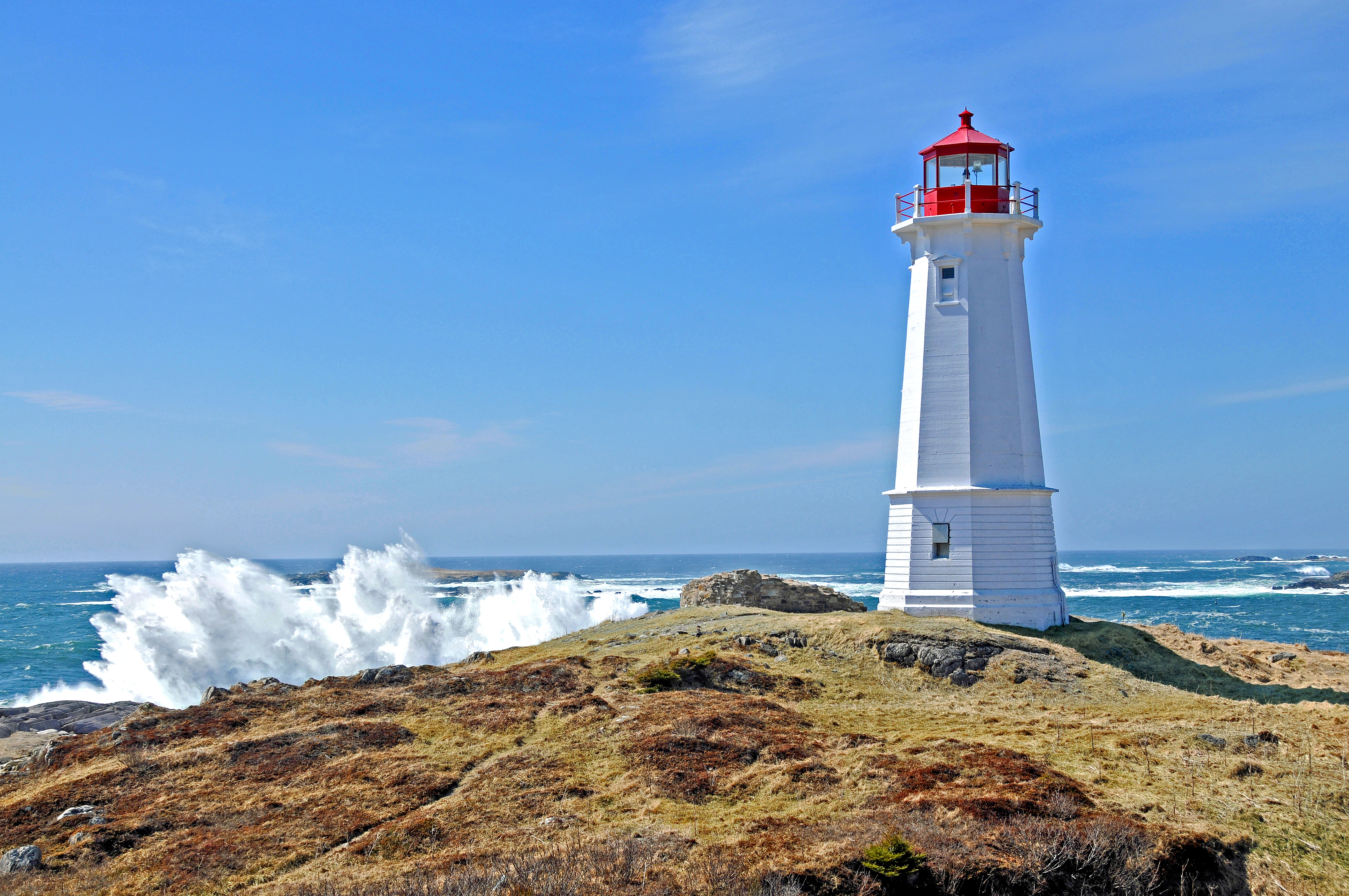
The Concrete Survivor
The current lighthouse was built in 1923, and its designers clearly learned from the past. An octagonal concrete tower decorated with neoclassical architectural features, it is a twin of the Georges Island Lighthouse in Halifax harbor. Concrete does not burn. The tower was destaffed in 1990 as automation replaced the keepers who had maintained the light for generations, but the structure endures. Today it serves as a popular lookoff point where visitors can take in the sweep of the Atlantic and the coastline that has consumed so many ships. In 2008, the Louisbourg Lighthouse Trail opened, a coastal walking path that begins at the lighthouse and winds along the shore. Interpretive plaques along the trail mark the ruins of the previous lighthouses, layering three centuries of maritime history into a single walk. Standing at the point, with the ruins of the 1734 tower visible nearby, the foundation of the 1842 tower underfoot, and the concrete octagon of the 1923 tower behind you, the cumulative weight of what this coast demands becomes clear.
From the Air
Located at 45.91N, 59.96W on Lighthouse Point, at the entrance to Louisbourg Harbour on Cape Breton Island, Nova Scotia. The white octagonal concrete tower is visible from altitude as a bright point on the rocky headland. The Fortress of Louisbourg reconstruction is directly to the southwest. The nearest airport is J.A. Douglas McCurdy Sydney Airport (CYQY), approximately 35 km northwest. Frequent fog and maritime weather; the lighthouse exists precisely because visibility here is unreliable.