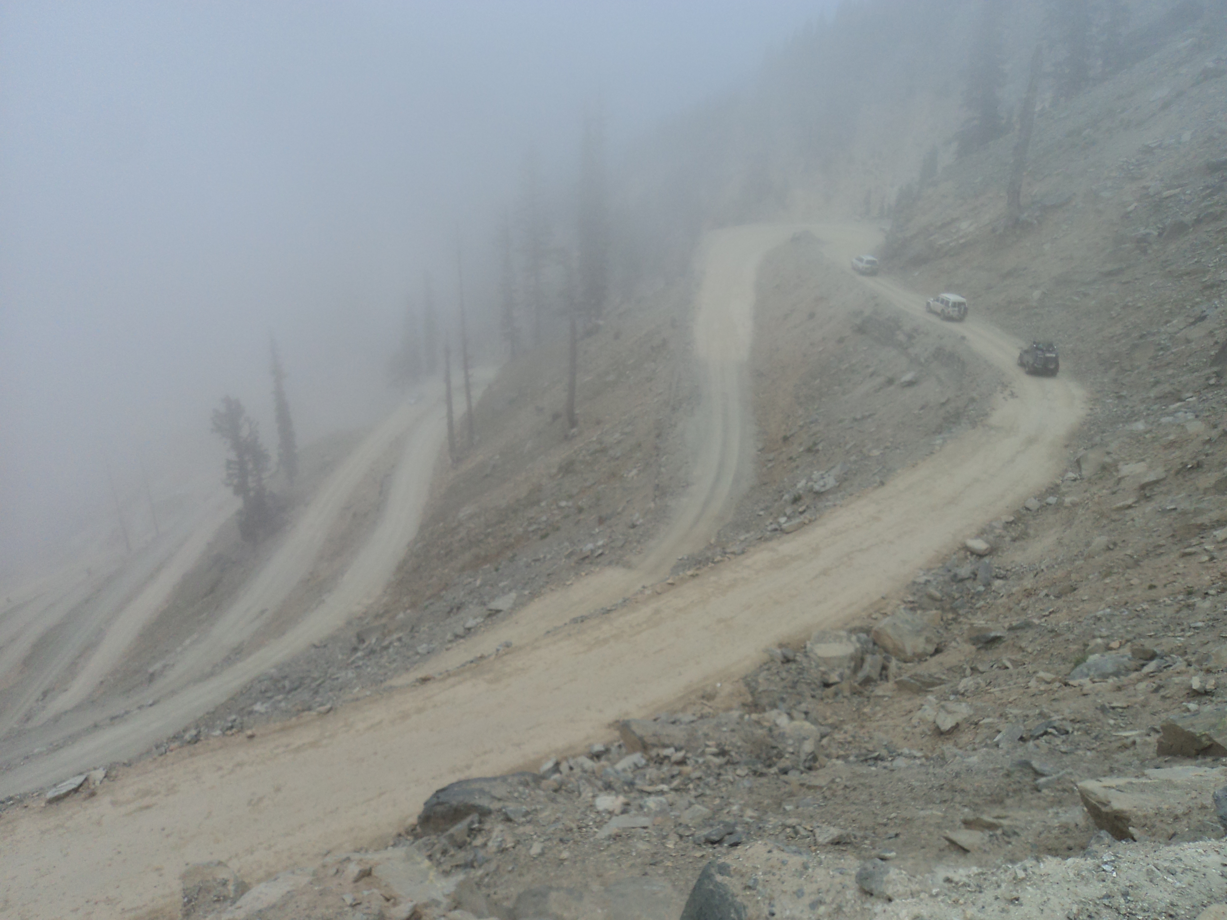
Lowari Pass
Every spring, the snow melts on Lowari Pass and the dead appear. Travelers who attempted the crossing during winter, buried by avalanches that strike without warning between the high walls of the Hindu Raj Mountains, lie where they fell until the thaw finds them. It is a grim seasonal ritual on what remains the shortest route between Chitral and Peshawar -- and at 10,230 feet, paradoxically, the lowest pass into one of Pakistan's most isolated regions. The alternatives are worse: a journey down the Kunar River through hostile Afghan territory, or the much longer route over Shandur Top to Gilgit. So people keep crossing Lowari, as they have for centuries, and the mountains keep extracting their toll.
Gateway to Chitral
Lowari Pass -- also called Lowari Top, though the word "Top" is believed to come not from English but from an ancient language no longer spoken in the region -- connects the Chitral District to Upper Dir in Khyber Pakhtunkhwa province. It is one of four major mountain passes into Chitral, alongside the Dorah Pass from Badakhshan in Afghanistan, Shandur Top from Gilgit, and Broghol from the Wakhan Corridor. At 10,230 feet, Lowari is by far the lowest of these crossings; the others range from 12,000 to 15,000 feet. That relative accessibility is what makes it the primary route, despite the dangers. The pass cuts through the Hindu Raj Mountains, a spur of the higher Hindu Kush, threading between peaks that tower above the road on both sides.
Guardians and Porters
The communities on either side of Lowari have shaped their lives around the pass for generations. On the Chitral side live the people of Ashret, speakers of the Palula language, who were historically assigned by the Mehtar of Chitral to serve as guardians of the crossing. Their role was both practical and political -- controlling access to Chitral's most vulnerable entry point. On the Dir side, Khowar people make their living as porters, carrying loads across the pass when vehicles cannot. During the six months of annual closure, from late November through May, these porters become the only link between Chitral and the outside world. The pass has also claimed its share of notable victims: in 1954, the Mehtar of Chitral himself was killed when his airplane crashed into Lowari Top.
Six Months of Silence
Heavy snow renders Lowari Pass impassable to vehicles for roughly half the year. The closure typically runs from late November to the end of May, and during those months the mountains on either side create a natural funnel for avalanches. Snow accumulates on the steep slopes, and when it releases, there is nowhere to go but down -- across the road and onto anyone caught in the open. The danger is not theoretical. Bodies recovered each spring testify to the risk accepted by those who attempt the winter crossing on foot, whether driven by urgency, commerce, or simple miscalculation. Despite its reputation as one of the ten most dangerous roads in Pakistan, the pass remains popular because geography offers no better option. Chitral is boxed in by mountains and international borders, and Lowari is the least bad way through.
A Tunnel Beneath the Mountain
In 2017, a South Korean company called Sambu completed the Lowari Tunnel, an 8.5-kilometer passage bored beneath the pass to provide year-round access to Chitral. The project was meant to solve the problem that had defined life on Lowari for centuries -- seasonal isolation, avalanche deaths, the annual severing of Chitral from the rest of Pakistan. Construction began in 2005, was redesigned from a rail tunnel to a road tunnel in 2009, and the tunnel was inaugurated by Prime Minister Nawaz Sharif in July 2017, finally offering a route that bypasses the most dangerous sections of the pass. Whether the tunnel will hold against the same forces that have always governed this landscape -- the weight of snow, the patience required by altitude, the sheer difficulty of maintaining infrastructure in the Hindu Raj -- remains an open question. The mountains have outlasted every human engineering project attempted on their slopes so far.
From the Air
Located at 35.35N, 71.80E in the Hindu Raj Mountains of Khyber Pakhtunkhwa, Pakistan, at an elevation of 10,230 feet. The pass connects the Chitral and Upper Dir districts, cutting through steep mountain terrain. From the air, the road is visible as a thin line switchbacking through snow-covered slopes in winter. The Lowari Tunnel (8.5 km) runs beneath the pass. The nearest significant airfield is Chitral Airport (OPCH) to the northwest. Expect severe mountain weather, high winds, turbulence along ridgelines, and reduced visibility during winter months. The Hindu Kush range rises to the north and west.