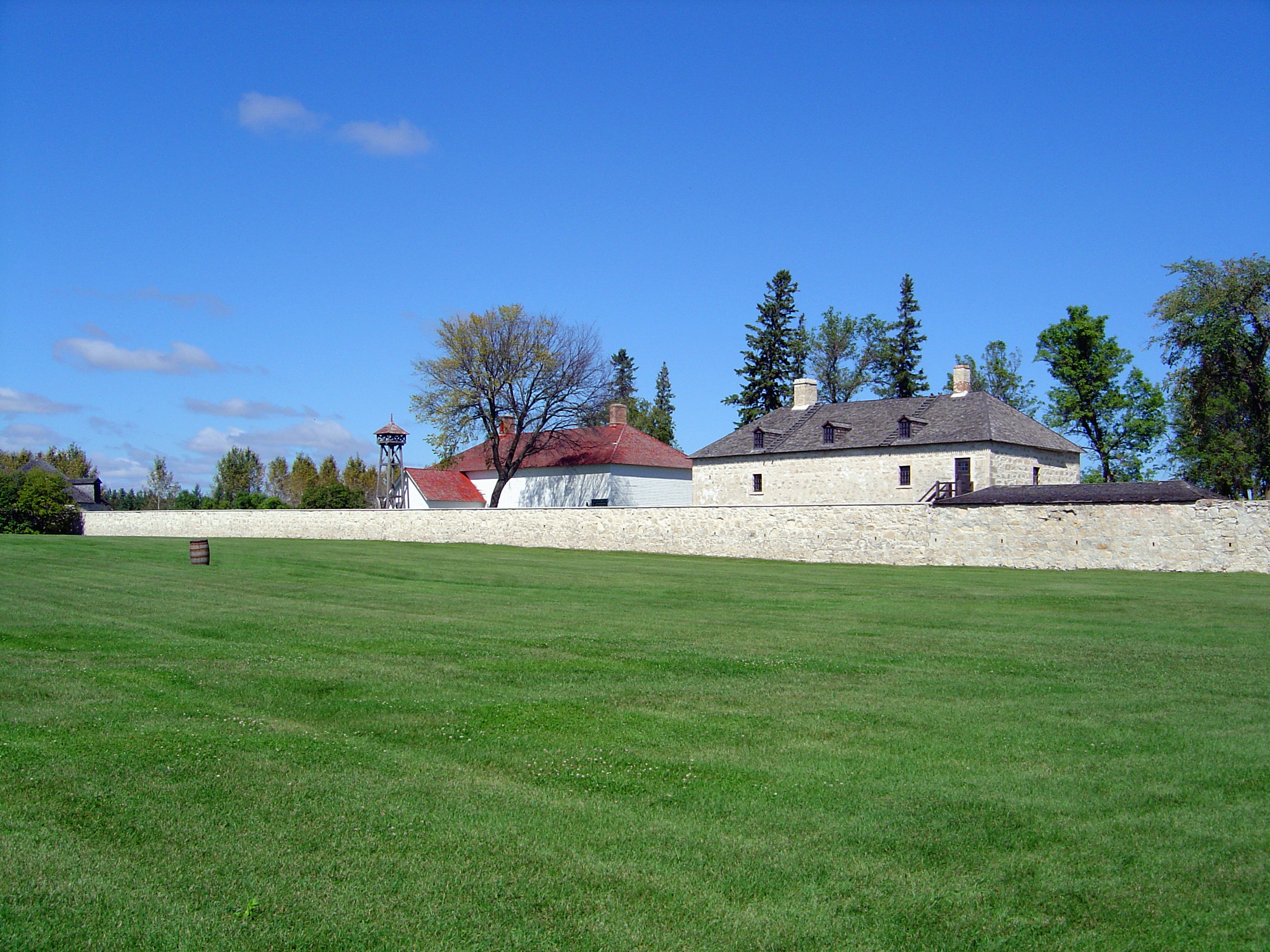
Lower Fort Garry
The walls were never meant to stop an army. When limestone masons finished the enclosure at Lower Fort Garry in 1848, the fortifications served a purely theatrical purpose: impressing visiting Hudson's Bay Company officers and local traders with the appearance of imperial authority. The soldiers who actually built those walls -- men of the British 6th Regiment of the Foot, dispatched to Manitoba in 1846 over a boundary dispute with the United States -- had arrived long after the threat evaporated. With nothing to fight, the idle troops became a nuisance, causing minor disturbances around the settlement. Putting them to work on the walls was as much about keeping soldiers occupied as it was about finishing the fort. That blend of pragmatism and pretense runs through the entire history of Lower Fort Garry, a place built because of a flood, sustained by the fur trade, and witness to some of the most consequential moments in Western Canadian history.
Born from a Flood
In 1826, the Red River burst its banks in one of the most devastating floods in recorded Manitoba history, destroying the original Fort Garry near The Forks in present-day Winnipeg. Governor George Simpson of the Hudson's Bay Company went looking for higher ground downriver and settled on a site below the St. Andrew's Rapids. The location made practical sense: heavy fur packs and York boats could bypass the rapids entirely, eliminating a time-consuming portage. Construction began in 1830 with the fur loft and the Big House, the governor's residence. But there was a problem. The population of the Red River settlement was clustered near The Forks, and nobody wanted to travel the extra distance to do business at the new fort. Lower Fort Garry never became the administrative center Simpson envisioned. Upper Fort Garry was rebuilt in stone at The Forks instead. The lower fort found its niche as a supply depot, serving the surrounding Cree, Anishinaabe, Metis, and European populations -- many of them Orkney Scots -- with manufactured goods traded for produce and furs.
Where Treaty 1 Was Signed
On August 3, 1871, seven chiefs of the Ojibway (Saulteaux) and Swampy Cree First Nations gathered at Lower Fort Garry to negotiate with the federal government. The result was Indian Treaty No. 1, the first numbered treaty in Western Canada, transferring the land that now comprises much of modern Manitoba. The treaty's stated intent was to ensure peaceful settlement of the prairies by European immigrants while providing First Nations people with land, access to resources, and necessities for survival. Almost immediately, the two parties disagreed on its meaning. Treaty 1 set the template -- and the tensions -- for the ten subsequent numbered treaties that would reshape the entire Canadian West. Today a Historic Sites and Monuments Board of Canada plaque outside the Visitor Reception Centre commemorates the agreement, a reminder that this quiet fort on the Red River was where the legal framework for Western Canada's transformation was first put to paper.
Training Ground for the Mounties
The first contingent of North-West Mounted Police arrived at Lower Fort Garry on October 22, 1873. On November 3, they were sworn in and commenced training. The bitter Manitoba winter that followed was spent drilling and learning to ride on a parade ground frozen hard as concrete -- unforgiving terrain for recruits pitched unexpectedly from their horses. Inspector James F. MacLeod, who had passed through during the Red River Rebellion of 1870, returned to find his fiancee, Mary Drever, still at the fort. By June 1874, the recruits were preparing for the arrival of Commissioner G.A. French and the other divisions, then headed out to meet them at Fort Dufferin. These men would become the iconic force that policed the Canadian frontier, and their formative months were spent within these limestone walls, learning horsemanship on frozen ground beside the Red River.
A Fort of Many Lives
After its fur-trade era, Lower Fort Garry reinvented itself with remarkable versatility. By the 1860s it had become an industrial center with a flour mill, sawmill, forge, and brewery. During the Red River Rebellion of 1870, Louis Riel occupied Upper Fort Garry while the Quebec Rifles garrisoned the lower fort -- though no fighting ever occurred here. The fort later served as a federal penitentiary and, from 1885 to 1886, a mental hospital. One of its most notable patients was Honore Jaxon, Louis Riel's secretary, found not guilty of treason by reason of insanity after the North-West Rebellion. From 1911 to 1963, the grounds hosted a golf course and motor country club. The Hudson's Bay Company finally transferred ownership to the federal government in 1951, and the site was designated a National Historic Site in 1958. In 2011, Canada's History magazine named it one of the country's top ten National Historic Sites. Today, costumed interpreters recreate life in the early 1850s among the original limestone buildings and walls.
From the Air
Located at 50.112°N, 96.932°W on the western bank of the Red River, approximately 32 km north of downtown Winnipeg. The fort compound is visible from the air as a rectangular limestone-walled enclosure on the riverbank. The Red River itself is the primary visual navigation reference, winding north through the Manitoba plains. Winnipeg James Armstrong Richardson International Airport (CYWG) lies approximately 35 km to the south-southwest. St. Andrews Airport (CKL5) is closer, roughly 10 km south. Best viewed at 2,000-4,000 feet AGL for the fort layout and river context. The flat prairie terrain makes the limestone walls and surrounding heritage buildings distinctive from altitude.