Lubaantun
In 1943, the adventurer F.A. Mitchell-Hedges purchased a crystal skull at a Sotheby's auction in London. It had previously belonged to collector Sydney Burney, and photographs had appeared in the journal Man as early as 1936. None of this stopped Mitchell-Hedges' adoptive daughter Anna from later claiming she had found the skull as a teenager at Lubaantun, a Maya ruin in the jungles of southern Belize. The story was nonsense -- investigators Joe Nickell and archaeologist Norman Hammond proved as much -- but it stuck, and for decades the crystal skull eclipsed the real wonder of Lubaantun: a city built entirely without mortar, from black slate blocks fitted together with such precision that they have held for over a thousand years.
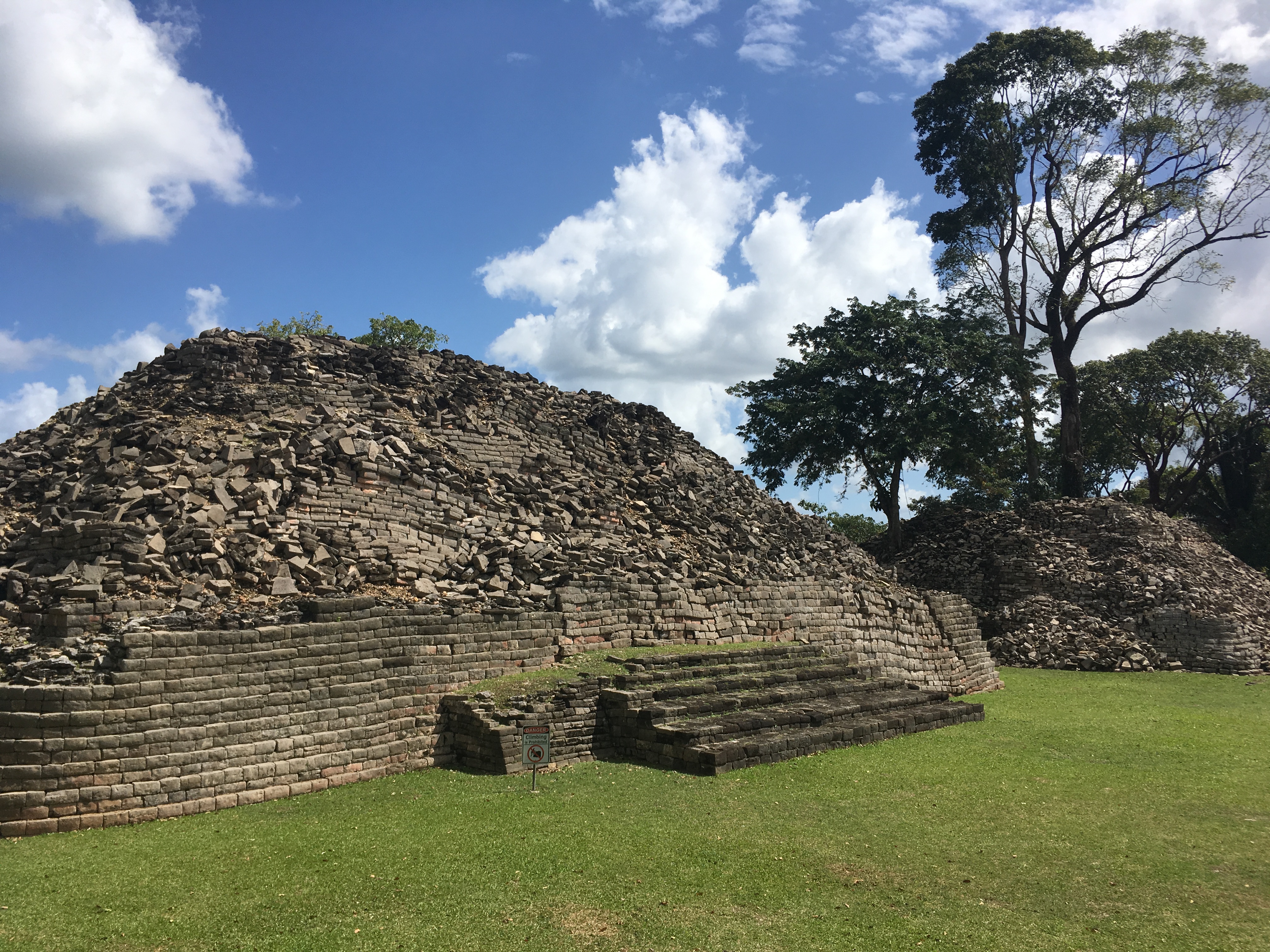
Place of Fallen Stones
The modern Maya name Lubaantun means "place of fallen stones," and arriving at the site you understand why. Located in Belize's Toledo District, about 42 kilometers northwest of Punta Gorda and 3.2 kilometers from the village of San Pedro Columbia, the ruins rise on an artificially raised platform between two small rivers at an elevation of 61 meters. The city flourished from roughly AD 730 to 890, then was completely abandoned. Its architecture is unlike almost anything else in the Maya lowlands. Where other sites used limestone bound with mortar and coated in stucco, Lubaantun's builders chose black slate, cut into large blocks and laid dry. Several structures feature distinctive "in-and-out masonry" -- every second course of stone projects slightly beyond the one below it, creating a rippling, textured surface. The corners of the step-pyramids are rounded rather than squared, and no stone superstructures sit atop the pyramids; whatever crowned them was built from wood and thatch, long since vanished.
Whistles in the Rubble
Lubaantun's most remarkable finds are not its buildings but its figurines. Hundreds of mold-made ceramic whistle figurines, each with two finger holes allowing three notes, were excavated by T.A. Joyce during British Museum expeditions in 1926 and 1927. They depict cosmological figures, officials in ceremonial dress, and two distinct physical types that Joyce categorized as "classical" -- featuring cranial modification, ear flares, and nose ornaments -- and "chubby," with large foreheads and smooth cheeks. Male figurines wear girdles, capes, and carry provision bags and spears. Female figurines carry water jars and baskets of agricultural products. A special series depicts figures wearing close-fitting helmets, crests, a single glove on the right hand, and exaggerated thigh flaps -- the dress of ballgame players. The site has three ballcourts, to the east, west, and south of the main E-group buildings.
Cacao Capital
Research by archaeologists Robert Sharer and Loa Traxler established that Lubaantun was occupied briefly, from about AD 700 to 870, and served as the local capital of its area during that window. Ceramic and stone effigies with cacao pods have been found at the site, pointing to Lubaantun as a major production center for cacao -- the commodity that functioned as both luxury food and currency throughout the Maya world. Evidence from Heather McKillop's excavations at nearby Stingray Lagoon, where Lubaantun-style whistle figurines and unit-stamped pottery appeared alongside salt production facilities, suggests the city participated in trade networks linking inland production to coastal exchange. The population may have reached 600 people per square kilometer. Scholars believe Lubaantun and neighboring Nim Li Punit were politically created from the earlier centers of Pusilha or Uxbenka, strategic foundations designed to control access to ecological resources and pre-existing trade routes.
Rediscovery and Reckoning
Dr. Thomas Gann first investigated Lubaantun in 1903 after Q'eqchi' and Mopan Maya villagers told inhabitants of Punta Gorda about the large ruins. R.E. Merwin of Harvard's Peabody Museum cleared and mapped the site in 1915, discovering the first ballcourt with its hieroglyphic stone markers. Then came Mitchell-Hedges in 1924, claiming in the Illustrated London News to have "discovered" what Gann had already documented. After the British Museum expeditions of the 1920s, the site was neglected for over 40 years -- looted by treasure hunters but ignored by archaeologists -- until Norman Hammond led a joint British Museum, Harvard, and Cambridge University project beginning in 1970. His team excavated a family tomb containing 15 adults, all with dental cavities and signs of childhood malnutrition, a sobering glimpse into daily life behind the ceremonial grandeur. In 1998, the Maya Archaeological Sites Development Program, backed by the European Union and Belize's Department of Archaeology, restored portions of the site and built a visitor center. Today Lubaantun is accessible by road, its mortarless walls still standing without the aid of a single drop of cement.
From the Air
Located at 16.28N, 88.97W in the Toledo District of southern Belize, approximately 42 km northwest of Punta Gorda. From the air, the site appears as a raised clearing between two small river tributaries amid dense broadleaf jungle. The Maya Mountains rise to the west. Nearest airport is Punta Gorda airstrip (MZPG). The village of San Pedro Columbia is approximately 3 km to the southeast. The site is inland from the Caribbean coast, with the Belize Barrier Reef visible offshore to the east.