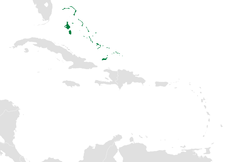
Lucayan Archipelago
Only 38 of them are inhabited. That number bears repeating, because the Lucayan Archipelago contains roughly 740 islands and 2,400 cays scattered across the western Atlantic between Florida and Hispaniola, and the vast majority are empty -- no roads, no docks, no footprints. From the air, they appear as pale brushstrokes on deep blue canvas, low-lying slivers of limestone and coral where the ocean floor rises close enough to the surface to catch the light. The archipelago encompasses both the sovereign nation of the Bahamas and the British Overseas Territory of the Turks and Caicos Islands, but its name reaches further back than either government, to the Lucayan people who paddled dugout canoes between these islands for seven centuries before Europeans arrived.
The People the Islands Remember
The Lucayans were a branch of the Taino, the broader Indigenous group that populated much of the Caribbean. They settled the archipelago beginning around the 8th century CE, building communities across the island chain and establishing trade routes that connected them to neighboring islands by dugout canoe. They had their own language, governance, customs, and spiritual traditions. In October 1492, the Lucayans became the first Indigenous Americans to encounter Christopher Columbus. The meeting was catastrophic. Within three decades, the Spanish had enslaved so many Lucayans -- transporting them to Hispaniola and Cuba to work in mines and on plantations -- that by 1520 some islands were completely depopulated. An entire civilization, erased in a single generation. The archipelago that still bears their name is their most enduring monument.
Limestone and Light
The geology of the Lucayan Archipelago is deceptively simple. The islands sit on two large submarine platforms of limestone and coral, the Great Bahama Bank and the Little Bahama Bank, built up over millions of years by the slow accumulation of marine organisms. Because the underlying rock is porous and soluble, the islands are almost universally flat. The highest point in the entire chain is Mount Alvernia on Cat Island, a modest summit that barely qualifies as a hill by most standards. What the landscape lacks in elevation it compensates for in color. The shallow banks surrounding the islands refract sunlight through water so clear that the seabed is visible from thousands of feet above, producing the electric blues and greens that have defined the Bahamas in the popular imagination.
Two Nations, One Chain
Politically, the archipelago is divided between two entities with very different histories. The Bahamas, independent since 1973, comprises about 700 of the islands and most of the cays. Its capital, Nassau, sits on New Providence Island and serves as the economic and population center. Andros, the largest island in the chain, remains largely undeveloped despite its size. To the southeast, the Turks and Caicos Islands remain a British Overseas Territory, encompassing 40 islands and cays with eight inhabited. Providenciales has become the tourism hub, while Grand Turk retains the administrative functions. Despite their political separation, the two territories share the same limestone foundations, the same hurricane vulnerabilities, and the same shallow-water ecosystems that make the region one of the most biologically productive marine environments in the Atlantic.
Life Above and Below the Waterline
The archipelago's marine ecosystem is its greatest natural asset. Spotted dolphins and common bottlenose dolphins patrol the deeper channels between the banks, while humpback whales pass through during their annual migration. Coral reefs fringe many of the islands, supporting communities of tropical fish, sea turtles, and invertebrates. On land, the picture is subtler. Coastal caves harbor frogs, lizards, nonpoisonous snakes, and several species of bats. The islands support diverse birdlife, with species adapted to everything from mangrove swamps to dry scrubland. But the defining feature of life here is the water itself -- warm, shallow, and startlingly transparent, shaping everything from the economy to the ecology to the quality of the afternoon light.
From the Air
The Lucayan Archipelago stretches roughly 600 nautical miles from Grand Bahama (near Florida) southeast to the Turks and Caicos Islands, centered approximately at 23.74N, 75.37W. At cruising altitude, the archipelago is unmistakable: pale islands and sandbars scattered across varying shades of blue water, with the shallow Bahama Banks producing vivid turquoise coloring visible from FL350 and above. Key airports include Nassau/Lynden Pindling International (MYNN), Freeport/Grand Bahama (MYGF), and Providenciales (MBPV) in the Turks and Caicos. The best visibility for appreciating the island chain's full extent is at 10,000-15,000 feet on clear days. Hurricane season runs June through November, bringing occasional severe weather.