Magnuson Park
Twenty-two submarine diving-plane fins sweep across a field of grass in a 500-foot arc, arranged to evoke a pod of orca surfacing through the earth. Artist John T. Young installed them here in 1998, a sculptural nod to the naval past embedded in every acre of Magnuson Park. This 350-acre stretch of northeast Seattle was, for most of the twentieth century, a military airfield -- the place where the Navy tested seaplanes, trained pilots, and launched patrols over Puget Sound. Before that, the Coast Salish people who lived along the lakeshore knew the nearby prairie as BEbqwa'bEks, a "small prairie" shaped by centuries of deliberate burning. The land has been many things. That it ended up as a public park was not inevitable, and the story of how it got there involves a gifted county real estate deal, a senator's legacy, and one of the most ambitious wetlands restoration projects in the Pacific Northwest.
From Prairie to Runway
The first park on this peninsula appeared in 1900, a gift from developers Morgan and Mrs. Carkeek to the people of Seattle. It did not last. After World War I, military boosters began pushing for a naval air station at Sand Point, and King County started buying up parcels around the Carkeek donation. By 1922, the U.S. Navy was building on land it leased from the county. Four years later, the county deeded the Navy 413 acres outright -- a half-million-dollar gift in 1926 currency -- and the name Carkeek Park migrated to a different site on the west side of the city. Naval Air Station Seattle operated for decades, training aviators and hosting patrols. The station saw peak activity during World War II, when Building 193 went up in 1943 as a hangar for transport aircraft. By 1970, the airfield was deactivated, the base renamed Naval Support Activity Seattle, and negotiations over what to do with the surplus land began in earnest.
A Senator's Namesake
In 1975, the Navy handed a large portion of the property to the City of Seattle and to NOAA, which established its Western Regional Center on the north end. The city's share became Sand Point Park, a name that stuck for two years before the city council renamed it in 1977 to honor Warren Magnuson, the U.S. Senator who had represented Washington for thirty-six years. Magnuson was a former naval officer himself, and the renaming felt apt -- though locals still call it Sand Point as often as they call it Magnuson. The old runways were demolished in the late 1970s, and NOAA's new construction was completed by 1982. What had been flat military tarmac gradually softened into playing fields, walking paths, and open meadow, but the transition left scars. Roughly twenty percent of the park's surface remained sealed under concrete and asphalt, and the storm drains installed during the Navy era aged badly, saturating sports fields and flushing untreated runoff straight into Lake Washington.
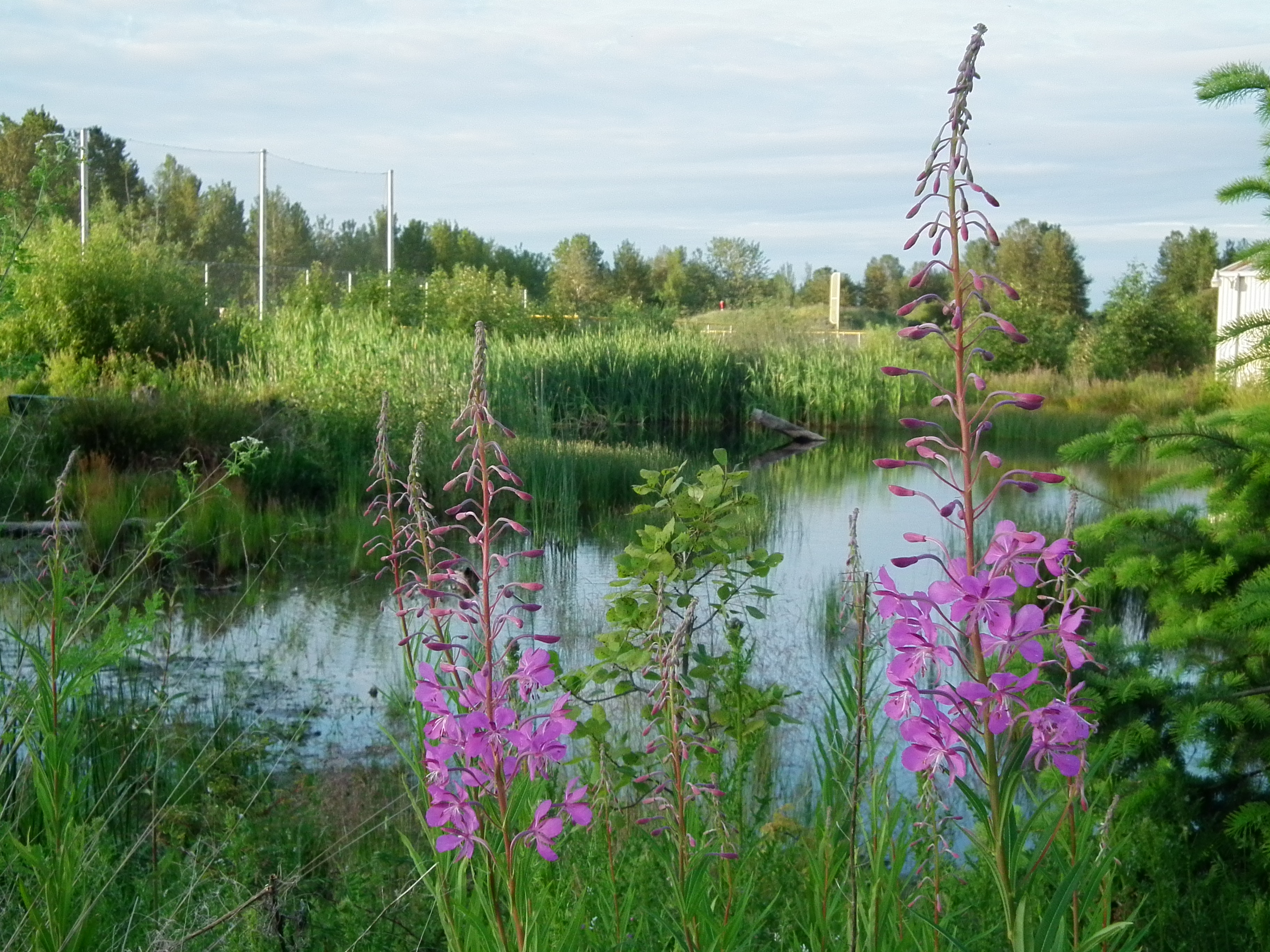
Rewilding the Airfield
The park's most dramatic transformation came with its wetlands restoration project, which reshaped the southern end of the property from flat, poorly drained former tarmac into a sculpted landscape of mounds, plateaus, valleys, and ponds. The engineering was practical: the constructed wetlands channel stormwater through natural filtration before it reaches Lake Washington, reducing the pollution that decades of impervious surfaces had been dumping into the lake. But the ecological results went further than drainage. The restored wetlands attracted bird species that had not been documented on the peninsula in living memory. The Seattle Audubon Society now runs a Neighborhood Bird Project here, tracking the returning wildlife. Building 193, the old transport-aircraft hangar that had served its final years as a commissary, was demolished in December 2006 to make room for the restoration. Where concrete once covered the ground, cattails and sedges now grow in seasonal pools.
Fins, Fields, and Community
Today Magnuson Park is a sprawling, slightly eccentric place. The Fin Project -- those four submarine fins -- anchors the park's identity as a space where art, history, and recreation overlap. A sailing center teaches youth from across the city to handle boats on Lake Washington. Forty acres of sports fields serve soccer leagues and pickup games. A community garden occupies part of the grounds. Housing developments on the perimeter provide affordable units in a city where affordability is increasingly scarce. NOAA's campus on the north end gives the park an unusual neighbor: a federal science agency whose researchers study everything from fisheries to weather systems. The peninsula itself remains a distinctive geographic feature, jutting into Lake Washington between Wolf Bay and Pontiac Bay, visible from the air as a green finger pointing east into blue water. On clear days, the Cascades rise behind the lake, and the park's open meadows offer one of the few unobstructed sightlines in northeast Seattle.
From the Air
Magnuson Park occupies the Sand Point peninsula at 47.681N, 122.248W, jutting east into Lake Washington between Wolf Bay (north) and Pontiac Bay (south). The 350-acre green expanse is clearly visible from altitude, with NOAA's Western Regional Center buildings at the north end and the restored wetlands at the south. The former runway alignments are still faintly traceable in the park's geometry. Nearest airports: Boeing Field (KBFI) 9nm south, Kenmore Air Harbor (S60) 5nm north, Renton Municipal (KRNT) 11nm southeast. Best viewed at 2,000-3,000 feet on approach from the east over Lake Washington, where the peninsula's shape is unmistakable against Seattle's residential grid.