Magome-Tsumago Trail
The poet Matsuo Basho walked this road. So did hundreds of feudal lords, dragging their retinues on mandatory journeys to the shogun's court in Edo. The Magome-Tsumago Trail covers just eight kilometers of the Nakasendo, the great inland highway that once connected Tokyo and Kyoto through Japan's mountainous spine. But those eight kilometers happen to be the best-preserved section of the entire route, a stretch of forest path, rural hamlets, and mountain scenery designated as a National Historic Site. What makes the trail remarkable is not its difficulty -- most walkers finish in two to three hours -- but its power to collapse four centuries of distance between you and the travelers who came before.
The Center Mountain Road
The Nakasendo, whose name translates to "center mountain road," was one of five official highways established by the Tokugawa shogunate to bind Japan together during the Edo period. Unlike the coastal Tokaido road, which required dangerous river crossings, the Nakasendo chose an inland route through the mountains of central Honshu. Sixty-nine post stations lined its length, providing lodging, meals, and fresh horses for travelers. The section between Magome and Tsumago was among the most scenic and most demanding, crossing a mountain pass through dense cedar forest. The Nakasendo flourished because of the sankin-kotai system, which compelled feudal lords to alternate between their home domains and the capital. Entire processions of samurai, servants, and supply bearers trudged these mountain paths. When the railway arrived in the late 1800s, the old highway fell silent. These two post towns, too remote for modernization to reach, simply stayed as they were.
Setting Out from Magome
Most walkers begin in Magome, because the trail runs mostly downhill in that direction. The post town sits on a hillside in Gifu Prefecture, its stone-paved main street lined with dark wooden buildings that have been restored to their Edo-period appearance. The trail leaves town through rice paddies and rural fields at the edge of the Kiso Valley, briefly joining a paved road before splitting off onto a walking path. Early landmarks include a monument to an Edo-period travel writer and an old shrine where highway travelers once paused to pray for safe passage. After the shrine, the trail crosses from Gifu Prefecture into Nagano Prefecture, and the character of the walk changes. The forest closes in. The path narrows. Somewhere around the halfway point, a traditional tea house built in the Edo period still serves tea and sweets to passing walkers, just as it did centuries ago.
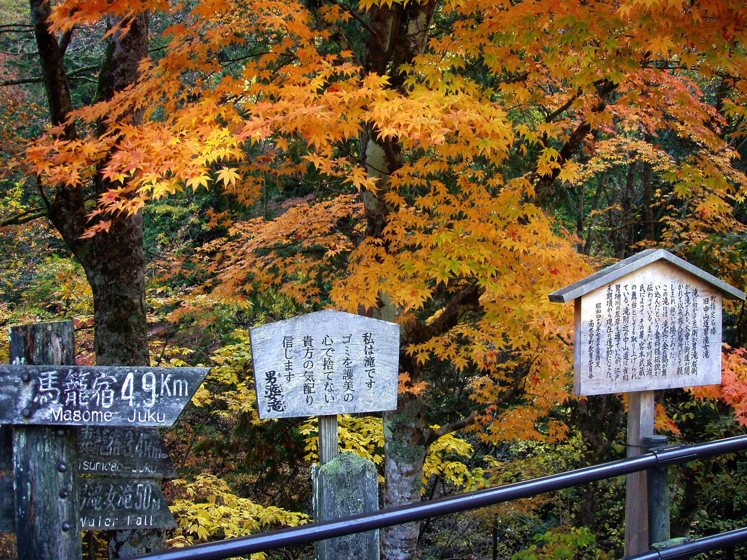
Through the Forest
The middle section of the trail is where the modern world vanishes most completely. Cedar trees tower overhead, filtering the sunlight into green columns. The path follows stream beds and wooden bridges through terrain that feels genuinely wild. A stone Buddha appears beside the trail, the only one carved from stone in the entire Kiso Valley. Farther along, old inns serve food traditional to the region. The path occasionally merges with a country road, then ducks back into the trees. There are no convenience stores, no vending machines, no cell towers intruding on the illusion. The Aragari River must be crossed before reaching the outskirts of Tsumago, where the trail transitions from wilderness back to civilization. Soba shops and traditional inns mark the approach to the second post town, and the walk ends at its quiet main street, where the Edo period feels less like history and more like a place you can still visit.
Practical Wisdom for the Trail
The Magome-Tsumago Trail rewards the unhurried traveler. A luggage forwarding service operates between the two towns for about 500 yen per bag, freeing walkers from their packs. The trail is gentle enough that hiking boots are unnecessary except in winter, when icy conditions make sturdy footwear essential. Bear bells are sold at the tourist information center for the cautious, though encounters are extremely rare. Those who prefer not to walk can take a bus between Magome and Tsumago in about twenty minutes for around 700 yen. The nearest train station is Nakatsugawa, connected by a 25-minute bus ride to Magome. From Nagoya, the Wide View Shinano limited express reaches Nakatsugawa in about an hour and a half. Walkers who complete the trail and want more can continue along the Nakasendo toward Ochiai, though the preservation thins quickly beyond Tsumago.
From the Air
The Magome-Tsumago Trail is located at approximately 35.527N, 137.568E in the Kiso Valley of central Japan, straddling the border between Gifu and Nagano Prefectures. From the air, the trail follows a forested mountain corridor between two small valley settlements visible as clusters of dark-roofed buildings amid dense green canopy. The Kiso River valley runs roughly north-south through the area. Look for the distinctive steep hillside of Magome to the south and the flatter river-bottom setting of Tsumago to the north. Mount Ena (2,191m) dominates the skyline to the south. Nearest airports: Chubu Centrair International (RJGG) about 150km southwest, Matsumoto Airport (RJAF) about 80km north. Mountain terrain creates turbulence; best viewed in clear conditions at moderate altitude.