Makran Coastal Highway
Before 2004, the journey from Karachi to Gwadar took at least two days. The only route was an uncarpeted "jeep track" that punished vehicles into early retirement and tested the endurance of anyone foolish enough to attempt it. Most travelers opted for the longer but paved route through Quetta, hundreds of kilometers inland. Then, in December 2004, the Makran Coastal Highway opened, and 653 kilometers of Pakistan's Arabian Sea coast went from inaccessible frontier to six-hour road trip. The same Frontier Works Organisation that had carved the Karakoram Highway through the mountains of northern Pakistan -- one of the highest paved roads on Earth -- had tamed the coast.
A Road to Gwadar's Future
The highway was never just about connecting two cities. When the decision to build a deep-water port at Gwadar was taken in the early 1990s, the Makran Coastal Highway became essential infrastructure. Without it, Gwadar would have been an economic island -- a port with no road linking it to Karachi, Pakistan's commercial capital, or to the rest of the national highway network. The highway also offered China a strategic alternative: a land-sea corridor bypassing the vulnerable chokepoints of the Strait of Malacca. Construction commenced in 2002 under the Frontier Works Organisation and was completed in three years, an impressive pace given the terrain. The road passes through Ormara and Pasni before reaching Gwadar, threading through desert, mountain passes, and coastal stretches that had seen virtually no infrastructure for centuries.
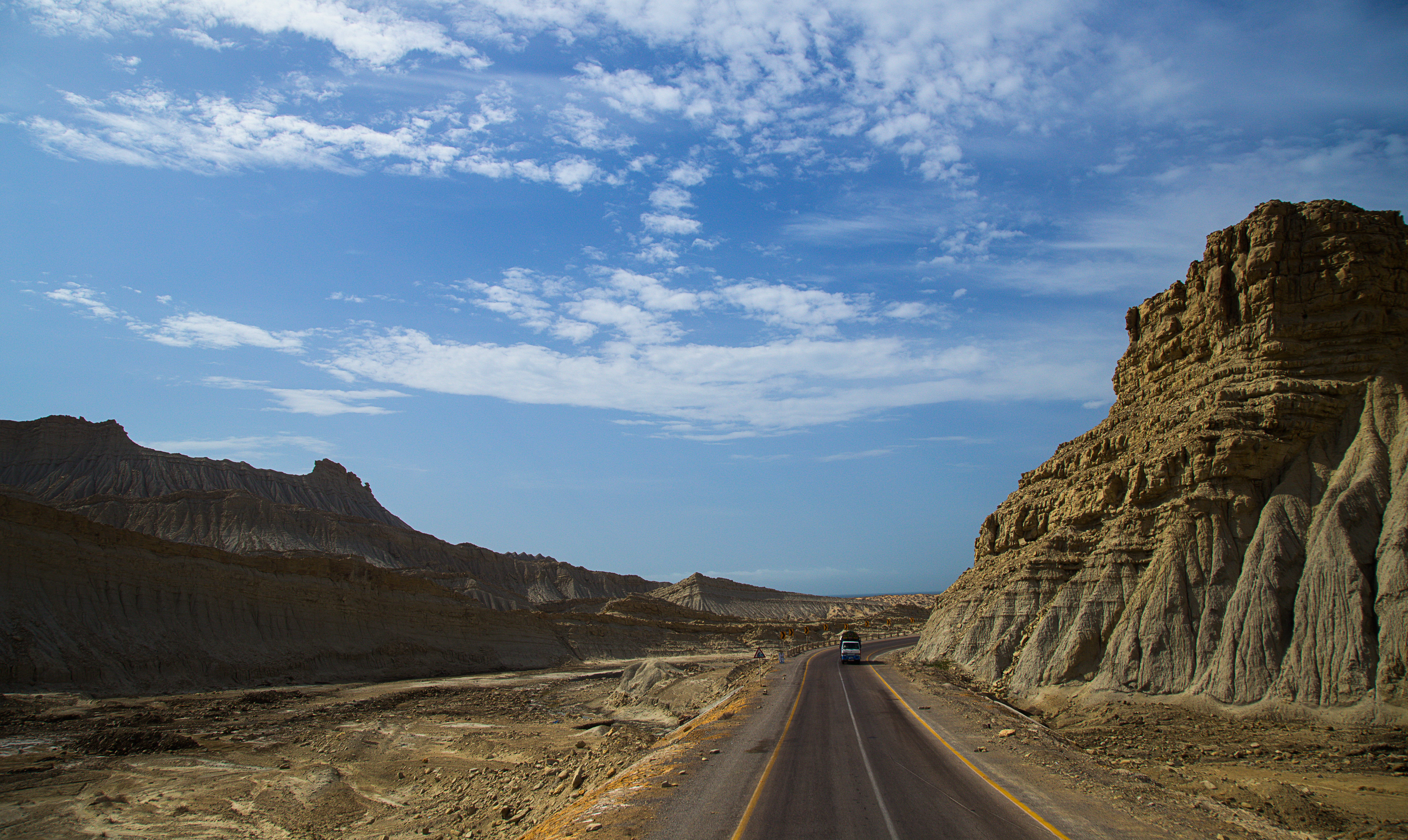
Driving Through Deep Time
The highway passes through Hingol National Park, and this is where the drive becomes extraordinary. Rock formations sculpted by millennia of wind and wave erosion rise from the desert in shapes that defy casual explanation. The Princess of Hope -- a hoodoo that resembles a crowned woman -- stands beside the road. The Balochistan Sphinx looms at Buzi Pass, looking eerily like its Egyptian namesake. Mud volcanoes bubble in the distance. The Hingol River estuary opens to reveal wetlands thick with migratory birds. Before the highway, these landscapes were known only to the scattered fishing communities and pastoralists who lived among them. Now, travelers from Karachi can reach the Golden Beach at Kand Malir -- listed among Asia's 50 most beautiful beaches in 2018 -- in a matter of hours.
Connecting Communities to Markets
The Government of Pakistan built the highway with specific economic objectives: develop infrastructure along the coastline, transform Ormara, Pasni, and Gwadar into major port cities, and reduce the time and cost of transporting fresh seafood from coastal catchment areas to markets in Karachi and export processing zones. Before the highway, the seafood industry along the Makran coast operated under crippling logistical constraints. Fish caught in the morning could spoil before reaching a market. Transportation costs consumed whatever margins existed. The highway cut those costs dramatically, making it feasible for coastal fishermen to reach urban markets the same day. It also opened the region to tourism for the first time, bringing visitors to beaches, Hindu pilgrimage sites, and geological wonders that had been accessible only to the most determined travelers.
The Road Ahead
The Makran Coastal Highway is managed and maintained by Pakistan's National Highway Authority, and it has transformed life along the coast in ways both intended and unforeseen. Pilgrimage traffic to the Hinglaj Mata Temple has surged, with over 250,000 visitors arriving each spring -- a journey that once required walking more than 150 miles across open desert. Tourist traffic to Hingol National Park has grown steadily. But the highway also brought new pressures: increased fishing activity in previously remote waters, more plastic pollution on pristine beaches, and the slow encroachment of development into ecosystems that had been protected by their own inaccessibility. The road that opened the Makran coast to the world also exposed it to the world's demands.
From the Air
The Makran Coastal Highway (N-10) runs 653 km along Pakistan's Arabian Sea coast from Karachi (OPKC) to Gwadar (OPGD), passing through Ormara and Pasni (OPPI). The highway is visible as a thin ribbon along the coast at altitude. Best viewed at 3,000-8,000 feet AGL. The road passes through Hingol National Park, where dramatic rock formations and mud volcanoes are visible from the air. Key visual landmarks include the Princess of Hope formation, the Balochistan Sphinx at Buzi Pass, and the Kand Malir beach.