Manapouri
Two hundred and seventy people live in Manapouri. That is the entire town. But in 1970, this tiny settlement on the shore of a glacial lake became the focal point of New Zealand's first major environmental campaign, when nearly 265,000 citizens -- almost ten percent of the country's population -- signed a petition to protect the lake from being permanently altered by a hydroelectric scheme. The Save Manapouri campaign changed how New Zealand thought about conservation, and the lake it fought to protect remains one of the most beautiful in the country, its surface reflecting mountains that have barely changed since the glaciers carved them.
Tears That Became a Lake
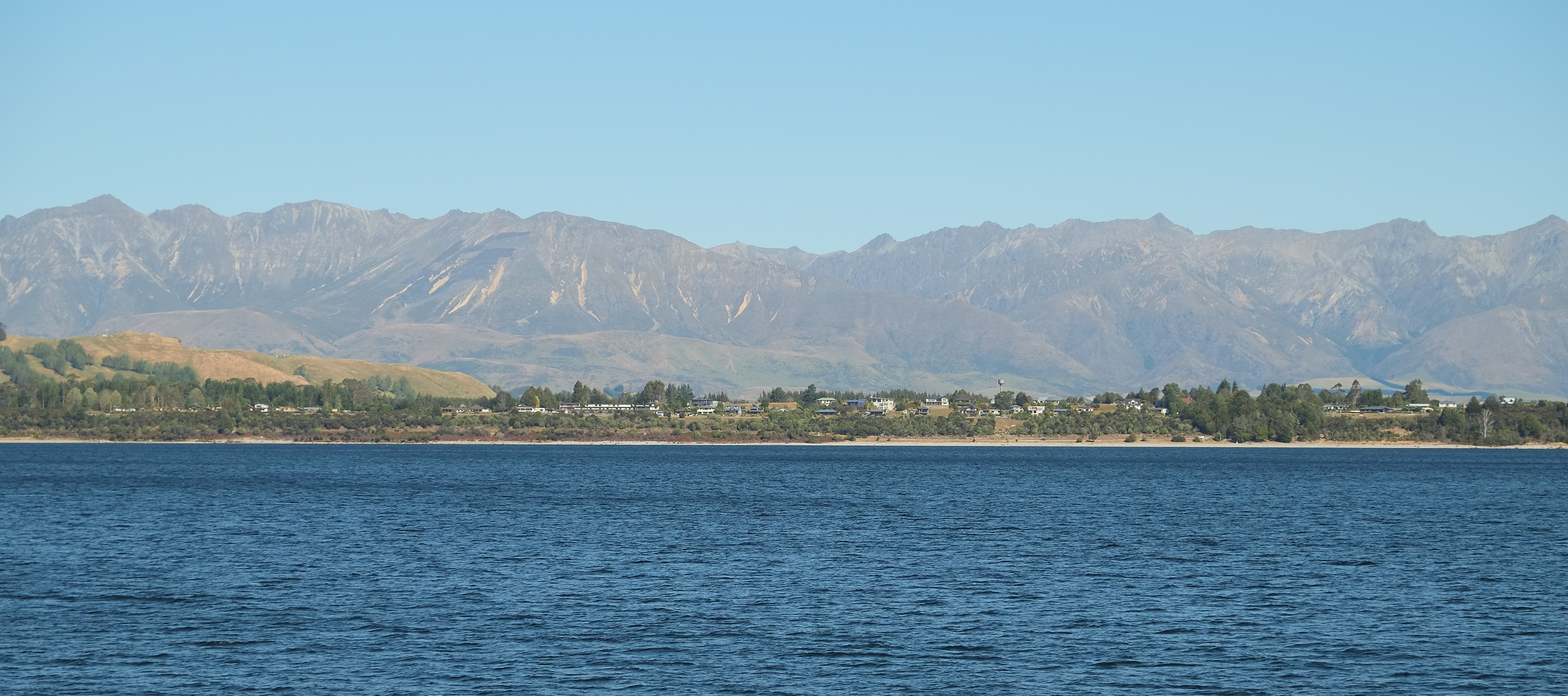
The Maori name Manapouri means "lake of the sorrowing heart," and the story behind it is one of the most poignant in New Zealand's oral tradition. Two sisters, Moturua and Koronae, were daughters of a local chief. One day, Koronae ventured deep into the forest and became stranded after a fall. Her sister Moturua went searching and found Koronae trapped, unable to be rescued. Rather than leave her, Moturua lay down beside Koronae, and there the sisters remained until they died. Their tears, according to the legend, pooled and grew until they formed the lake. At 444 meters deep, Lake Manapouri is New Zealand's second-deepest lake, its bed carved by glaciers so far below the surface that the bottom lies 267 meters below sea level. The 33 islands scattered across the water, 22 of them wooded, give the lake the intricate, many-armed shape that makes it look more like a fjord than a typical mountain lake.
Power Beneath the Mountains
In the 1960s, the New Zealand government approved a plan to generate electricity from Lake Manapouri by building a power station entirely underground. Workers excavated 200 meters straight down through solid rock to carve out a machine hall 111 meters long, 18 meters wide, and 39 meters high, removing 1.4 million tonnes of rock in the process. Water drops 200 meters from the lake into the turbines, then flows through a 10-kilometer tailrace tunnel under the mountains before discharging into Doubtful Sound at Deep Cove. The engineering was extraordinary. But the original plan called for raising the lake level by up to 12 meters, which would have drowned the shoreline, submerged islands, and fundamentally altered the lake's character. The power station was built, but the fight over the lake level was just beginning.
The Campaign That Changed a Nation
In October 1969, a Southland sheep farmer named Ron McLean launched the Save Manapouri campaign at a public meeting in Invercargill. Within months, 14 local committees had formed across the country. McLean toured New Zealand with a simple message: the lake should not be sacrificed for electricity. By 1970, the petition had gathered 264,907 signatures, delivered to Parliament in bundles of cardboard boxes wheeled in on a hand trolley. It was, at the time, the largest petition in New Zealand history relative to the population. The campaign worked. Labour promised in its 1972 election manifesto not to raise the lake level, and passed legislation to that effect upon winning power. The Guardians of Lakes Manapouri, Monowai, and Te Anau were established to monitor water levels and ensure they stayed close to natural fluctuations. In 2002, the government rejected a proposal to extract 40,000 cubic meters of water for commercial bottling. Manapouri had become a symbol of what citizens could protect when they organized.
Gateway to Doubtful Sound
Today, Manapouri's primary role is as the departure point for Doubtful Sound, one of Fiordland's most remote and spectacular waterways. The journey itself is part of the experience: visitors board a boat at Pearl Harbour on the lake's southern shore, cross Lake Manapouri to West Arm, then travel by coach over the steep and winding Wilmot Pass before descending to Deep Cove, where a cruise boat waits. The full-day trip feels like entering a different world, and in some respects it is. Doubtful Sound receives far fewer visitors than Milford Sound, partly because getting there requires effort and partly because there is no road access. The town itself is compact, walkable in minutes, and makes no pretense of being a destination in its own right. Manapouri exists at the margin of wilderness, a place where the road ends and the fiords begin.
From the Air
Manapouri lies at 45.57S, 167.61E on the eastern shore of Lake Manapouri. The town is a small settlement visible as a cluster of buildings at the lake's edge. Lake Manapouri's distinctive multi-armed shape, with its 33 islands, is clearly recognizable from altitude. The Manapouri Power Station is underground and not visible from the air, but Deep Cove at the end of the tailrace tunnel is visible where Doubtful Sound begins. The nearest airport is Te Anau/Manapouri (NZMO), approximately 5 nautical miles north. Queenstown Airport (NZQN) is about 95 nautical miles northeast. The Wilmot Pass road connecting the lake to Deep Cove is visible as a thin line cutting through dense bush.