Manas River
The golden langur has no hair on its black face, but its body glows with a ruff the color of ripe wheat. It lives in the dense forests flanking the Manas River, swinging between Bhutan and India through canopy so thick that sunlight barely reaches the forest floor. The monkey is one of the rarest primates on Earth -- roughly 1,200 in Bhutan, about 180 in India -- and its survival depends entirely on the corridor of protected wilderness that the Manas River has made possible. This is not merely a river. It is the spine of one of Asia's great ecological sanctuaries.
Three Nations, One Current
Known as the Drangme Chhu in Bhutan, the Manas River begins its 400-kilometer journey in southern Tibet at an altitude of 4,500 meters. It enters India briefly in the Tawang district of Arunachal Pradesh before plunging south through Bhutan, where three major branches -- the Drangme Chhu, Mangde Chhu, and Bumthang Chhu -- drain most of the eastern half of the country. The river carves V-shaped gorges through the Lower Himalayas, flowing in a southwesterly direction before emerging into the swampy foothills of Assam and joining the Brahmaputra at Jogighopa. The total drainage basin covers 41,350 square kilometers -- an area split between Bhutan and northeastern India. Within 140 kilometers of horizontal distance, the elevation drops from over 7,500 meters at the Himalayan crest to barely 100 meters near the Indian border, a vertical gradient that produces an extraordinary range of climates and ecosystems packed into a narrow band.
The Duars: Gates to the Plains
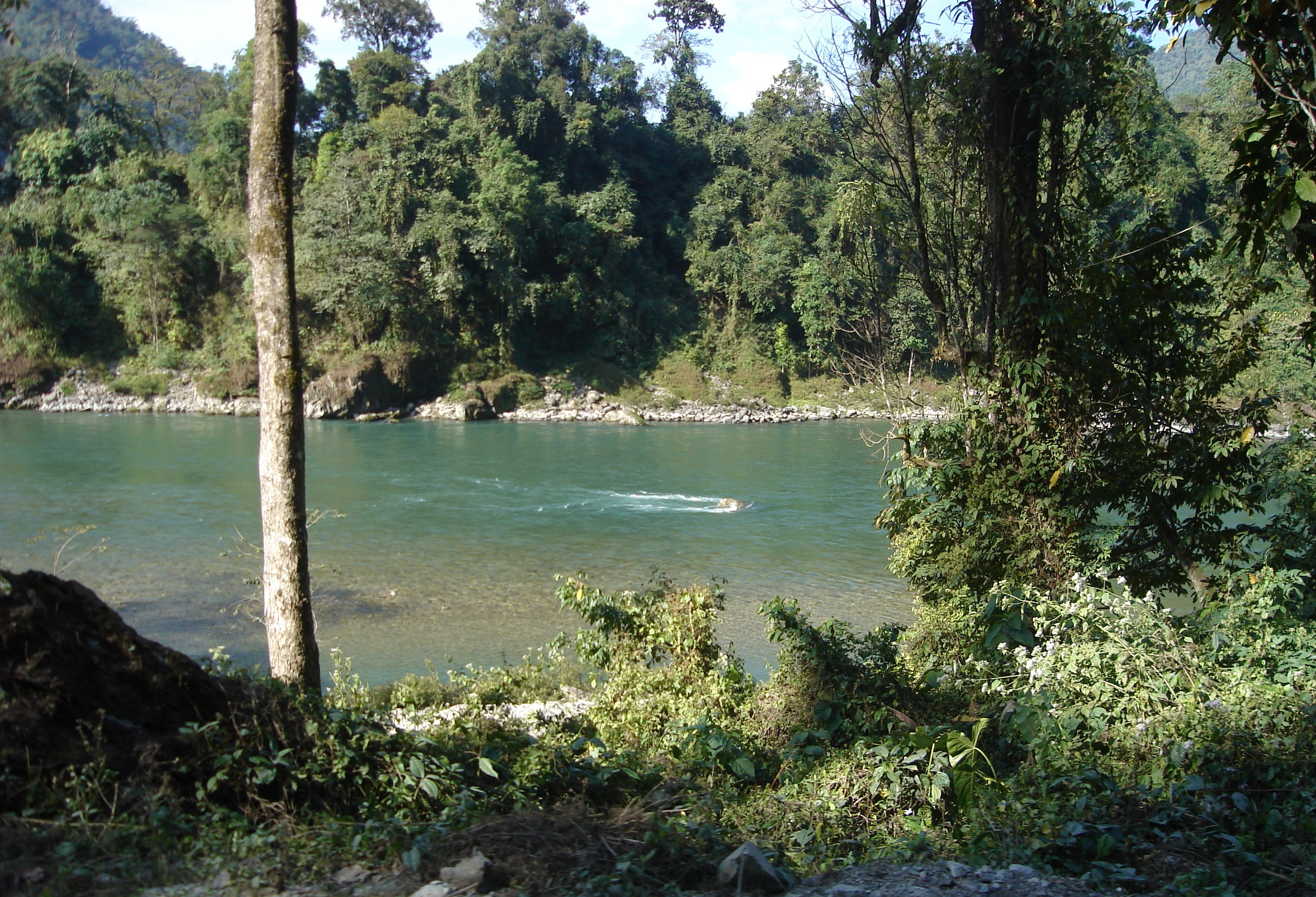
Where the Manas spills out of the Himalayan foothills, the valley widens into alluvial plains marked by swamps, marshes, and rich sediment deposits. These lowlands are called the Duars -- from the Sanskrit for "passes" or "gates" -- a 15-kilometer strip of outermost foothills where each passage between the mountains is named after its stream. The fertility here is legendary. Tea estates and paddy fields carpet the landscape, sustained by the same annual floods that keep the soil rich. The upper Manas catchment remains snowbound; the middle reaches are thickly forested. But in the lower stretches, smooth sandy riverbanks lined with trees give way to the broad, braided channels typical of Himalayan rivers approaching the Brahmaputra.
A Sanctuary Under Siege
The Manas valley harbors two connected protected areas: Bhutan's Royal Manas National Park, established in 1966 across 43,854 hectares, and India's Manas Wildlife Sanctuary, designated a UNESCO World Heritage Site in December 1985. Together they shelter Bengal tigers -- an estimated 100, mostly within the park boundaries -- alongside Asian elephants, one-horned rhinoceros, pygmy hogs, hispid hares, and wild Asiatic water buffalo. Four species of hornbill patrol the canopy. Ganges river dolphins navigate the murky channels below. The park is home to 22 endangered mammal species and 362 bird species. But conservation here has never been simple. In 1980, the Bodo people -- who dominate the area around the sanctuary -- took refuge within its boundaries during the Bodoland agitation, demanding autonomy from Assam. Poaching, encroachment, and political instability have tested the sanctuary repeatedly.
The Dam That Never Was
In the 1970s, India and Bhutan proposed a multipurpose dam on the Manas for hydroelectric power, irrigation, and flood control. The project would have generated 2,800 megawatts and required a 100-kilometer canal connecting the Manas reservoir to the Sankosh River. There was one problem: the canal would have cut directly through the Manas Tiger Reserve. India's Ministry of Environment and Forests objected. UNESCO's World Heritage Committee echoed the concern. Prime Minister Rajiv Gandhi ultimately killed the project, and it is unlikely to be revived. The decision preserved the ecological integrity of the valley -- but the tension between development and conservation along the Manas corridor has not gone away. A smaller hydropower project on the Mangde Chu, a Manas tributary in central Bhutan, is currently under study, a reminder that the river's resources remain coveted.
From the Air
Located at 26.217N, 90.633E where the Manas River crosses the India-Bhutan border in western Assam. The river is visible from altitude as a significant watercourse flowing south through dense forested terrain into the Brahmaputra floodplain. Nearest airports: Lokpriya Gopinath Bordoloi International Airport, Guwahati (VEGT), approximately 150 km east. The Royal Manas National Park and Manas Wildlife Sanctuary are visible as continuous dense forest on either side of the border. Recommended viewing altitude: 10,000-15,000 feet AGL. The Brahmaputra River is the dominant navigation reference to the south.