Manawatawhi / Three Kings Islands: New Zealand's Evolutionary Outpost
Some of the creatures on these islands have closer genetic relatives in Australia and New Caledonia than in the New Zealand that lies just 55 kilometers to the southeast. The Manawatawhi / Three Kings Islands are a group of thirteen uninhabited islands perched on a submarine plateau where the South Pacific Ocean and the Tasman Sea collide. During the Last Glacial Maximum, when sea levels dropped more than 100 meters and most of New Zealand's offshore islands reconnected to the mainland, the Three Kings remained cut off. An 8-kilometer-wide submarine trough, 200 to 300 meters deep, kept them isolated. They have been on their own for a very long time.
Deep Time on a Small Rock
Genetic studies of insect populations on the Three Kings have produced separation dates ranging from 24 million years ago to 2.24 million years ago, depending on the species. That range tells a story in itself: different lineages arrived at different times, by different means, and then evolved in isolation on these small, inhospitable islands. The flax snail Placostylus bollonsi has stronger genetic links to species in Australia and New Caledonia than to any snail on mainland New Zealand. Falla's skink, Oligosoma fallai, exists only here. The Manawatawhi paua, Haliotis pirimoana, is an abalone species found only in the surrounding waters, formally described as recently as 2024. These islands are a natural laboratory for evolution, small enough to walk across but old enough to have produced species that exist nowhere else.
The Last Glimpse of the Living World
In Maori mythology, Ohau, the westernmost of the islands, holds a role of profound spiritual weight. It is the final glimpse of New Zealand that departing spirits see after leaving the world at Cape Reinga / Te Rerenga Wairua. The spirits travel north from wherever they died, gather at the ancient pohutukawa tree above Spirits Bay, pass through the turbulent waters off Cape Reinga, and catch one last sight of land at Ohau before continuing to the ancestral homeland. Manawatawhi was traditionally settled by Muriwhenua Maori, and members of Ngati Kuri would periodically voyage to the islands as refuge during times of warfare and to harvest hapuku, seabirds, and eggs. The islands served both the living and the dead.
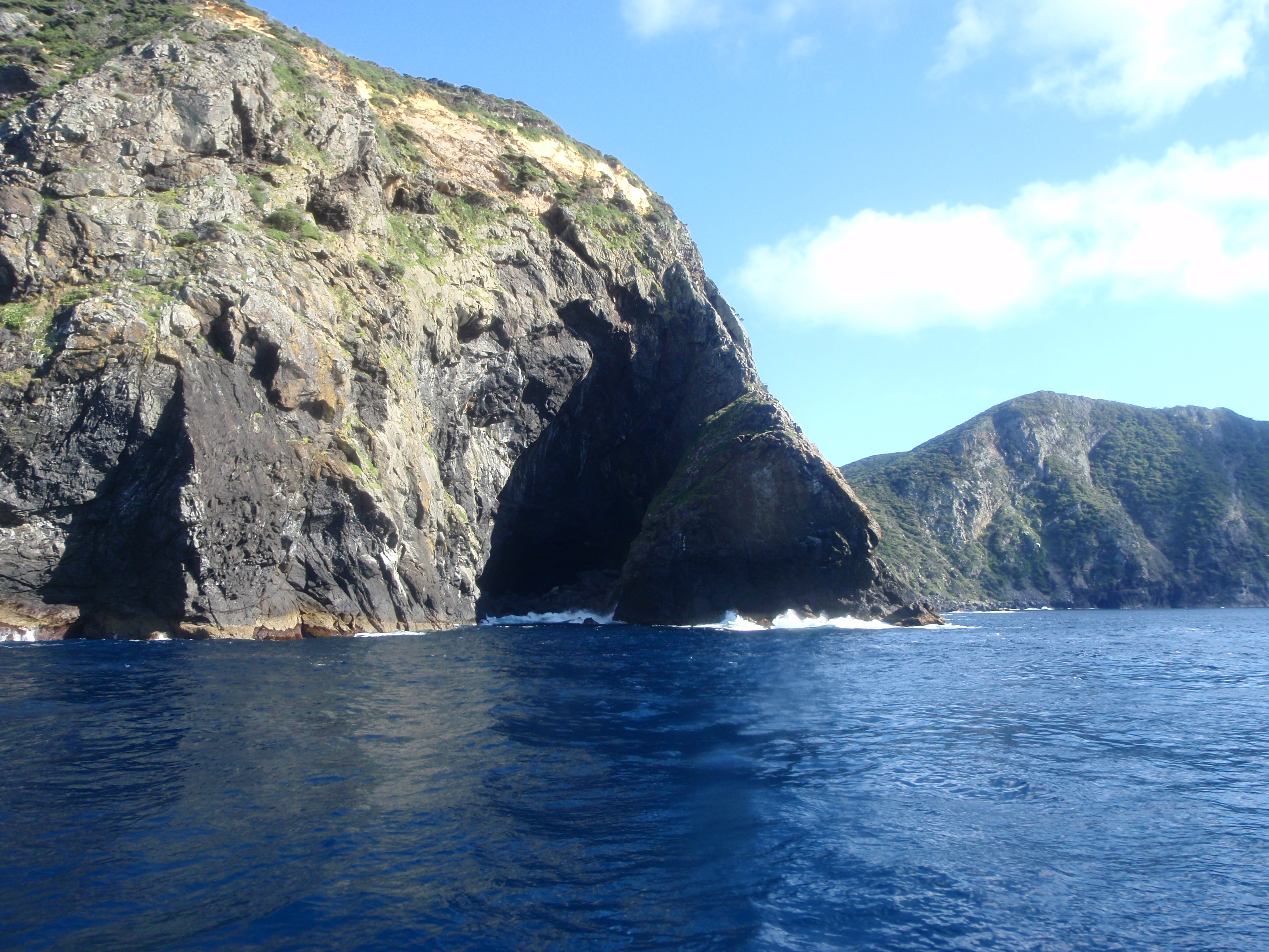
Rocks Without Beaches
The geography of the Three Kings is inhospitable by any standard. The islands rise steeply from King Bank, a submarine plateau surrounded by extremely deep water. There are no beaches, just cliffs dropping into turbulent seas. Four main islands and a scattering of smaller rocks make up the group, totaling 6.85 square kilometers. They are not part of any New Zealand region or district; instead, they fall under the administrative category of Area Outside Territorial Authority, a designation shared with New Zealand's other outlying islands. The currents where the Tasman and Pacific converge create treacherous conditions around the islands, visible from the air as bands of different-colored water meeting and churning. Landing on the Three Kings requires calm weather and serious seamanship.
Goats and Conservation
Rats and mice, the usual destroyers of island ecosystems, were never introduced to the Three Kings. Goats were not so lucky an omission. Introduced to Great Island at some point in the past, they caused significant damage to the vegetation and soil before conservation efforts intervened. The islands are now a nature reserve administered by New Zealand's Department of Conservation. Access is restricted. The absence of the invasive predators that have devastated other New Zealand islands makes the Three Kings exceptionally valuable for conservation, a place where native species persist in something close to their original ecological context. Every island in the group is, in effect, a living museum of what New Zealand's biology looked like before human arrival.
From the Air
Located at 34.16°S, 172.09°E, approximately 55 km northwest of Cape Reinga. From altitude, the Three Kings appear as a tight cluster of dark, rocky islands in deep blue open ocean, with no beaches visible. The convergence of the Tasman Sea and Pacific Ocean often creates visible current patterns and color bands in the water around the islands. The submarine plateau they sit on is not visible but the abrupt depth changes produce distinctive wave patterns. Nearest airport is Kaitaia Aerodrome (NZKT), approximately 130 km southeast. The islands' isolation from the mainland is dramatic from the air. Best viewed at 5,000-10,000 feet.