Mandalay Hill
According to legend, the Buddha stood on this hill and pointed toward the flat plain below, prophesying that in the year 2400 of the Buddhist Era, a great city would rise at its foot. In 1857 AD -- the year the prophecy foretold -- King Mindon laid the foundations of Mandalay. Whether the legend preceded the city or the city generated the legend matters less than the fact that Mandalay Hill has been treated as sacred ground ever since. At 240 meters, it is not a dramatic peak. But its four covered stairways, its tunnels lined with gilded Buddhas, its fragrant champac trees, and the panoramic view from the Sutaungpyei Pagoda at its summit have made it one of Myanmar's most important pilgrimage sites for nearly two centuries.
The Climb as Pilgrimage
Two enormous chinthe -- stylized stone lions -- guard the southern approach, which is the main way up. The climb is gentle but rich with stops. Early on, pilgrims pass U Khanti's hall, where three fragments of bone believed to be relics of the Gautama Buddha were kept from 1923 until after the Second World War. Leaving the hall, you can take a tunnel lined with statues of the Hnakyeik shissu, the 28 Buddhas of past and present worlds, or climb a steep staircase alongside it. Stalls sell flowers, paper streamers, miniature pennants, and refreshments. The covered walkways feature frieze paintings from the late Konbaung dynasty period, including one vivid depiction of Avici Hell that stops climbers in their tracks. For Buddhists, ascending the hill is not exercise. It is a meritorious deed -- each step an offering.
The Prophecy at the Halfway Point
Halfway to the summit, a large standing Buddha occupies the Shweyettaw Pavilion. Called the Byadeippay -- the "prophesying" -- Buddha, the statue holds its right hand in a non-traditional mudra, pointing directly toward the city below. This is the image that gives the legend its physical anchor: the Buddha gesturing toward the place where his teachings would flourish. Near the top of the hill, another story from Myanmar's mythological past surfaces: a mark attributed to Kyanzittha, the warrior king of Bagan, who according to legend vaulted across the Irrawaddy River using his spear. Just below the summit, the image of the ogress Sanda Muhki completes the cycle. Having nothing else to offer the Buddha, she offered her own body -- and for this extreme act of devotion, the Buddha prophesied she would be reborn as a great king who would build the city below. That king, the faithful believe, was Mindon.
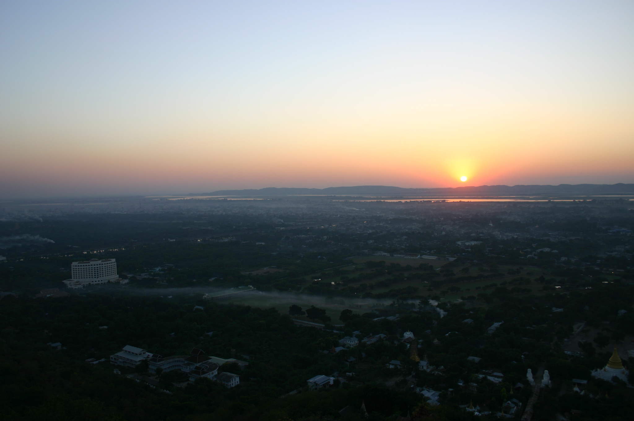
The View from Sutaungpyei
At the summit, the Sutaungpyei Pagoda -- its name means "wish-fulfilling" -- opens onto a panorama that encompasses everything Mandalay was and is. The old city walls and moat form a perfect square below. The white stupas of Kuthodaw Pagoda, each holding a marble page of the world's largest book, spread in concentric rows to the southwest. The Irrawaddy winds westward, the Minwun Hills rising on its far bank. To the east, the Shan Yoma mountain range marks the horizon. Champac trees bloom wild on the slopes, their white blossoms branching like candelabra, alongside the crimson flowers of flame trees. At sunset, tourists and pilgrims crowd the terrace together, watching the light turn the river and the western hills to amber. Just below, on the northern slope, the Mwegyi Hnakaung Pagoda holds images of two great cobras believed to have frequented the hill to pay homage to the Buddha. Pilgrims tuck banknotes into their open mouths and pray.
Battle for the Sacred Hill
In March 1945, the sacred became strategic. Japanese forces had fortified Mandalay Hill, honeycombing its pagodas and temples with machine-gun positions, well-supplied and heavily garrisoned. The British Fourteenth Army's Indian 19th Infantry Division, commanded by Major-General Thomas Wynford Rees -- nicknamed the "Pocket Napoleon" by his men for his small stature and outsized military career -- closed in from the north. On 9 March, a Gurkha battalion stormed the southern slope, fighting hand-to-hand among the same stupas and stairways that pilgrims had climbed for generations. The battle raged all day and through the night. Two companies of a British battalion joined the next morning, but the Japanese held firm. The last defenders had to be driven from the cellars by rolling petrol drums down the staircases and igniting them with tracer rounds. The hill did not fall until 11 March.
What the Battle Cost
With the hill secured, attention turned to Fort Dufferin -- the walled city with Mandalay Palace -- where remaining Japanese forces held out. When shelling from the hilltop failed to breach the massive walls, the British resorted to aerial bombardment. The splendid teak palace of King Mindon, a national heritage of immense importance, burned during the siege. Whether it was the British shelling, the bombing, or the Japanese themselves who set the fire was never determined with certainty. The loss was irreversible. The prophecy said a great city would rise here. It did not promise the city would survive intact. Mandalay Hill endures as it always has -- a place of devotion, panoramic beauty, and layered memory, where the fragrance of champac blossoms mingles with the weight of everything that has happened on these slopes.
From the Air
Mandalay Hill sits at 22.01N, 96.11E, rising 240 meters northeast of Mandalay's city center. From the air, look for the prominent forested hill studded with white and gold pagodas, with the distinctive square moat and walls of the old royal city immediately to the southwest. The Kuthodaw Pagoda's concentric white stupas are visible at the hill's southwestern base. The Irrawaddy River flows to the west. Mandalay International Airport (ICAO: VYMD) is approximately 35 km south. Best viewed at 2,000-4,000 feet for the hill's pagoda details and the city layout below.