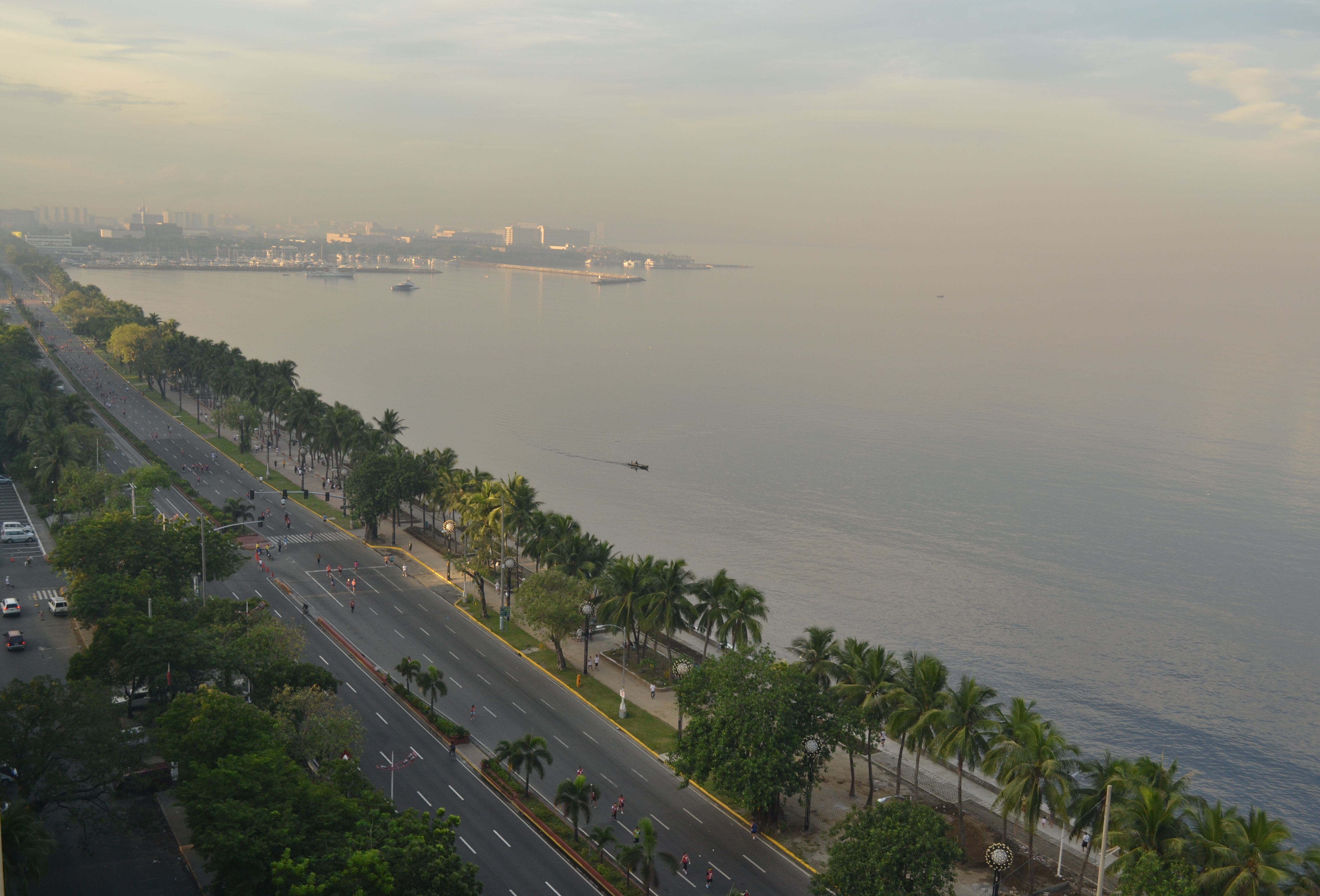
Manila Bay
Every evening, thousands of Filipinos gather along the Baywalk promenade to watch the sun sink into Manila Bay. The ritual feels timeless, but the bay itself has changed almost beyond recognition. This 1,994 square kilometer basin -- bounded by Bataan's mountains to the west, the sprawl of Metro Manila to the east, and the rice provinces of Bulacan and Pampanga to the north -- was once ringed by mangrove forests and teeming with fish. Today it is one of the most contested bodies of water in Southeast Asia, pulled between the demands of 13 million people and the ecosystems that sustained the region long before any of them arrived.
Gateway of Empires
Long before the Spanish arrived, Manila Bay's protected waters made it a natural crossroads for trade between the Philippine islands and the merchants of China, Japan, and the Malay world. The Spanish recognized the same advantage in 1571, establishing Manila as the terminus of the galleon trade that linked Asia's silks and spices to the silver mines of New Spain. For more than two centuries, treasure-laden galleons departed from Cavite at the bay's southern shore, crossed the Pacific to Acapulco, and returned with the silver that powered the colonial economy. The bay's strategic importance made it a target. On May 1, 1898, Commodore George Dewey's Asiatic Squadron steamed past Corregidor Island at the bay's mouth and destroyed the Spanish fleet in a single morning. The Battle of Manila Bay lasted only hours, but it transferred control of the Philippines from one empire to another and announced the United States as a Pacific power. The 19-kilometer-wide entrance that Dewey's ships navigated remains the bay's defining geographic feature -- a bottleneck that opens into waters stretching 60 kilometers at their widest.
A Living Ecosystem Under Siege
Beneath the bay's surface, an intricate web of habitats persists against long odds. Coral reefs near the mouth at Mariveles and Corregidor provide sanctuary for fish, while seagrass beds off Malolos and Orion shelter juvenile species. Along the coasts of Bataan and Pampanga, surviving stands of mangrove -- dominated by Avicennia marina and 15 other species across nine families -- buffer the shoreline against typhoon surges. Wetlands covering roughly 46,000 hectares of mudflats, swamps, and beaches support 99 bird species, with over 19,000 individual birds counted at monitoring stations along the shore. But the pressures are relentless. Conversion of mangrove areas to fishponds straightened what was once an irregular coastline. By 1993, overfishing had driven fish stocks into steep decline, replaced in the catch by squid, shrimp, and small pelagic species like herrings and anchovies. The Pampanga River, which contributes nearly half of the bay's freshwater, carries agricultural runoff laced with pesticide residues -- metamidophos, endosulfan, chlorpyrifos -- from the rice paddies upstream.
Polluted Waters, Contested Shores
An average of 30,000 ships arrive and depart the bay each year, and the industries lining its shores -- shipyards in Cavite, refineries in Bataan, the dense commercial fabric of Metro Manila -- pour effluent into waters already burdened by domestic sewage from millions of residents. The Pasig River, which connects Manila Bay to Laguna de Bay, has long functioned as an open drain for the capital's waste. Fecal coliform levels once reached 2.2 million per 100 milliliters near the Manila waterfront, orders of magnitude above safe swimming standards. In January 2019, the Department of Environment and Natural Resources launched an ambitious rehabilitation program, marshaling multiple government agencies to clean up the bay. The Supreme Court had already ordered the demolition of illegal structures along waterways feeding into Manila Bay. By 2020, a controversial beach nourishment project deposited crushed dolomite along the Roxas Boulevard shoreline -- drawing criticism from environmentalists who questioned the logic of building a synthetic beach beside polluted water, but also producing measurable improvements in fecal coliform counts.
Between the Tides and the Future
Manila Bay faces a threat that no cleanup campaign can fully address. Studies project sea levels could rise between 0.75 and 1.9 meters by 2100, and the bay's low-lying eastern shore -- home to some of the densest urban areas on Earth -- sits squarely in the flood zone. In 2010, a Dutch ambassador proposed an audacious solution at a tidal flooding forum in Manila: close the bay with dykes, as the Netherlands has done with its own coast. The idea acknowledged a hard truth -- that protecting Manila might require reimagining the bay's relationship with the sea entirely. Plans for a bridge connecting Bataan and Cavite provinces across the bay, with a turn near Corregidor Island, have been in discussion since 1987 and gained government approval in 2020. Whether as bridge or barrier, the bay's future will be shaped by how the Philippines balances the demands of a growing megacity against the ecological systems that once made this harbor one of the richest in the Pacific.
From the Air
Centered at approximately 14.52N, 120.77E. Manila Bay is unmistakable from altitude -- a wide semicircular indentation on Luzon's western coast, with the narrow mouth between Bataan Peninsula and Cavite clearly visible. Corregidor Island sits in the entrance. Manila's Ninoy Aquino International Airport (RPLL) lies along the eastern shore. Clark International Airport (RPLC) is about 80 km to the north. Best viewed at 10,000-15,000 ft for the full bay panorama, or lower along the Baywalk waterfront. Haze and smog are common over Metro Manila.