Manitoulin Island
Somewhere beneath the waters near Manitowaning, an underwater cave holds a powerful spirit. The Anishinaabe named this place Manidoowaaling -- cave of the spirit -- and the island that shelters the cave became Mnidoo Mnising, Spirit Island. The English name Manitoulin is a worn-down echo of the original Ojibwe, filtered through French colonial maps and two centuries of pronunciation drift. The spirit, presumably, does not care what outsiders call the place. The island itself is remarkable enough to justify any name: the largest freshwater island on Earth, sitting in Lake Huron like a world within a world, holding 108 lakes of its own, some of which contain islands of their own. It is a geography that folds inward, layer after layer, as if the landscape were demonstrating something about infinity.
Islands Within Islands Within Islands
The numbers alone are disorienting. Manitoulin Island sits in Lake Huron, separating the main body of the lake from Georgian Bay to the east and the North Channel to the north. It contains 108 freshwater lakes. The largest of these, Lake Manitou, is the biggest lake in any freshwater island in the world. And within Lake Mindemoya sits Treasure Island -- the largest island in a lake on an island in a lake on Earth. That recursive geography is not just a curiosity; it shaped how people lived here for millennia. The three largest lakes -- Manitou, Kagawong, and Mindemoya -- provided fish, fresh water, and transport corridors. The island's alkaline soil, unusual for Northern Ontario, prevented blueberries from growing but encouraged hawberries, a small fruit so closely identified with the place that people born on Manitoulin are called Haweaters. Every August, the Haweater Festival draws thousands to celebrate with parades, fireworks, craft shows, and rural competitions like horse pulls.
Twelve Thousand Years of Human Presence
Archaeological excavations at Sheguiandah, on the island's eastern shore, have uncovered evidence of Paleo-Indian and Archaic cultures dating from 10,000 BC to 2,000 BC -- making it one of the oldest known habitation sites in Ontario. Public interest in the discoveries was so intense that it contributed to Ontario passing legislation in 1953 to protect archaeological sites. The island is sacred to the Anishinaabe, the People of the Three Fires -- a loose confederation of the Ojibwe, Odawa, and Potawatomi nations. The North Channel that borders Manitoulin was a highway for French voyageurs and coureurs des bois pushing westward toward Lake Superior. The first European to settle on the island was Father Joseph Poncet, a French Jesuit who established a mission near Wiikwemkoong in 1648. The Jesuits named the island Isle de Ste-Marie. But European contact brought catastrophe. The Iroquois, seeking control of the fur trade, drove the Anishinaabe from the island during the Beaver Wars of the 1650s. According to Anishinaabe oral tradition, the people burned their settlements as they left, purifying the land from disease. Manitoulin lay mostly uninhabited for nearly 150 years.
Treaties, Resistance, and Unceded Land
The Odawa, Ojibwe, and Potawatomi began returning to Manitoulin after the War of 1812. In 1836, they ceded the island to the British Crown, which designated it a refuge for Indigenous peoples. A Roman Catholic mission was re-established in 1838, and the Jesuits took it over in 1845. Then, in 1862, the government opened the island to non-Indigenous settlement through the Manitoulin Island Treaty. The chief of Wikwemikong refused to sign. His people's reserve was withheld from development, and it remains unceded to this day. On August 7, 1975, the Wikwemikong Unceded Indian Reserve formally reasserted sovereignty over its lands and surrounding waters. Six Anishinaabe reserves still exist on the island -- M'Chigeeng, Sheguiandah, Sheshegwaning, Aundeck Omni Kaning, Wiikwemkoong, and Zhiibaahaasing -- alongside two incorporated towns, Gore Bay and Northeastern Manitoulin and the Islands, and eight townships. The island's permanent population of around 13,000 swells by more than a quarter each summer as tourists arrive for boating, hiking, and the quiet pace of island life.
One Bridge, One Ferry, Two Runways
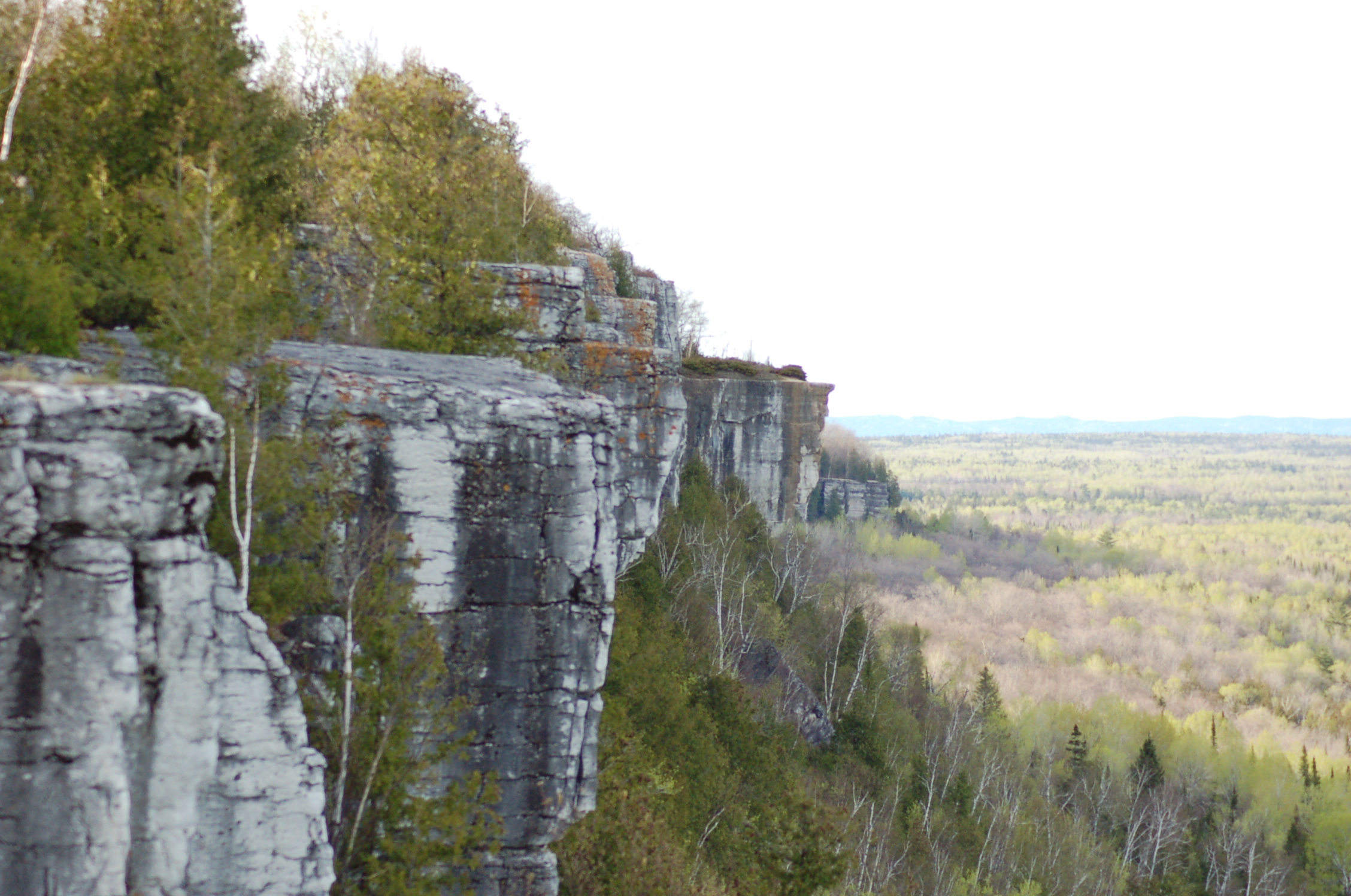
Getting to Manitoulin requires commitment. Year-round access comes via the one-lane Little Current Swing Bridge, which crosses the North Channel at Little Current -- a bottleneck that enforces patience on every visitor. From early May to late October, the Chi-Cheemaun ferry -- Ojibwe for Big Canoe -- makes daily crossings between Tobermory at the tip of the Bruce Peninsula and South Baymouth on Manitoulin's southern shore. Winter ice shuts the ferry down entirely. Two small airports, Gore Bay-Manitoulin Airport and Manitoulin East Municipal Airport, provide access for small planes and border patrol clearance. The limited transportation has preserved something essential about the island. Manitoulin moves at its own tempo. The landscape is a mosaic of limestone bluffs, farmland, boreal forest, and quiet lake shorelines -- a world large enough to contain genuine wilderness but small enough that everyone knows which roads to take when the swing bridge is up.
From the Air
Located at 45.767N, 82.200W in Lake Huron, Ontario. Manitoulin Island is unmistakable from altitude -- a massive landmass clearly separated from the Ontario mainland by the North Channel to the north, with Georgian Bay to the east and the open waters of Lake Huron to the south and west. The island's 108 inland lakes are visible as scattered dark patches against the green and brown terrain. Lake Manitou, the largest, is prominent near the island's center. The Little Current Swing Bridge at the northeast tip connects to the mainland. The Chi-Cheemaun ferry route from South Baymouth to Tobermory may be visible as a wake crossing the open water to the south. Two airports: Gore Bay-Manitoulin Airport (CYZE) on the north shore, and Manitoulin East Municipal Airport (CYME) on the east side. Best viewed from 5,000-8,000 ft AGL to appreciate the full extent of the island and its relationship to Lake Huron, Georgian Bay, and the North Channel. On clear days, the Bruce Peninsula is visible to the south.