Manning Provincial Park
The hiker appears out of nowhere, trail-worn and weathered, having walked 4,265 kilometers from the Mexican border. Manning Provincial Park marks the end of that journey - the northern terminus of the Pacific Crest Trail, where a modest monument stands in the meadows above the Crowsnest Highway. For the through-hikers who complete this odyssey, Manning represents triumph and relief. For everyone else, it represents one of British Columbia's most accessible mountain parks: a place where the Crowsnest Highway cuts straight through, where a ski resort operates in winter, where cabins with running water await at day's end. This is wilderness with infrastructure, adventure with safety nets. The grizzlies don't care about these distinctions, but the families loading kayaks probably do.
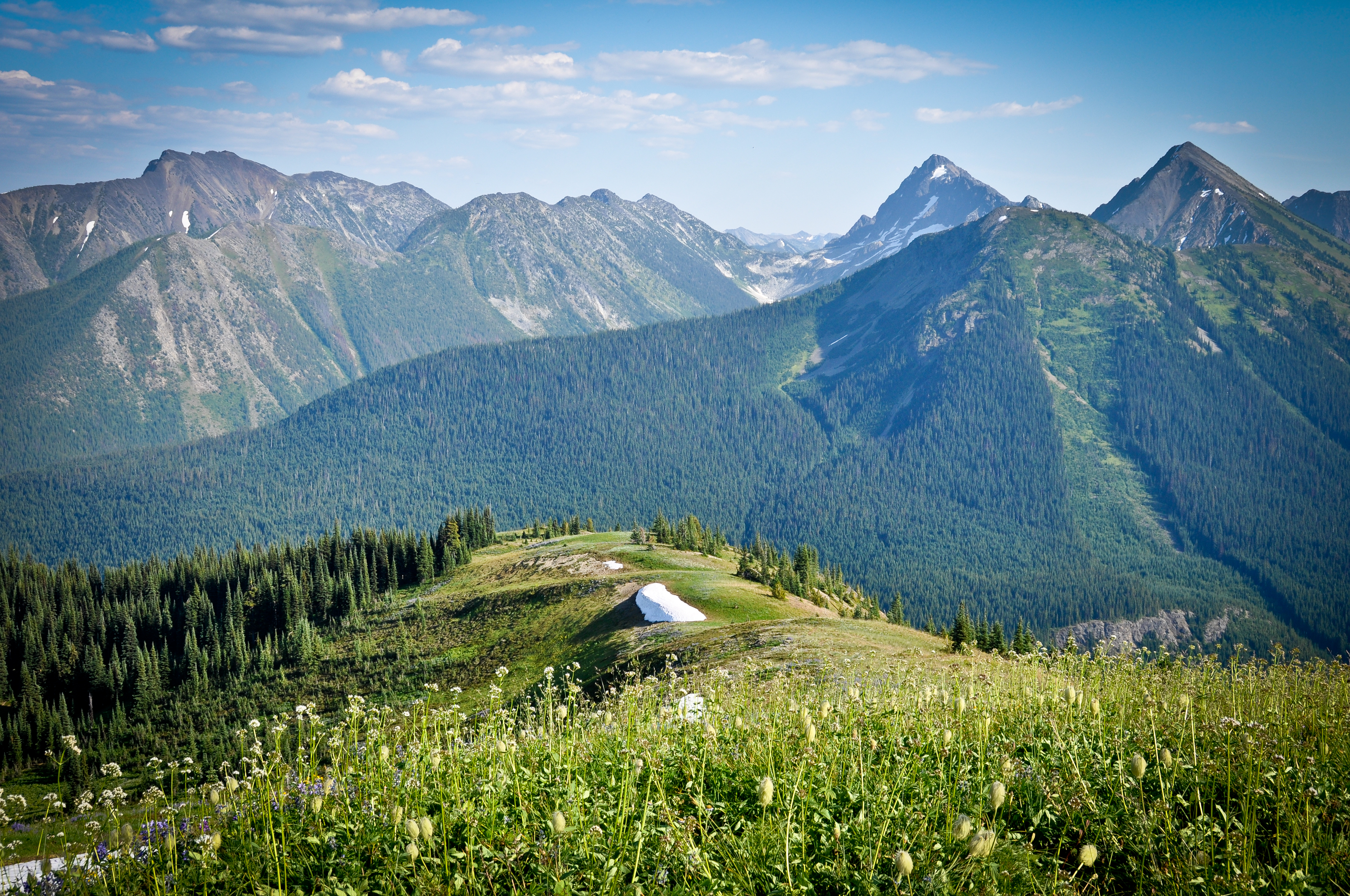
Cascade Character
Manning sits in the Cascade Range, that volcanic chain running from California through Oregon and Washington before terminating here in southern British Columbia. The park shares its character with Mount Rainier and the North Cascades to the south - steep terrain, heavy snowfall, alpine meadows that explode with wildflowers once the snowpack melts. But unlike its American counterparts, Manning feels less discovered. The Gibson Pass Valley receives snow measured not in inches but in meters, falling dry and light - powder that draws skiers from across the region. Summer transforms the same slopes into meadows where the Heather Trail winds through subalpine blooms, one of the finest wildflower walks in the province.
Four Seasons Development
Manning Park Resort sits at the park's heart, a private operation within public land that offers what most provincial parks do not: lodges with restaurants and pubs, a ski hill with lifts and rentals, activity programs that don't require you to be an expert at anything. The Bear's Den pub pours cold beer. The Country Store sells groceries and camping supplies. Winter brings downhill skiing and snowboarding, cross-country trails groomed to racing standards, tubing hills for children and the young at heart. Summer opens the lakes to kayaks and canoes, the trails to hikers and mountain bikers. It's not wilderness in the purist sense, but it serves a population that wants nature accessible, not intimidating.
Bears and Black Ice
Brown bears, black bears, and grizzlies all roam these mountains. Summer hikers hang food in bear caches provided at wilderness campgrounds; day visitors keep granola bars out of their tent vestibules. The bears have learned that humans mean food, which creates problems for both species. Winter brings different dangers: the Crowsnest Highway becomes a ribbon of black ice and accumulated snow, where chains and winter tires transform from optional to essential. The park tries to keep at least one campground open from mid-May through Canadian Thanksgiving in October, but opening dates depend on snow conditions, not calendars. Some years the powder lasts until July at higher elevations.
Trail's End, Trail's Beginning
The Pacific Crest Trail monument sits in a meadow above the park, reachable by a short hike from the road. Each year, a few hundred through-hikers complete the journey from Mexico that began five months and millions of footsteps earlier. Many more start section hikes from here, heading south into the North Cascades. But for most visitors, Manning's trails serve gentler purposes: the Lightning Lake loop for families, the Frosty Mountain trail for those seeking views without backpacking, the campgrounds at Lightning Lake and Coldspring for those who want trees and stars without venturing far from the car. The park occupies 70,844 hectares, large enough to lose yourself if you want, accessible enough that you don't have to.
From the Air
Located at 49.07N, 120.78W in the Canadian Cascades, straddling the Crowsnest Highway (Hwy 3). Lightning Lake and the Manning Park Resort complex are visible from altitude as the only developed area within the park boundaries. The terrain is mountainous, rising from approximately 1,000m at valley floors to over 2,400m at major peaks. The park lies approximately 3 hours east of Vancouver via Highways 1 and 3, or 2.5 hours from Kelowna. No airports within the park; Princeton Airport (YDC) lies to the east, Chilliwack Airport (YCW) to the west. Expect heavy snowfall from November through April; summer brings variable weather with afternoon thunderstorms possible.