Manovo-Gounda St. Floris National Park
In early 1997, four members of the park staff at Manovo-Gounda St. Floris National Park were shot. It was not an isolated incident but a tipping point. Tourism ceased. Development projects collapsed. The security situation, already dire, deteriorated into something closer to anarchy. UNESCO, which had inscribed the park as a World Heritage Site just nine years earlier for its extraordinary diversity of life, added it to the List of World Heritage in Danger. Nearly three decades later, it remains there. Manovo-Gounda St. Floris is a park in name and on maps, but what it protects now is mostly the memory of what it once contained.
Between the Rivers and the Mountains
The park occupies the eastern end of Bamingui-Bangoran province in the north of the Central African Republic, hard against the Chad border. It is vast -- one of the largest protected areas in the region -- and its geography reads like a catalog of Central African landscapes. The northern boundary follows the Aouk and Kameur Rivers along the international border. The Vakaga River marks the eastern edge, the Manovo River the west. To the south, the ridge of the Massif des Bongo rises as a natural wall. The Ndele-Birao road cuts through the park, a reminder that even this wilderness was never truly empty of human passage. The terrain encompasses floodplains, wooded savannah, and gallery forests along the watercourses -- habitat diverse enough to support one of the richest assemblages of large mammals in Central Africa.
A Roll Call of the Vanishing
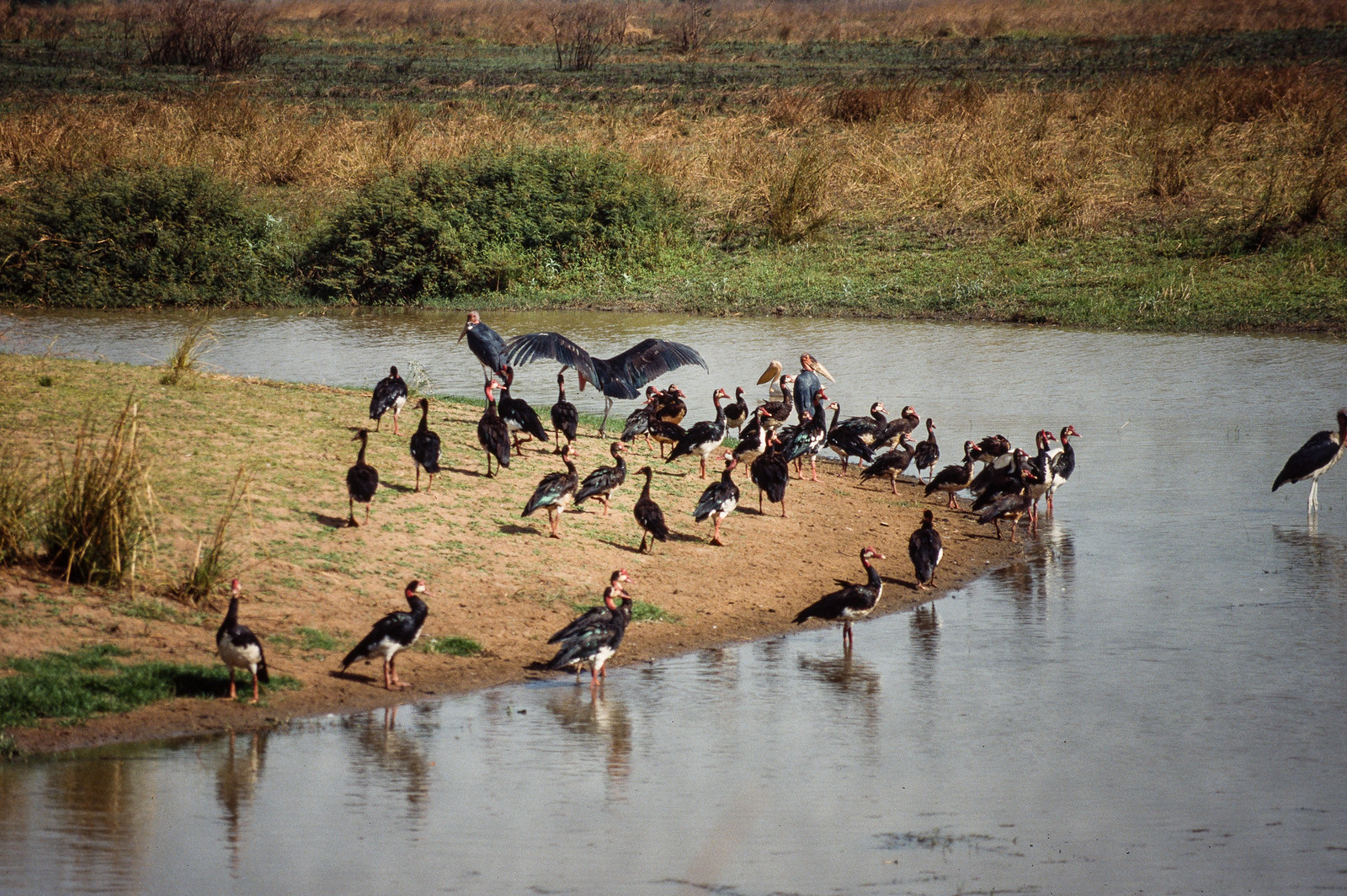
The wildlife that earned Manovo-Gounda its World Heritage inscription in 1988 was remarkable. Black rhinoceroses, African elephants, Sudan cheetahs, African leopards, red-fronted gazelles, African buffalos, Kordofan giraffes, and West African lions -- species whose ranges had already contracted dramatically elsewhere -- all found refuge in the park's vast, relatively undisturbed habitat. BirdLife International designated it an Important Bird Area for the significant populations of waterfowl and other species on the northern floodplains. The park was a living ark. But arks require walls, and Manovo-Gounda's were paper thin. The western black rhinoceros, once indigenous to the park and the broader Central African Republic, was declared extinct in 2011.
Eighty Percent
Armed poachers -- not opportunists with snares but organized groups with automatic weapons -- moved through the park with near impunity. Illegal grazing by herders from across the border compounded the pressure on habitat. UNESCO's own reports estimated that as much as 80% of the park's wildlife was harvested by these heavily armed hunters. The word "harvested" appears in the official documents, clinical and inadequate for describing what happened. Elephant populations were decimated. Lion numbers fell. The cheetahs and leopards, already ghosts in many African parks, became harder to find. The shooting of the four park staff members in 1997 was the event that made the outside world pay attention, but for the animals and the rangers who tried to protect them, the crisis had been building for years.
Heritage in Danger
The World Heritage Committee's response followed bureaucratic channels. A detailed state of conservation report was recommended. A rehabilitation plan was called for. The government of the Central African Republic proposed assigning management to a private foundation -- a model that had shown promise elsewhere in Africa, notably at Zakouma National Park in neighboring Chad. But the CAR's own instability worked against any sustained recovery effort. Civil war erupted in 2012, further destabilizing the north. The park, already short of staff and resources, became effectively unmanageable. Breeding programs for some species have been proposed, and conservation organizations continue to advocate for Manovo-Gounda's restoration. Whether that restoration can happen while the broader security situation in northern CAR remains unresolved is a question no report has yet answered.
What a Name Carries
The park's triple-barreled name -- Manovo-Gounda St. Floris -- combines the Manovo River, the Gounda region, and the French colonial designation honoring a Catholic saint. It is a name that carries the layered history of this place: indigenous geography, regional identity, and the European powers that drew the borders. From the air, the park still looks wild and immense. The floodplains spread green and gold depending on the season. The rivers wind through the landscape in the slow, wide curves that characterize this part of Africa. The Massif des Bongo rises in the south. It looks, from altitude, like it should be teeming with life. That it largely is not -- that the park's greatest distinction now is its presence on a danger list -- is a fact that the landscape itself does nothing to reveal.
From the Air
Located at 8.50N, 21.50E in northern Central African Republic, near the Chad border. The park is vast, occupying the eastern end of Bamingui-Bangoran province. From altitude, the northern floodplains along the Aouk and Kameur Rivers (marking the Chad border) are the most visible features. The Massif des Bongo ridge defines the southern boundary. The Ndele-Birao road is visible cutting through the park. No airports with scheduled service are nearby; the closest major airport is Bangui M'Poko International Airport (FEFF), far to the south. The region is effectively inaccessible to tourists due to ongoing security concerns.