Manu National Park
More than 1,300 species of butterflies have been counted here. That number alone should convey something about the sheer biological extravagance of Manu National Park, a UNESCO World Heritage Site spanning the eastern slopes of the Andes down into the Amazon basin in southeastern Peru. From cloud forests draped in orchids at nearly 4,000 meters to oxbow lakes where black caimans drift through still water, Manu encompasses an entire gradient of life, telescoped into a single protected area. It is one of the few places on Earth where a spectacled bear foraging in highland scrub and a green anaconda hunting in lowland swamp fall within the same park boundary.
A Vertical World
Manu covers more than 1.7 million hectares across the regions of Madre de Dios and Cusco, a sweep of terrain that drops from Andean ridgelines near 4,000 meters above sea level to the flat Amazon basin plains below 300 meters. The 190-kilometer Manu road is the only link between these two realms, switchbacking from highland grasslands through cloud forest and into the lowland canopy. Climate shifts dramatically with altitude: cold, windswept puna at the top gives way to mist-soaked montane forest, which in turn dissolves into the heat and humidity of tropical rainforest. Each elevation band supports its own community of plants and animals, from the gnarled Polylepis woodlands of the heights to towering Brazil nut trees in the lowlands below.
The Inventory That Never Ends
Scientists have documented roughly 160 mammal species in the park, 132 reptile species, 210 fish species, and over 1,000 bird species. The invertebrate numbers are staggering: 300 species of ants, 650 species of beetles, 136 species of dragonflies. And the butterfly count keeps climbing past 1,300. In the mountain zones, white-tailed deer and Andean foxes share territory with the elusive spectacled bear, South America's only bear species. Down in the lowlands, jaguars patrol riverbanks where giant otters fish and spectacled caimans bask. The mata mata turtle, with its flat, leaf-shaped head, lies motionless on the river bottom, waiting. In 2021, researchers from the Field Museum helped solve a decades-long taxonomic mystery involving a mammal species from Manu, underscoring how much remains unknown even in one of the most studied rainforests on Earth.
People of the Forest
Manu is not uninhabited wilderness. The Matsiguenka, Yine, Harakmbut, and Yora peoples live within the park's boundaries, maintaining ways of life deeply connected to the forest. Other groups, including the Mashco-Piro, live in voluntary isolation, choosing to remain uncontacted. Their presence raises difficult questions about conservation, sovereignty, and the right of indigenous communities to determine their own futures. UNESCO recognized Manu as a Biosphere Reserve in 1977 and a World Heritage Site in 1987, designations that acknowledged both the ecological and cultural significance of the area. The park's management must balance the demands of scientific research, limited tourism, and the rights of the peoples who have called these forests home for centuries.
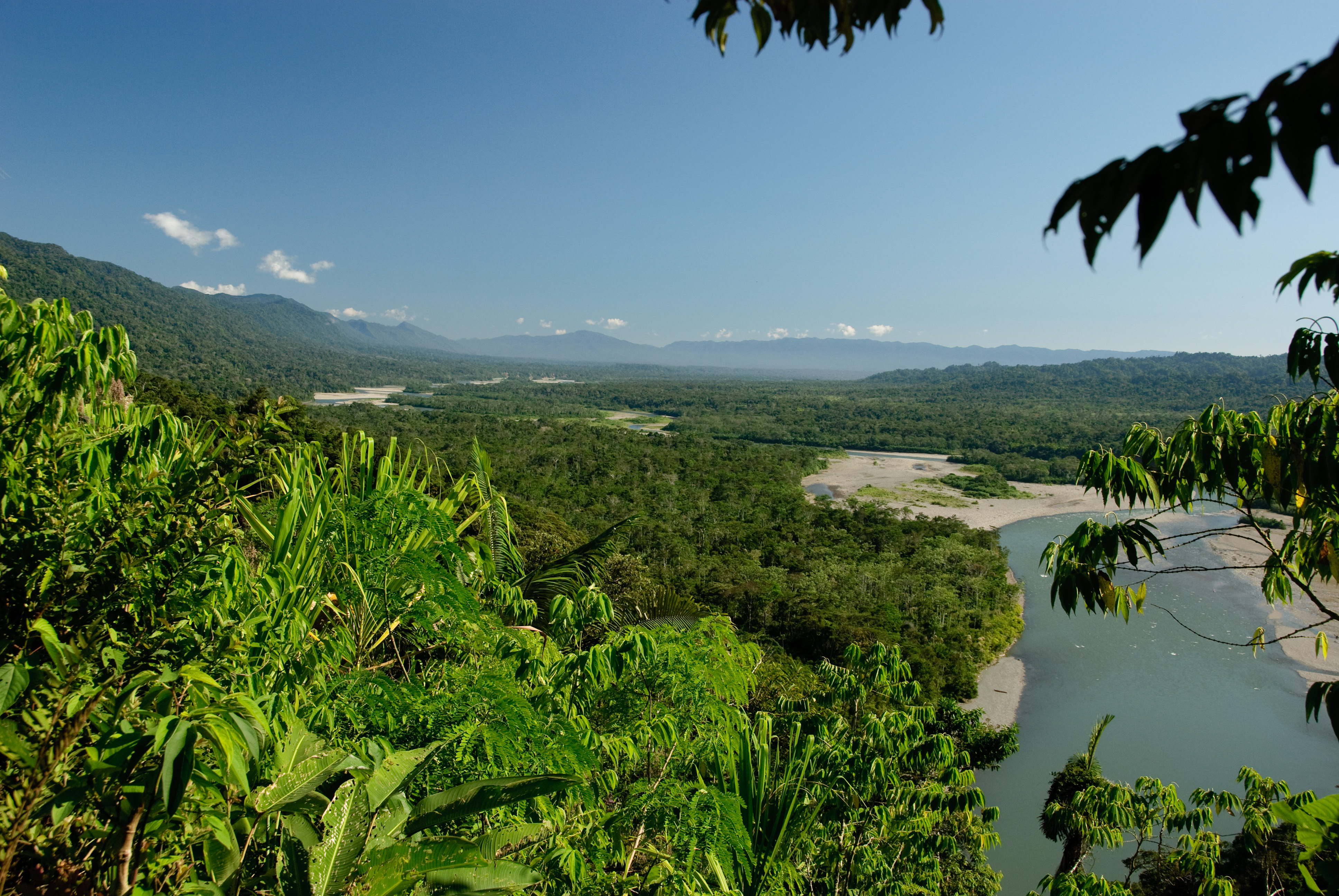
Where Rivers Write the Map
In the lower Manu basin, the river meanders across the floodplain, cutting new channels and abandoning old ones. The abandoned bends become oxbow lakes, cochas, each one a self-contained ecosystem where caimans hunt, macaws visit clay licks, and giant river otters raise their young in family groups. Five tourist areas open along these waterways offer access via trails, swamps, and river shores. An 18-meter observation tower provides a canopy-level view of the forest, while a canopy walkway strings through the treetops. Three lodges and five camping sites serve the small number of visitors allowed in at any time. Access is tightly controlled: this is not a park designed for crowds, but for the patient observer willing to sit still long enough for the forest to reveal itself.
The Road In
Reaching Manu requires commitment. The single access road from the highlands descends through hairpin turns, sometimes washed out by landslides during the rainy season. Most visitors enter through Cusco, hiring transport for the long journey over the Andes and down into the lowland forest. River travel takes over from there, with motorized canoes ferrying passengers deeper into the reserve. The Cocha Cashu Biological Station, operated in partnership with the San Diego Zoo, has hosted researchers since the 1970s, making Manu one of the longest-studied tropical forests anywhere. For all its remoteness, the park faces threats: road-paving projects risk opening corridors for illegal logging and settlement, a tension between development and preservation that defines conservation across the Amazon.
From the Air
Located at 12.14S, 71.66W in southeastern Peru. The park spans from Andean highlands to Amazon lowlands. Nearest significant airport is Alejandro Velasco Astete International (SPZO) in Cusco, approximately 150 km northwest. From cruising altitude, the transition from highland terrain to unbroken lowland canopy is visible, with the Manu River's meandering course and oxbow lakes distinguishable in clear conditions. Expect cloud cover along the eastern Andean slopes.