Marib Dam
Sometime around the eighth century BCE, the Sabaeans did something audacious. In the Balaq Hills of what is now Yemen's Ma'rib Governorate, where the monsoon floods poured through Wadi Adhanah in violent seasonal surges, they built a dam. Not a modest earthen berm, but a massive structure of hard rock and lead that captured the floodwaters between three mountains and held them "like a sea," as the medieval geographer Yaqut al-Hamawi would later describe it. Sluice gates allowed farmers to irrigate precisely the amount of land they needed, then close again. In a landscape stretching from the Red Sea to the Empty Quarter, this single piece of engineering transformed a patch of Arabian desert into the breadbasket of an empire.
The Wealth That Water Built
The dam made Ma'rib possible, and Ma'rib made the Kingdom of Sheba rich. As capital of the Sabaean civilization, the city sat at the nexus of the frankincense and spice trade routes connecting Arabia to Abyssinia and the wider ancient world. Without the dam's irrigation, the surrounding plains could never have supported a population large enough to sustain a trading empire. Archaeological evidence suggests that simple earth dams and canal networks existed in the area as early as 1750 BCE, but the Great Dam -- the one that entered legend -- dates to approximately the eighth century BCE. Its earliest known inscription records construction or repair work under Yatha' Amar Watar I, who reigned from 760 to 740 BCE. For the next thirteen centuries, the Sabaeans and their Himyarite successors would maintain, rebuild, and expand this structure, fighting an endless battle against siltation, erosion, and the sheer force of monsoon water.
Breaches and Migrations
The dam did not fail once. It failed repeatedly, and each failure remade the region. Around 145 BCE, a major breach occurred during a war between the people of Raydan and the Kingdom of Saba. Many scholars believe this was the catastrophic Sayl al-'Arim -- the Flood of the 'Arim -- referenced in Surah 34 of the Quran. The fighting delayed repairs, crops failed, and large numbers of people dispersed in search of land capable of supporting life. Arab proverbs still speak of the "hands of Saba" having separated at that time. Further breaches struck in 449, 450, 542, and 548 CE, each requiring increasingly onerous maintenance. The dam was repaired in 450 by Sharhabil Ya'far and again in 543 by Abraha, the Abyssinian viceroy of Yemen. Inscriptions on the dam itself record the enormous labor costs of these restorations.
Rats at the Foundation
Local tradition holds that the dam's final destruction was foretold by a king named Imran, who was also a soothsayer, and later by the king's wife. Legend blames the breach on enormous rats that gnawed at the structure with their teeth and scratched it with their nails -- a folk explanation for the relentless erosion that no amount of stonework could fully contain. In 570 or 575 CE, the dam was overtopped for the last time and left unrepaired. The Quran alludes to this final destruction as divine punishment upon a people who had turned away from gratitude. The practical consequences were devastating. The failure of the irrigation system is estimated to have provoked the migration of up to 50,000 people from Yemen to other parts of the Arabian Peninsula and as far as the Levant. Some historians trace the origins of several major Arab tribal federations to this diaspora.
A Second Dam Rises
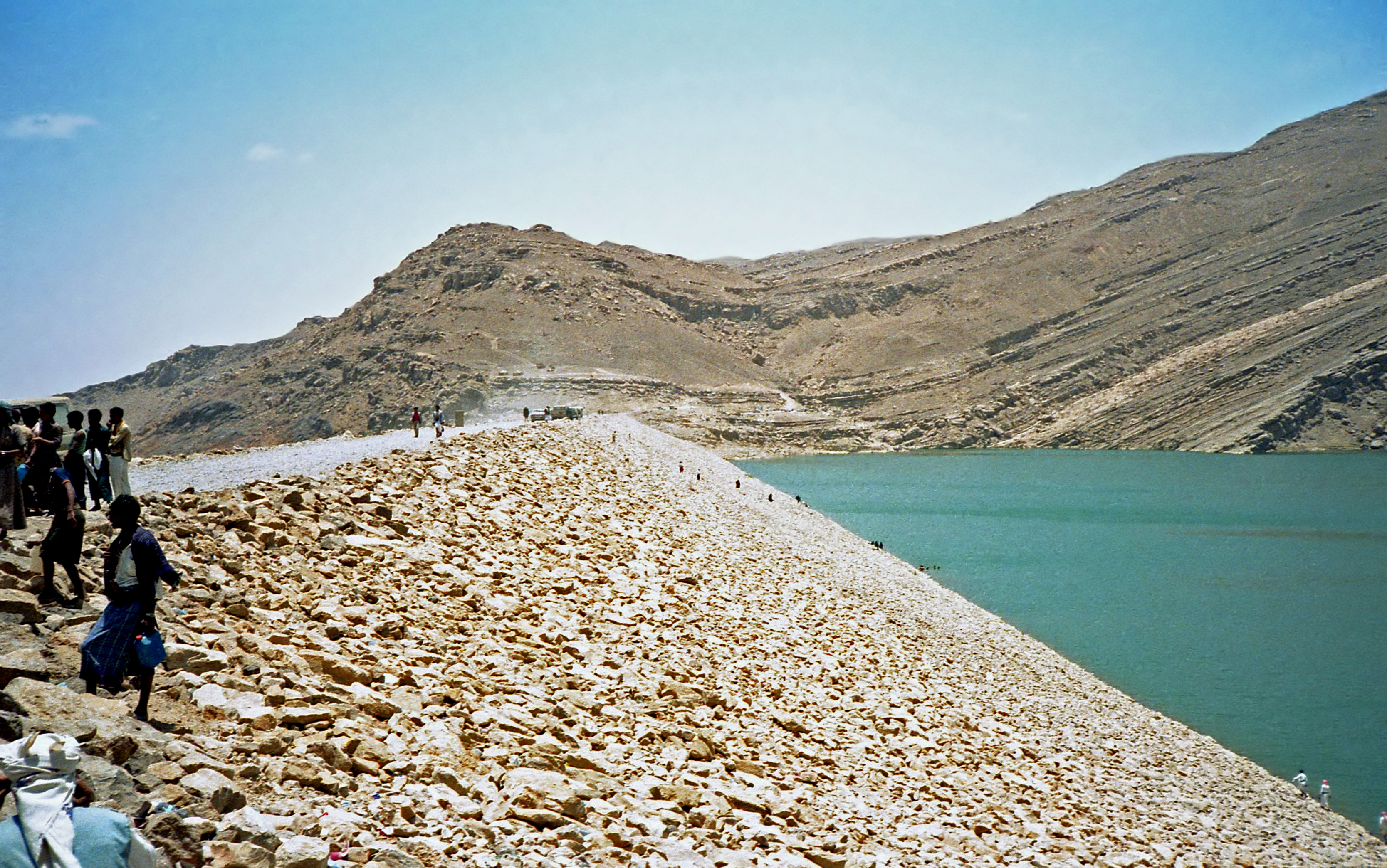
In the 1980s, a new dam was built three kilometers upstream of the ancient ruins, funded by Sheikh Zayed bin Sultan Al Nahyan of the United Arab Emirates, whose tribe reportedly traced its ancestry to Ma'rib. The Turkish construction firm Dogus Group built the modern structure: 38 meters high, 763 meters long, with a storage capacity of 398 million cubic meters. Like its predecessor, the new dam was designed to irrigate the Ma'rib plains. But the wadi bed beneath it consists of alluvial sand and gravel up to 30 meters thick, and significant water seeps through the foundation -- a loss that does not threaten the dam's structure but diminishes its usefulness. Plans have been discussed to rebuild the ancient dam itself as both a functioning water-capture system and a heritage monument, though the complexity of such a project would require coordination among multiple international organizations under UNESCO auspices.
Heritage Under Fire
In 2015, the dam was damaged in an airstrike during the Saudi-led military intervention in Yemen. Yemeni officials attributed the strike to coalition forces. The damage to a structure that had already endured three millennia of human and natural assault added a bitter modern chapter to the dam's long history. Despite the ongoing Yemeni civil war, the site received a measure of international recognition in 2023 when the Marib Dam, along with other landmarks of the ancient Kingdom of Saba, was inscribed on the UNESCO World Heritage List. The ancient ruins still stand in the Balaq Hills -- stone sluice channels, inscribed walls, the ghosts of an irrigation network that once fed a civilization. The modern dam holds water behind it. Between the two, the entire arc of Yemeni history is written in concrete and stone.
From the Air
The Marib Dam site is located at 15.396N, 45.244E in the Ma'rib Governorate, Yemen. The modern dam is visible from altitude as a long earthen structure across Wadi Adhanah, with the ancient ruins located approximately 3 km downstream. The surrounding terrain is arid highland desert with the Balaq Hills flanking the wadi. Nearest airport is Ma'rib Airport (OYMB). The site is a UNESCO World Heritage Site as of 2023. Exercise caution due to ongoing conflict in the region.