Martins Beach
For more than a century, the gate was open. Families parked along Highway 1, paid a few dollars, and drove down a narrow road through rolling coastal hills to reach two shallow coves framed by sheer cliffs and the sharp cone of Pelican Rock. Martins Beach was never famous, never crowded, never anything more than a quiet stretch of San Mateo County coastline where locals surfed and kids explored tidepools. Then, in 2008, Vinod Khosla bought the surrounding land and closed the road. What followed became the most closely watched property rights battle in modern California history.
A Family Beach, A Farmer's Name
Nicholas Martin purchased the land around these two coves in the 1850s, back when California was still sorting out its Mexican-era land grants. The beach that took his name sits within the old boundaries of Rancho Canada de Verde y Arroyo de la Purisima, a sprawling 8,906-acre grant from 1838. By the early 1900s, the Deeney family owned the property and established an open-door policy that would define the beach for generations. They charged for parking but let anyone walk to the water. In the 1920s, the Deeneys leased the beach to the Watts family, who built Watts Inn right on the sand and managed visitor amenities for decades. The building still stands. When the Deeneys resumed management in the 1990s, the arrangement continued unchanged: pay to park, the beach is yours.
The Gate That Changed Everything
Vinod Khosla, co-founder of Sun Microsystems and one of Silicon Valley's most prominent venture capitalists, purchased the property adjacent to the beach in 2008. Within two years, a gate appeared across Martins Beach Road, the only land route to the water. Public access, maintained informally for over a century, stopped. The legal theory behind the closure was straightforward: Khosla owned the road, and the Fifth Amendment protects private property from being taken without just compensation. But California's relationship with its coastline is anything but straightforward. The California Coastal Act of 1976 enshrined public access to the shore as a fundamental right, and the state's beaches belong to the people below the mean high tide line.
A Decade in Court
The Surfrider Foundation filed the first lawsuit in 2014, arguing that a century of public use had established an implied right of access. A San Mateo County judge ordered Khosla to open the gate. He refused, appealing through multiple courts. A key ruling held that Khosla could not close the gate without a permit from the California Coastal Commission, and the U.S. Supreme Court declined to hear his appeal in 2018. But the fight was far from over. In 2019, an appeals court ruled that the previous owners' practice of allowing access had not formally established a public right. The California Coastal Commission and State Lands Commission launched a new lawsuit in 2020, shifting the legal strategy. The New York Times captured the absurdity of it all in a headline: "Every Generation Gets the Beach Villain It Deserves."
Pelican Rock and What's at Stake
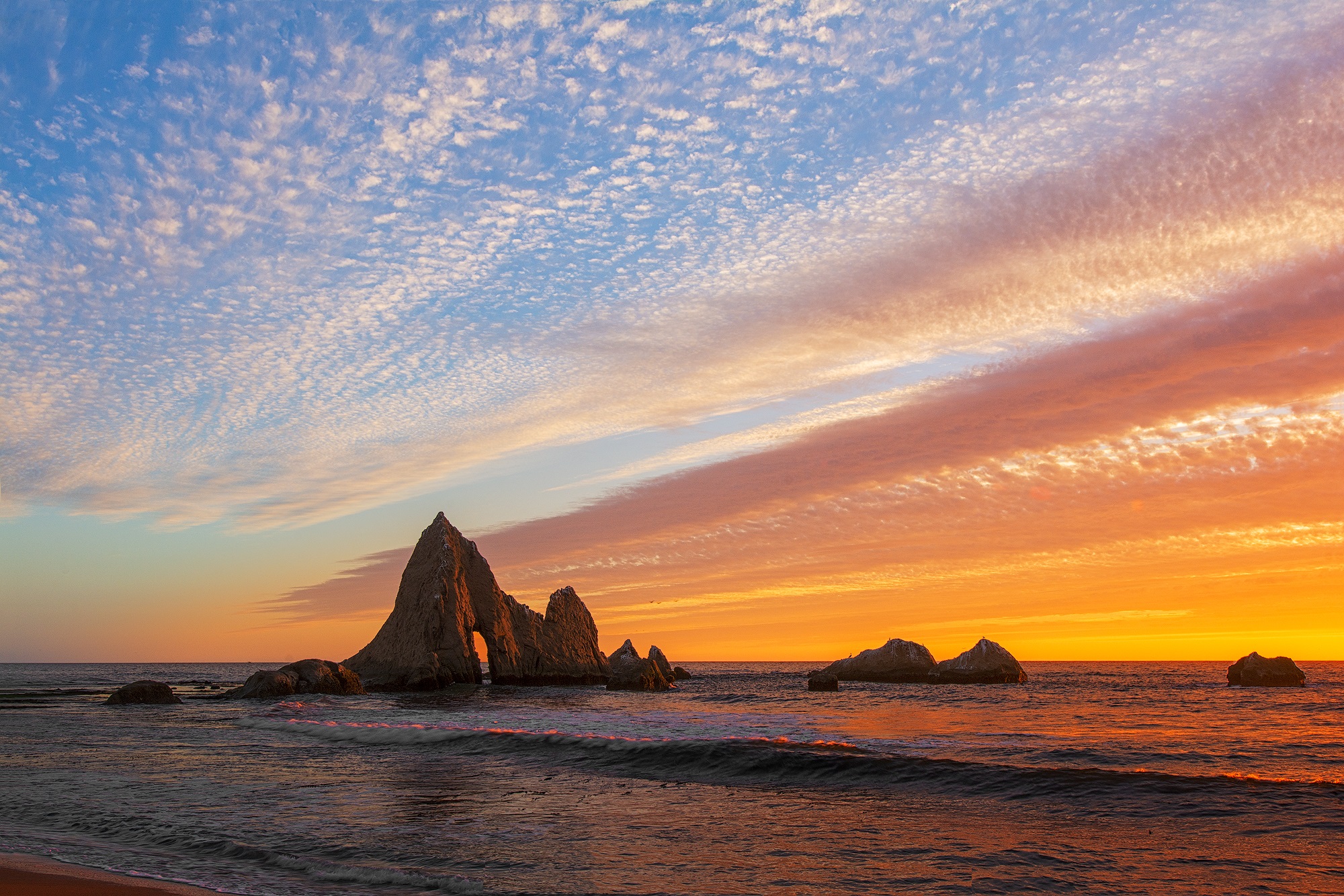
Beyond the legal drama, Martins Beach remains what it always was: two crescent coves separated by Pelican Rock, a sharp stone spire rising from a narrow spit ribboned with tidepools. Overhanging cliffs wall the coves on three sides, creating a sheltered pocket where waves break gently enough for children and consistently enough for surfers. The landscape is intimate in a way that California's grander beaches are not. There is no boardwalk, no concession stand, no lifeguard tower. The case matters because it tests the boundary between private property rights and the public trust doctrine that has governed California's coast since statehood. If one locked gate on one private road can sever access to a beach that generations of Californians treated as their own, the implications ripple far beyond San Mateo County.
From the Air
Located at 37.375°N, 122.408°W along the San Mateo County coast. The two coves and Pelican Rock are visible from low altitude south of Half Moon Bay. Nearest airport: Half Moon Bay Airport (KHAF), approximately 5 nm north. San Francisco International (KSFO) is 18 nm northeast. Best viewed below 3,000 ft AGL following Highway 1 southbound.