Matsushima
Matsuo Basho walked for months through the mountains of northern Japan in 1689, composing haiku at every turn. But when he reached Matsushima Bay and saw the 260 pine-covered islands scattered across its waters, the poet who always had something to say fell silent. The verse often attributed to him -- 'Matsushima, ah! Matsushima, Matsushima!' -- was likely penned by his traveling companion Kawai Sora, but the sentiment captures what visitors still feel. Some places exhaust the vocabulary. Matsushima, whose very name breaks into its two elements -- matsu (pine) and shima (island) -- simply is what it describes: a constellation of islands draped in ancient pines, ranked for centuries as one of Japan's Three Great Views.
Islands Beyond Counting
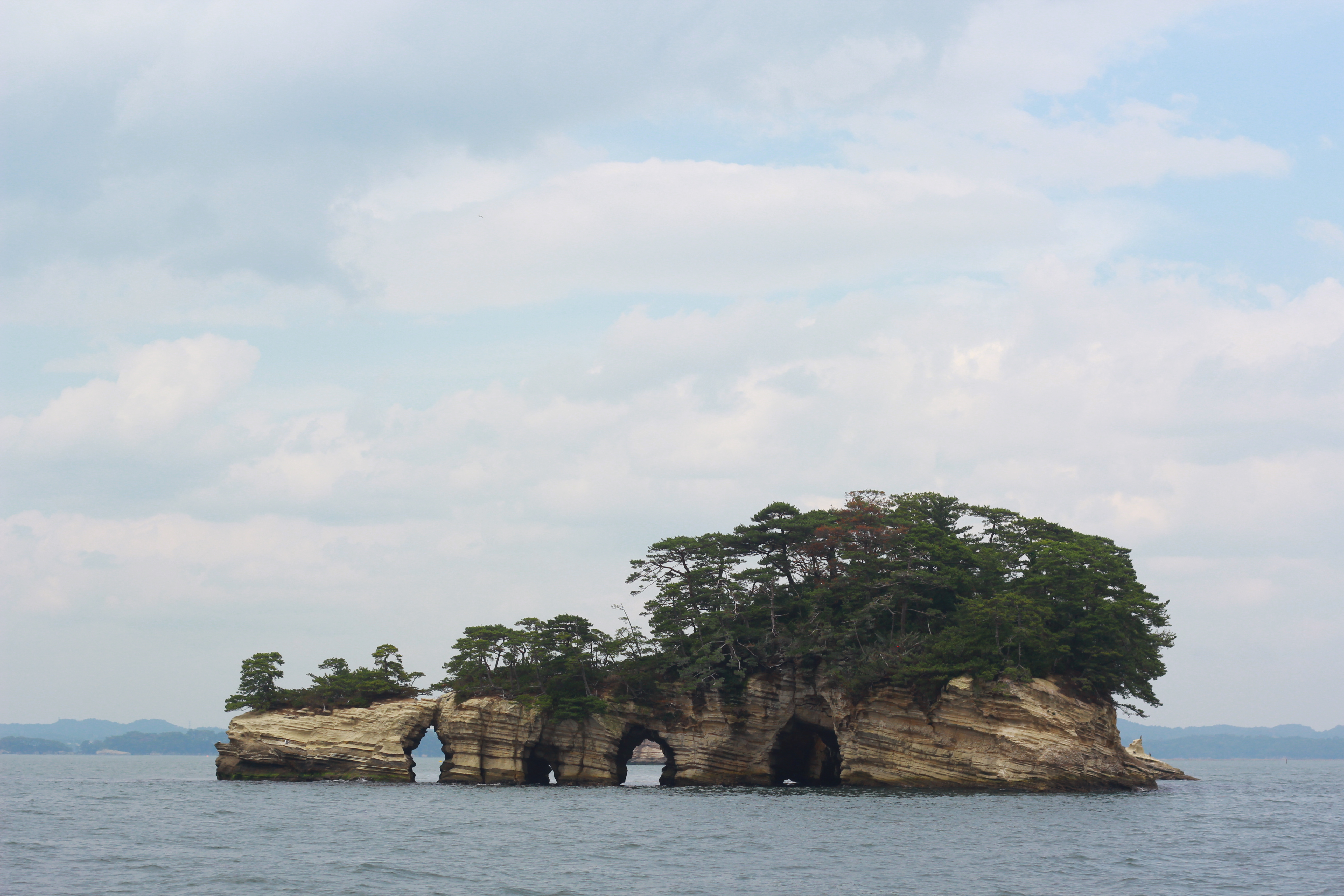
The roughly 260 islands that dot Matsushima Bay range from outcroppings barely large enough for a single tree to substantial landmasses honeycombed with sea caves. Cruise boats loop through the archipelago every half hour, threading past islands with names like Niojima, Senganjima, and Kaerujima. The volcanic tuff that forms them erodes into shapes the Japanese imagination has been cataloguing for centuries -- arches, pedestals, tunnels. From the water, each island presents its own miniature composition of weathered rock and wind-bent pine. The bay also shelters some of Japan's finest oyster beds, and from October onward, the main street near Matsushima-Kaigan Station becomes a stretch of oyster vendors offering them fresh, fried, baked, and grilled.
Four Windows on Beauty
Japanese aesthetic tradition identifies four specific hilltop viewpoints from which to contemplate the bay, each assigned its own poetic label. From Otakamori comes the Magnificent View, a sweeping panorama best reached by a short taxi ride from the station. Tomiyama offers the Beautiful View, while Ogitani, a promontory jutting into the bay itself, provides the Enchanting View. Tamonzan completes the set with the Grand View. Saigyo Modoshi no Matsu Park, the highest overlook, erupts in cherry blossoms each spring, layering pink against the blue-green expanse below. Together, these vantage points form a kind of curated gallery -- the same bay composed and recomposed by elevation, angle, and season.
The Poet's Pilgrimage
In 1689, Basho set out from Edo on the journey that would produce Oku no Hosomichi -- The Narrow Road to the Deep North -- one of the defining works of Japanese literature. Matsushima was a destination he had long anticipated. The town honors this connection annually, and the temples and shrines that Basho would have encountered still stand along the waterfront. Zuigan-ji, the grand Zen temple rebuilt by the powerful daimyo Date Masamune, remains the cultural anchor of the town. Godaido Hall perches over the water on a small island connected by a red bridge, its wooden balcony framing the bay like a painting. The spiritual and the scenic have always been intertwined here.
Shielded by Stone
When the magnitude 9.0 earthquake struck the Tohoku coast on March 11, 2011, the tsunami that devastated nearby communities arrived at Matsushima as well. But the same islands that give the bay its beauty also gave it protection. The initial wave measured 3.2 meters; the second, 3.8 meters -- significant, but far less destructive than the waves that obliterated towns along the open coast. Three people died in the area, a fraction of the catastrophic toll elsewhere. By March 18, electricity was restored; by late May, the train line to Sendai was running again. The temples, shrines, and ferry piers survived. Matsushima emerged as a rare story of resilience along a coast defined by loss, its ancient islands serving one final, unexpected purpose.
From the Air
Located at 38.37N, 141.08E along the Pacific coast of northeastern Honshu. The bay and its 260 islands are clearly visible from altitude, appearing as a cluster of green dots in the sheltered waters east of the town. Nearest major airport: Sendai Airport (RJSS), approximately 20nm to the south. The town sits about 14km northeast of Sendai city center. Best viewed on approach from the east over the Pacific, where the island-studded bay contrasts sharply with the open coastline to the north and south. Clear-weather visibility recommended to appreciate the island formations.