Mawlamyine
Rudyard Kipling arrived in 1889 and climbed to the Kyaikthanlan Pagoda, perched on a hill above the city. From there he looked out over the Gulf of Martaban, the limestone mountains of Kayin State, the river, the islands -- and wrote about "lookin' lazy at the sea." Thirty-six years later, George Orwell arrived as an Imperial Policeman and found a different Moulmein. He worked at the Police Commissioner Headquarters on its hill in Than Lwin Park, witnessed a hanging at the colonial-era prison, and stored up the experiences that would become some of the most searing essays in the English language. Mawlamyine -- known as Moulmein under British rule -- has been accumulating stories like this for centuries, each layer of its history visible in the pagodas, churches, colonial buildings, and port infrastructure that line the banks of the Thanlwin River.
Where the Rivers Meet the Sea
Mawlamyine sits where the Thanlwin (Salween) River empties into the Gulf of Martaban, a position that made it one of the most important ports in Southeast Asia during the colonial era. The British-India Steam Navigation Company ran routes from Moulmein to Calcutta, Penang, Malacca, Singapore, Colombo, and Bombay -- shipping lines that date to 1857. Rice and teak from the sawmills were exported worldwide. In 1894, a second-class ticket on the nine-hour steamer from Rangoon cost ten rupees. Across the water, the town of Mottama -- formerly Martaban -- served as the first capital of the Hanthawaddy Kingdom in the 13th and 14th centuries and was a major port on the Maritime Silk Road connecting China, Southeast Asia, and eventually Rome. The Martaban jars traded across Asia took their name from this port. Today the Thanlwin Bridge, stretching approximately 21,000 feet (6,600 meters) across the river, connects Mawlamyine to Yangon and the rest of Myanmar, making it the western terminus of the East-West Economic Corridor linking the South China Sea at Da Nang to the Indian Ocean.
A Pagoda, a Prison, and a Poet
The city's heritage buildings read like a bibliography of colonial literature. The Kyaikthanlan Pagoda, built in 875 AD during the reign of Mon King Mutpi Raja, commands the hilltop view that inspired Kipling. The Old Moulmein Prison, built in the 1830s, is where Orwell set his essay "A Hanging" and where, during World War II, Allied soldiers transferred from Singapore's Changi Prison were held before being sent to the notorious Burma-Siam death railway. St. Matthew's Church, the first Anglican church built in Myanmar, was erected in 1832 and rebuilt in 1887 by London architects James Piers St Aubyn and Henry J. Wadling. Orwell attended services there in 1926; gravestones of his relatives still stand in the churchyard. The First Baptist Church, built in 1827 by Adoniram Judson -- the American missionary who compiled the first Burmese-English dictionary -- received a $125,000 restoration grant from the U.S. Embassy in 2015 through the World Monuments Fund.
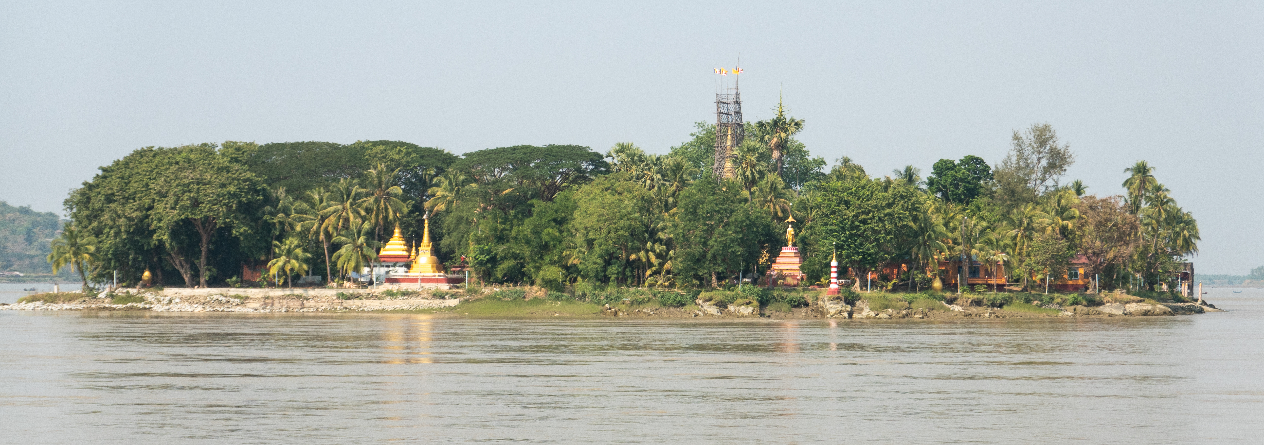
Mon Roots, Many Faiths
Beneath the colonial overlay, Mawlamyine is fundamentally a Mon city. Buddhist cultural presence here is ancient -- the U-zina Pagoda, according to legend, contains a hair of the Buddha and was built during the reign of King Ashoka. But the British annexation and American missionaries in the early 19th century introduced Christianity, and the city absorbed rather than rejected the newcomers. Hindu temples, Chinese temples, mosques, and Baptist churches stand alongside Buddhist pagodas. On Bilu Island, accessible by the Bogyoke Aung San Bridge just 500 meters offshore, Mon traditional handicraft culture persists. Nearby Gaungsay Kyun -- Shampoo Island -- earned its name because pristine water from its rocky outcrop was once carried to the palace for Burmese kings' royal hair-washing ceremonies during Thingyan. The British, less poetically, called it Crow Island. This layering of names tells the larger story: every culture that touched Mawlamyine left its mark, and the city kept them all.
A Princess, a Monastery, and the World's Largest Buddha
Princess Ashin Hteik Suhpaya, fourth daughter of King Thibaw -- the last king of the Konbaung dynasty -- returned from exile in 1915 and settled in a mansion on West Cantonment Road, where she lived until her death in 1936. Her tomb near Kyaikthanlan Pagoda holds the remains of her son and daughter as well. The Queen Seindon Monastery, known locally as Yadanabonmyint, survives as a masterwork of Burmese craftsmanship. About twenty kilometers south at Mudon stands the Win Sein reclining Buddha, the world's largest, approached by a roadway lined with 500 life-size statues of the Buddha's disciples. The Pa-Auk Forest Monastery, 15 kilometers southeast along the Taung Nyo Mountain range, draws 500 to 1,000 meditators from over 20 countries. Mawlamyine today is the capital of Mon State, home to three universities, and the gateway to southeastern Myanmar -- a city still collecting layers of history, one generation at a time.
From the Air
Located at 16.48°N, 97.63°E on the east bank of the Thanlwin (Salween) River where it meets the Gulf of Martaban. The city is identifiable by the Thanlwin Bridge (approximately 21,000 feet / 6,600 meters) crossing the river and the Kyaikthanlan Pagoda on the hilltop. Recommended viewing altitude 3,000-6,000 feet. Nearest airport: Mawlamyine Airport (VYMM), with regular flights to Yangon. The Mottama crossing and Bilu Island are visible to the west and northwest. The Win Sein reclining Buddha at Mudon is visible approximately 20 km to the south.