Mbala, Zambia
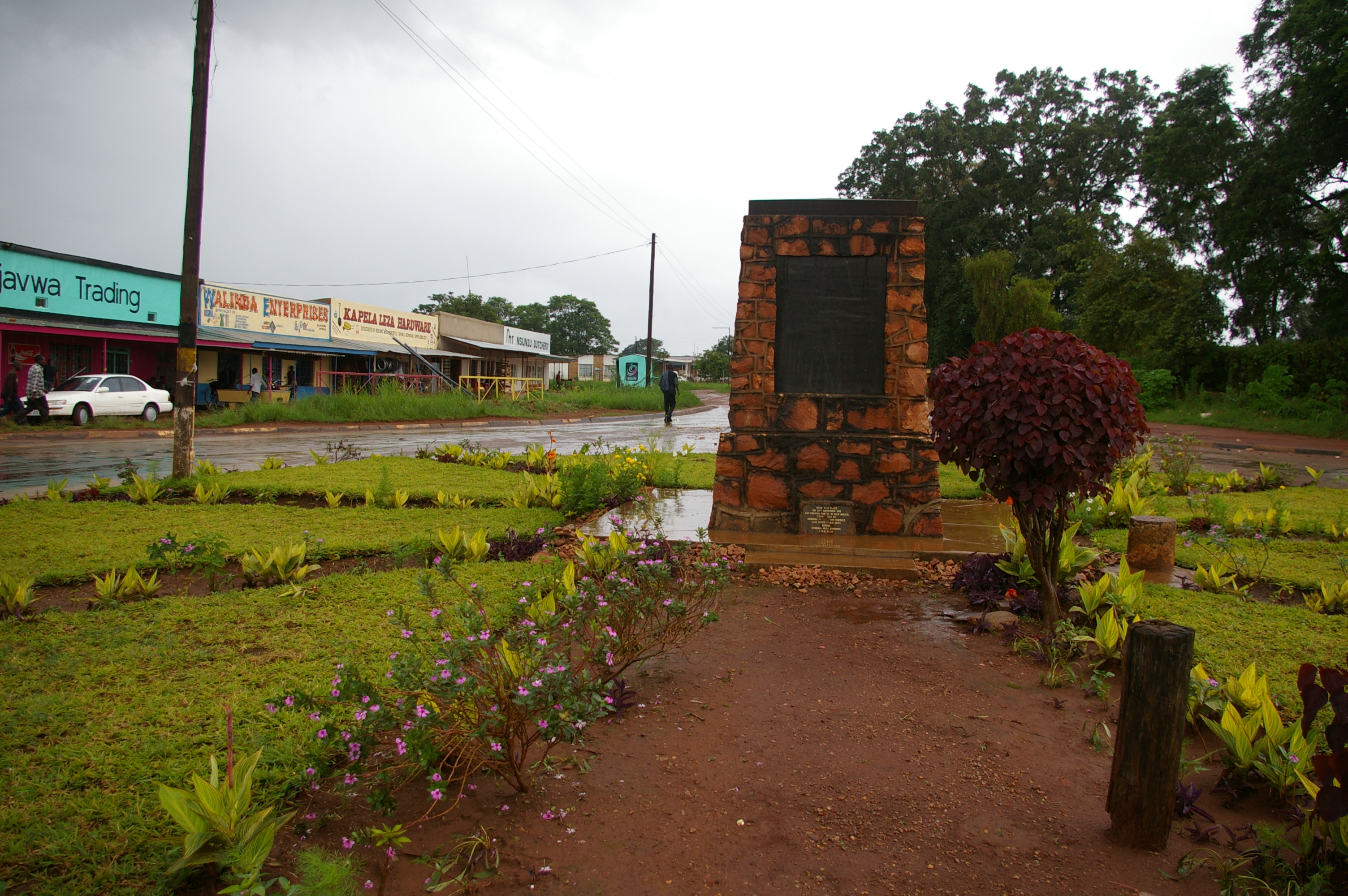
On 25 November 1918 -- fourteen days after the armistice silenced the guns in Europe -- German General Paul von Lettow-Vorbeck formally surrendered to the British in a small town near the southern end of Lake Tanganyika. His undefeated East African force had spent four years running rings around Allied armies ten times its size, and this remote plateau settlement at the edge of the Great Rift Valley was where the chase finally ended. The German troops were ordered to throw their weapons into Lake Chila, a tiny, picturesque lake within the town itself. That town was Abercorn. Today it is called Mbala, and the war memorial marking the surrender still stands about two kilometres southwest of the centre, a monument from a conflict most people associate with Flanders and the Somme, not with the high plateau of northeastern Zambia.
Chief Zombe's Village to Imperial Outpost
Before the British arrived, Mbala was the village of Chief Zombe on the Lucheche River. The area drew European attention after David Livingstone passed through in the 1860s, the first European to visit. Verney Lovett Cameron followed, surveying Lake Tanganyika. Missionaries from the London Missionary Society established stations at Niamkolo on the lake and Fwambo and Kawimbe on the plateau during the 1880s, working alongside the African Lakes Company. The slave trade ravaged the region throughout the nineteenth century, and the company devoted considerable effort to suppressing it. In 1895 the British South Africa Company took over administration of the territory, renamed it North-Eastern Rhodesia, and rechristened Chief Zombe's boma as Abercorn, after the company chairman. British administrators favoured the site for its healthy climate, its elevation of 1,670 metres, and the excellent hunting and fishing nearby. Until 1919, Abercorn was one of the most northerly outposts of British southern Africa.
Where the Plateau Meets the Abyss
Mbala sits at the very edge of the Zambian plateau, 1,670 metres above sea level and roughly 900 metres above Lake Tanganyika, which lies just 22 kilometres away in a straight line. The escarpment above the lake marks the terminus of the Albertine Rift, the western branch of the East African Rift, and the town occasionally feels earth tremors -- gentle reminders of the forces that tore the continent apart. The road winding down the escarpment to the port of Mpulungu passes close to Lunzua Falls and offers dramatic views of the lake below. Forty kilometres northwest by road stands Kalambo Falls, the second-highest waterfall in Africa at 235 metres, where the Kalambo River plunges over the rift escarpment. Archaeological sites around the falls record human activity stretching back 300,000 years. Within the town itself lies Lake Chila, a small body of water said to experience inexplicable episodes of drying out and sudden flooding from underground springs -- though whether this is geology or legend, nobody has conclusively established.
A Town That Time Outpaced
Mbala's heyday came in the 1950s and early 1960s, when it thrived as a colonial administrative centre. After Zambia's independence in 1964, the town regained its pre-colonial name but lost its momentum. The provincial capital, Kasama, and the junction town of Mpika claimed the better road and rail connections. Mbala's fertile soils and abundant water could not overcome the brutal arithmetic of transport costs -- too far from urban markets for most agricultural crops to be viable. The Great North Road connecting Mbala to Kasama, 165 kilometres south, deteriorated badly. By 2008, large sections had reverted to dirt. Tourism, which the area's waterfalls and rift escarpment could easily support, remained stunted by poor roads and a lack of regular air service. The airport, with its 2.6-kilometre runway once used by the Zambian Air Force, sits quiet. Wars and instability along the eastern and northern shores of Lake Tanganyika further isolated the region. Yet the Moto Moto Museum preserves the cultural heritage of the Mambwe and Lungu peoples, named after the French Catholic bishop Joseph Dupont, who earned the affectionate nickname Moto Moto.
The Weight of Where Things End
Mbala is a town defined by endings and by what persists despite them. The last formal surrender of World War I in Africa happened here, two weeks after the rest of the world had stopped fighting. The slave trade that terrorized the region for decades was stamped out here, by a combination of missionaries, traders, and imperial officers operating at the very limits of their reach. Colonial rule came and went, leaving behind an English name that lasted until independence and a war memorial that still stands in the grass. The town itself declined when the political geography shifted southward, leaving Mbala at the end of a road that no longer led anywhere the government considered important. But the Rift Valley escarpment still drops away to the west, and Lake Tanganyika still glitters below, and the archaeological record around Kalambo Falls still reaches back hundreds of thousands of years. Mbala endures, at the edge of things, as it always has.
From the Air
Located at approximately 8.83S, 31.37E at an elevation of 1,670 metres on the Zambian plateau. From altitude, the dramatic escarpment dropping to Lake Tanganyika is clearly visible to the northwest, with the lake itself approximately 22 km away. Kalambo Falls is 40 km northwest by road. Mbala Airport (FLBA) has a 2.6 km runway but no scheduled services. The nearest airport with regular service is Kasama, 165 km south. The M1 Great North Road is visible running south toward Kasama, and the M2 road winds down the escarpment toward Mpulungu on the lake.