McNee Ranch State Park
On the rare days when snow dusts the summit of Montara Mountain, McNee Ranch looks like it belongs in another state entirely. The 690-acre ranch climbs to 1,898 feet above sea level along the northern spur of the Santa Cruz Mountains, and from the top, on clear mornings, the view encompasses much of the San Francisco Bay Area -- the bridges, the city skyline, the East Bay hills, the Pacific stretching south toward Santa Cruz. But most people who hike McNee Ranch are not there for the view. They are there for the climb.
Serpentine Soils and Rare Survivors
The mountain's lower slopes contain serpentine soils, a geologically distinctive substrate that creates harsh growing conditions: low nutrient availability, high concentrations of heavy metals, and poor water retention. Plants that thrive on serpentine tend to be specialists, adapted to conditions that eliminate most competitors. McNee Ranch harbors two federally endangered species that depend on these soils. Hickman's potentilla is a tiny, inconspicuous plant first documented on this coast in 1933. The San Mateo thornmint, Acanthomintha duttonii, is even rarer, found only in a handful of locations in the county. These plants survive precisely because their habitat is so inhospitable to everything else.
The Fire Road to the Summit
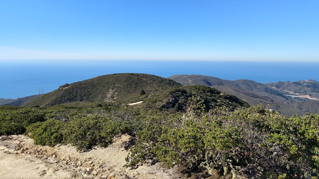
The main route to the summit is the North Peak Access Road, an unpaved fire road accessible from Pedro Mountain Road. The climb is steady and exposed, gaining nearly 1,900 feet over roughly two miles with minimal shade. Mountain bikers and trail runners share the road with hikers, and on weekends the parking area fills early. The effort is honest -- there are no shortcuts -- but the payoff is a 360-degree panorama that justifies every step. On the clearest days, the Farallon Islands are visible to the west, and Mount Diablo rises to the east above the inland valleys. The ranch is administratively part of Montara State Beach, linking the summit's ridge habitat to the tide pools and sandy shores below.
Coastal Mountain, Coastal Light
McNee Ranch occupies an unusual ecological position. At nearly 1,900 feet, it catches marine fog that rarely penetrates inland, creating a moist, cool environment on its western slopes even when the bayside communities bake in summer heat. The eastern slopes drain toward Crystal Springs Reservoir and the suburban peninsula. This dual exposure supports a range of habitats from coastal scrub to grassland, and the elevation gradient compresses them into a small area. The ranch is the kind of place where you can start a hike in fog so thick you cannot see fifty yards, climb for an hour, and emerge above the cloud layer into brilliant sunshine with the fog bank spread below you like a white sea. It is one of the San Francisco Peninsula's finest experiences, and it requires nothing more than a pair of shoes and a willingness to go uphill.
From the Air
Located at 37.56°N, 122.50°W. Montara Mountain's summit at 1,898 ft is the prominent peak on the San Mateo coast between Pacifica and Montara. The mountain rises steeply from the coastline and is a significant terrain feature for coastal approaches. Half Moon Bay Airport (KHAF) is approximately 5 nm south-southeast. San Francisco International (KSFO) is 10 nm north-northeast. Maintain safe altitude above the summit in reduced visibility conditions.