Medicine Hat: The City Rudyard Kipling Said Had Hell Beneath
Rudyard Kipling visited Medicine Hat in 1907 and declared it 'a city with all hell for a basement' - a reference not to wickedness but to the enormous natural gas reserves beneath the town. The gas was so abundant and accessible that Medicine Hat once offered free natural gas to residents; the city still provides some of Canada's cheapest energy. But the name came first, from a Blackfoot story about a medicine man whose headdress (or 'medicine hat') was lost while crossing the South Saskatchewan River - a supernatural loss that supposedly ended a battle. The city that grew there became an energy powerhouse, Kipling's hell-basement prophecy proving more accurate than he could have imagined.
The Name
Several stories explain 'Medicine Hat.' The most common: during a battle between Cree and Blackfoot warriors, a Cree medicine man lost his headdress while crossing the South Saskatchewan River. The loss demoralized the Cree, who fled. The location became known for the lost medicine hat. Alternatives exist: the hill above the town resembles a headdress; 'medicine' referred to spiritual power concentrated here. Missionaries tried to change the name to more 'respectable' alternatives; residents refused. In 1910, when some residents proposed changing the name to 'Gasburg,' Kipling wrote a famous letter opposing the change, concluding: 'What then should a city be re-christened that has sold its name? – Judasville.' The proposal was defeated ten to one. The city has been Medicine Hat since 1883.
The Gas
The Canadian Pacific Railway discovered natural gas while drilling for water in 1883. The reserves proved vast - some of Alberta's largest. The city developed gas production, providing fuel for residents and industry. For decades, Medicine Hat offered free or nearly free gas to residents and businesses, attracting manufacturing and earning the 'Gas City' nickname. The abundance was Kipling's 'hell for a basement' - the energy that seemed to flow without limit from underground. The reserves continue producing, though prices are no longer free. Medicine Hat remains an energy city, its economy built on what lies beneath.
The Economy
Cheap energy built Medicine Hat's industrial economy. Potteries thrived here, using gas-fired kilns; Medalta Potteries operated from 1912 to 1954, producing iconic Canadian stoneware. Greenhouses used cheap heating for year-round production. Fertilizer plants, glass factories, and other energy-intensive industries located here. The city's growth tracked energy prices - booming when gas was cheap, adjusting when markets changed. Today Medicine Hat has diversified, but energy remains foundational. The 'Gas City' identity persists, even as renewable energy begins supplementing the hell-basement inheritance.
The City
Medicine Hat is southeastern Alberta's largest city, population roughly 65,000, serving a vast agricultural hinterland. The South Saskatchewan River flows through downtown, the same river where the medicine hat was lost. The historic clay district preserves pottery heritage. The Esplanade arts center hosts culture. Cypress Hills, one of Canada's few dark sky preserves, rises to the south. The city is sunnier than most Canadian places - the warmest, driest climate in the prairies. The name that sounds strange to outsiders is beloved locally, a distinctive identity that multiple efforts have failed to change.
Visiting Medicine Hat
Medicine Hat is located in southeastern Alberta, roughly 300 km southeast of Calgary via the Trans-Canada Highway. The Historic Clay District preserves Medalta Potteries and related heritage. The Saamis Teepee, the world's largest teepee, stands beside the highway as a 1988 Olympics legacy. Cypress Hills Interprovincial Park, 70 km southeast, offers hiking, dark sky viewing, and the highest point between the Rockies and Labrador. Medicine Hat has full tourist services: hotels, restaurants, the amenities of a regional center. The city rewards visitors who appreciate energy history, prairie landscapes, and a name that Rudyard Kipling thought worth keeping.
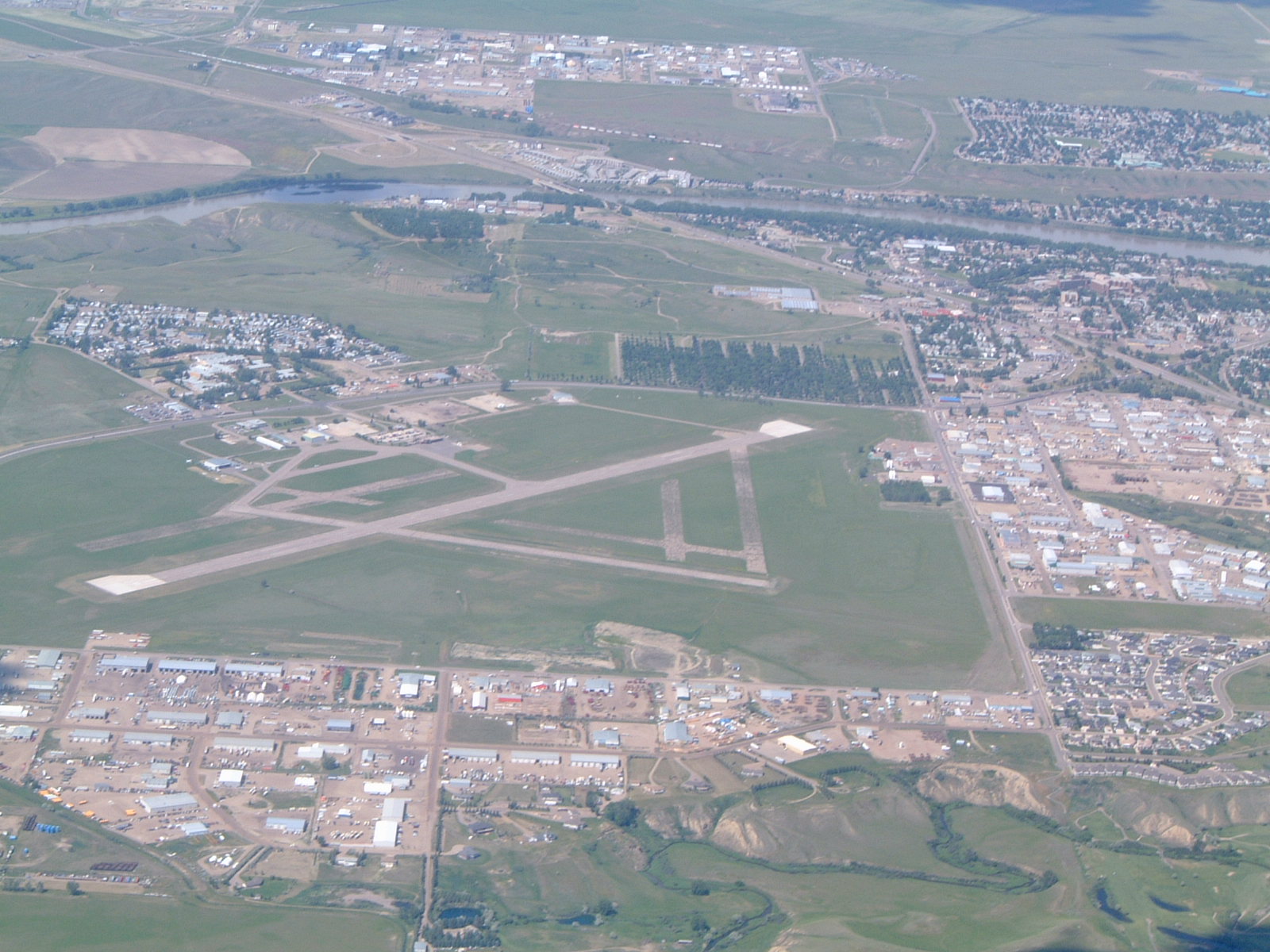
From the Air
Located at 50.04°N, 110.68°W on the South Saskatchewan River in southeastern Alberta. From altitude, Medicine Hat appears as a substantial city on the prairie - the largest settlement for many miles, the river snaking through its center. The Saamis Teepee is visible as a distinctive structure near the highway. The surrounding landscape is classic prairie: flat to rolling, agricultural, few trees except along river valleys. The gas fields that made the city's fortune are invisible - underground, the 'hell for a basement' that Kipling identified. Cypress Hills rise to the southeast, visible as elevated terrain breaking the prairie horizon. Medicine Hat looks like what it is: an energy city in farm country, built on a foundation of natural gas and an unforgettable name.