Medicine Rocks State Park
Theodore Roosevelt was not a man given to breathless superlatives, yet something about this remote corner of Montana stopped him cold. "As fantastically beautiful a place as I have ever seen," the young rancher declared of Medicine Rocks, and the judgment still holds. Rising from the high plains of Carter County like the remnants of some ancient cathedral, these sandstone formations have drawn seekers for millennia. The Crow called this place Inyan-oka-lo-ka, "rock with a hole in it," a name that captures only the physical truth. The deeper truth is written in the petroglyphs that cover these weathered surfaces, in the fasting beds where vision seekers once lay under infinite skies, and in the darkness that earned Medicine Rocks designation as an International Dark Sky Sanctuary in 2020.
Sixty-One Million Years in the Making
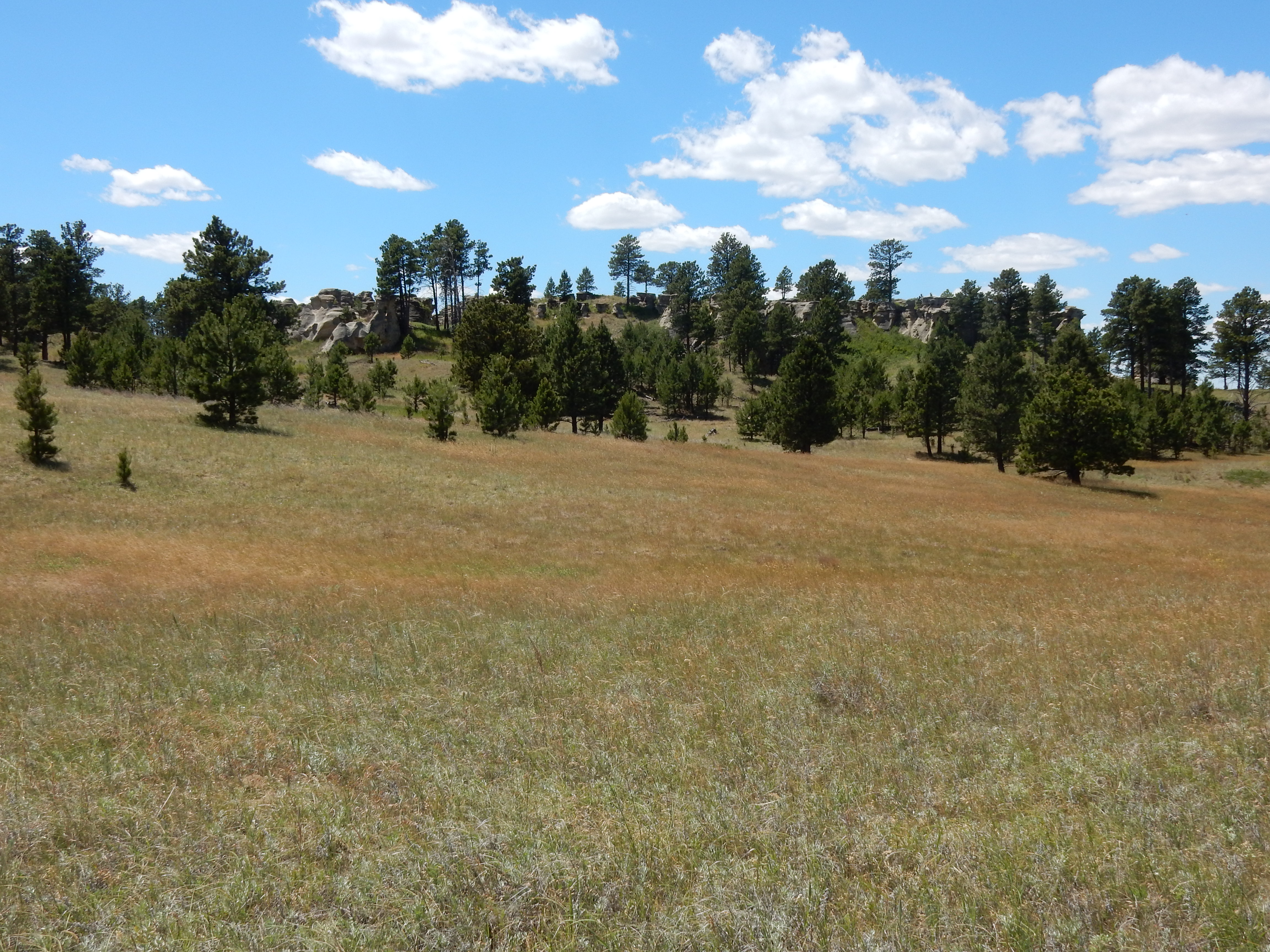
The story begins in the Paleocene, when a freshwater river flowed southeast across what is now eastern Montana, emptying into the last vestiges of the Western Interior Seaway. That river deposited fine-grained sand that compressed over eons into the Fort Union Formation's distinctive sandstone. Atop this freshwater layer, a saltwater estuary left its own mark: grey-tinged stone riddled with the burrows of ancient marine worms. Then time and weather went to work. Wind, dirt, sand, and rain carved the stone into arches, caves, columns, and flat-topped towers. Some formations reach heights that dominate the surrounding prairie. Within these layers, paleontologists discovered teeth from Plesiadapis anceps, an early primate-like mammal, and in 1935, the fossil remains of Baiotomeus, a primitive mammal new to science.
Where Visions Come
For the Plains tribes, Medicine Rocks was no mere geological curiosity. The Cheyenne stopped here on their seasonal journeys from the Yellowstone River Valley to the Black Hills, leaving offerings of beads, paint, and tobacco in crevices that seemed to reach between worlds. The Crow constructed fasting beds from flat stones, platforms where seekers would lie for days without food or water, waiting for the visions that would guide their lives. Their rock art still marks the sandstone surfaces, cryptic messages from across centuries. Bone and stone tools, fire rings, pottery, and teepee rings speak to generations of presence. The name "Medicine" in English captures the sacred dimension that transcended any single tribe: this was a place where the ordinary world grew thin.
Cowboys and Tax Collectors
The clash between frontier expansion and indigenous sacred space played out here as it did across the West. As white settlement pushed westward, hundreds of cowboys worked the surrounding ranches, and many carved their names into the same sandstone that held ancient petroglyphs, adding graffiti to sacred art. When Carter County was carved out of Fallon County in 1917, the region's character was already shifting. In the 1930s, the county seized the Medicine Rocks property to satisfy unpaid taxes, an act of bureaucracy that inadvertently preserved the site for public access. Montana established it as a state park in 1957, beginning a stewardship that has not always been smooth. In 1990, when the state parks department attempted to close Medicine Rocks at night, 240 angry citizens descended on a hearing in Baker, and the state backed down. A year later, a proposed three-dollar entrance fee was announced but never enforced after similar protests.
A Sanctuary of Stars
The remoteness that once made Medicine Rocks a place of pilgrimage now offers a different kind of revelation. In 2020, the International Dark-Sky Association designated the park as an International Dark Sky Sanctuary, recognizing what visitors discover when they camp at one of the twelve primitive sites and wait for nightfall. Here, where the nearest significant town is Baker, some twenty-five miles to the northeast, the Milky Way blazes with a clarity that urban dwellers have forgotten. The sandstone formations that glow orange and pink at sunset become dark silhouettes against a spray of stars so dense it seems impossible. The same sky that the Crow studied from their fasting beds, seeking guidance in the movement of constellations, remains essentially unchanged. The road to Medicine Rocks may become impassable after heavy rains, but for those who make the journey, the reward is a night sky that links the present to the deep past.
From the Air
Located at 46.04N, 104.47W in extreme eastern Montana, about 25 miles west-southwest of Baker. The sandstone formations are visible from altitude as distinctive light-colored outcrops amid the prairie. Nearest airport is Baker Municipal (KBHK), approximately 20nm northeast. The terrain is rolling high plains at roughly 3,200 feet elevation. Best viewed in morning or evening light when the sandstone shows its characteristic orange and pink hues. Clear skies common but summer thunderstorms can develop rapidly.