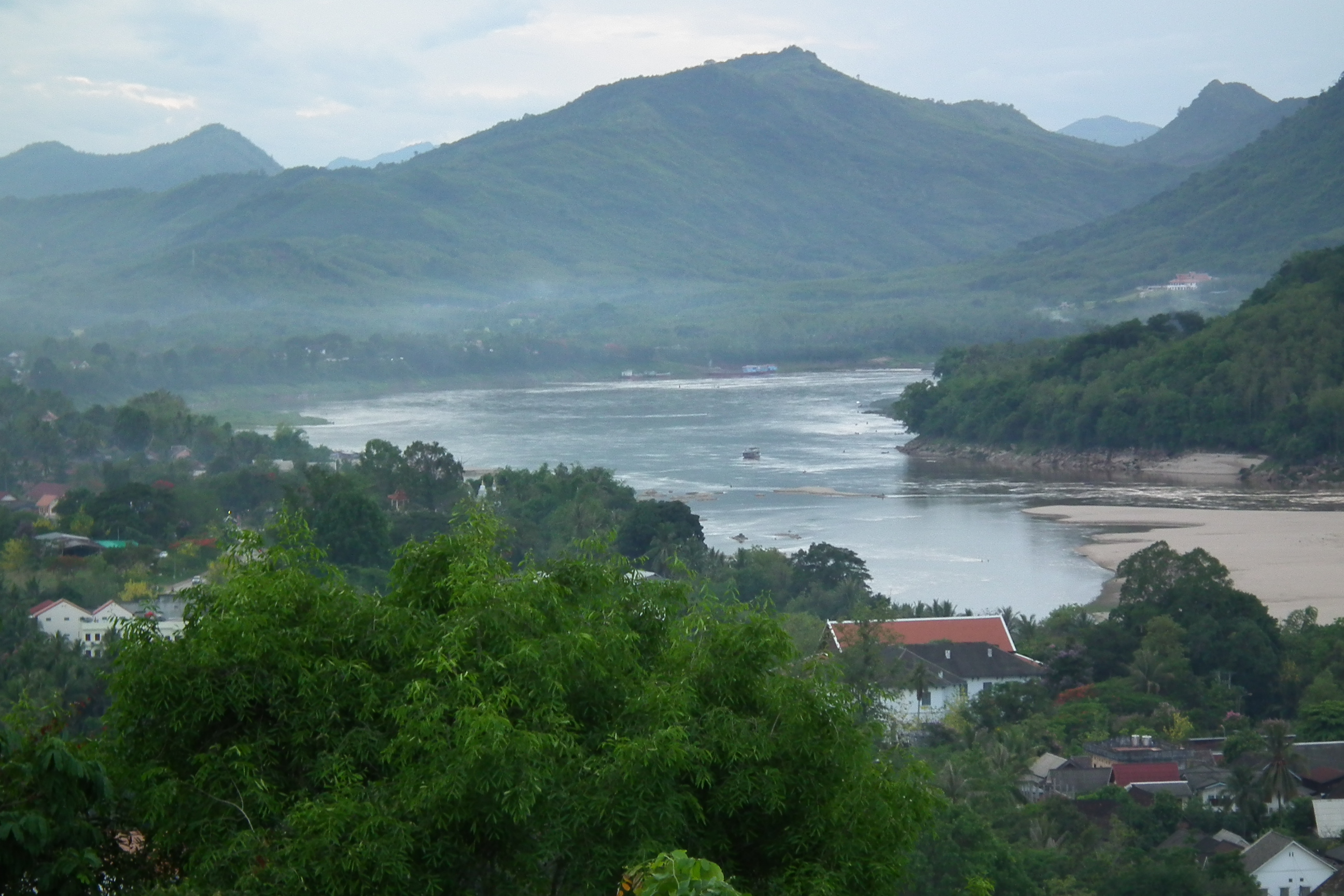
Mekong
The name Mekong may derive from the Khmer words for Mother Ganges, a river so central to Southeast Asian life that it inherited the name of South Asia's holiest waterway. From its source on the Tibetan Plateau at over 5,000 meters, the river descends 4,909 kilometers through China, Myanmar, Laos, Thailand, Cambodia, and Vietnam before emptying into the South China Sea. Along the way it changes names, characters, and even direction, swelling with monsoon rains until Cambodia's Tonle Sap River reverses its flow to absorb the flood. No other river on Earth performs that trick.
A River of Many Names
In China, the Mekong is the Lancang, the Turbulent River. In Laos and Thailand, it is Mae Nam Khong, the Mother of Waters. Early European traders called it the Cambodia River. The linguistic layering reflects a deeper truth: this is not one river but many, each stretch belonging to the people who depend on it. The Mekong runs through territory where Tai-Kadai, Austroasiatic, and Sino-Tibetan language families overlap, and the word Khong itself is an archaic term for river borrowed from Austroasiatic languages, cognate with Vietnamese song and Mon krung. The name Mekong, then, is something like Mother River River, a redundancy that speaks to how thoroughly the water defines the land around it.
The World's Richest Catch
The Mekong's aquatic biodiversity is second only to the Amazon's, but per hectare, no river on Earth is more concentrated with life. The largest freshwater fish ever recorded, a giant freshwater stingray caught in 2022, came from the Mekong, as did the previous record holder, a Mekong giant catfish caught in 2005. Commercial fish species divide into black fish, adapted to slow, oxygen-poor shallows, and white fish, which thrive in the fast, deep channels. But the river's productivity extends far beyond fish. Freshwater crabs, shrimp, snakes, turtles, and frogs, collectively called other aquatic animals, provide essential protein to the sixty million people living within the basin. For many communities along the lower Mekong, the river is not a resource but a pantry.
Dams and Drought
China has built a cascade of dams on the Lancang section that has fundamentally altered the river's behavior downstream. In 2019, the Mekong in the Golden Triangle dropped to its lowest level in a century. An investigation by the New York Times found that China had restricted the river's flow while communities in Laos, Thailand, Cambodia, and Vietnam endured drought. The Don Sahong Dam in southern Laos, completed near the Cambodian border, threatens one of the river's critical fish migration corridors. Each dam traps sediment that once fertilized downstream agriculture and sustained the Mekong Delta's growth. The cumulative impact threatens not just fish stocks but the livelihoods of millions who have no alternative source of protein or income.
Bridges Across Borders
For most of its length, the Mekong was a barrier as much as a highway. The Thai-Lao Friendship Bridges, four of them completed between 1994 and 2013, transformed the river from border into crossing. The first connects Nong Khai with Vientiane, carrying both road and rail traffic. The Kizuna Bridge in Kampong Cham, Cambodia, opened in 2001, linking Phnom Penh to the remote provinces of Ratanakiri and Mondolkiri. Each bridge reshapes commerce and culture along its banks, collapsing distances that the river once enforced. Phnom Penh itself still has no bridge over the Mekong proper, a fact that says as much about the river's width and power as about the city's infrastructure ambitions.
From the Air
The Mekong's source coordinates are 33.71N, 94.70E on the Tibetan Plateau at over 5,000 meters. The river is visible from altitude as it cuts through the Three Parallel Rivers region of Yunnan alongside the Yangtze and Salween. Downstream, the Mekong Delta in Vietnam is a vast green expanse of rice paddies and waterways. Nearest airports to the source region include Yushu Batang Airport (ZLYS). Downstream landmarks include Vientiane's Wattay International Airport (VLVT) and Phnom Penh International Airport (VDPP). The river's seasonal color changes from muddy brown in monsoon to blue-green in dry season are visible from cruising altitude.