Mergui Archipelago
The Mergui Archipelago - roughly 800 islands scattered across the Andaman Sea off the Malay Peninsula's northern end - remained closed to foreign tourists until 1997. Even in the late twentieth century, few Westerners could have pointed to these islands on a map, and fewer still had visited. That isolation, enforced first by geography and then by politics, preserved something extraordinary: a marine wilderness of limestone karsts, granite headlands, and coral reefs where whale sharks still glide through waters that most of humanity has never touched.
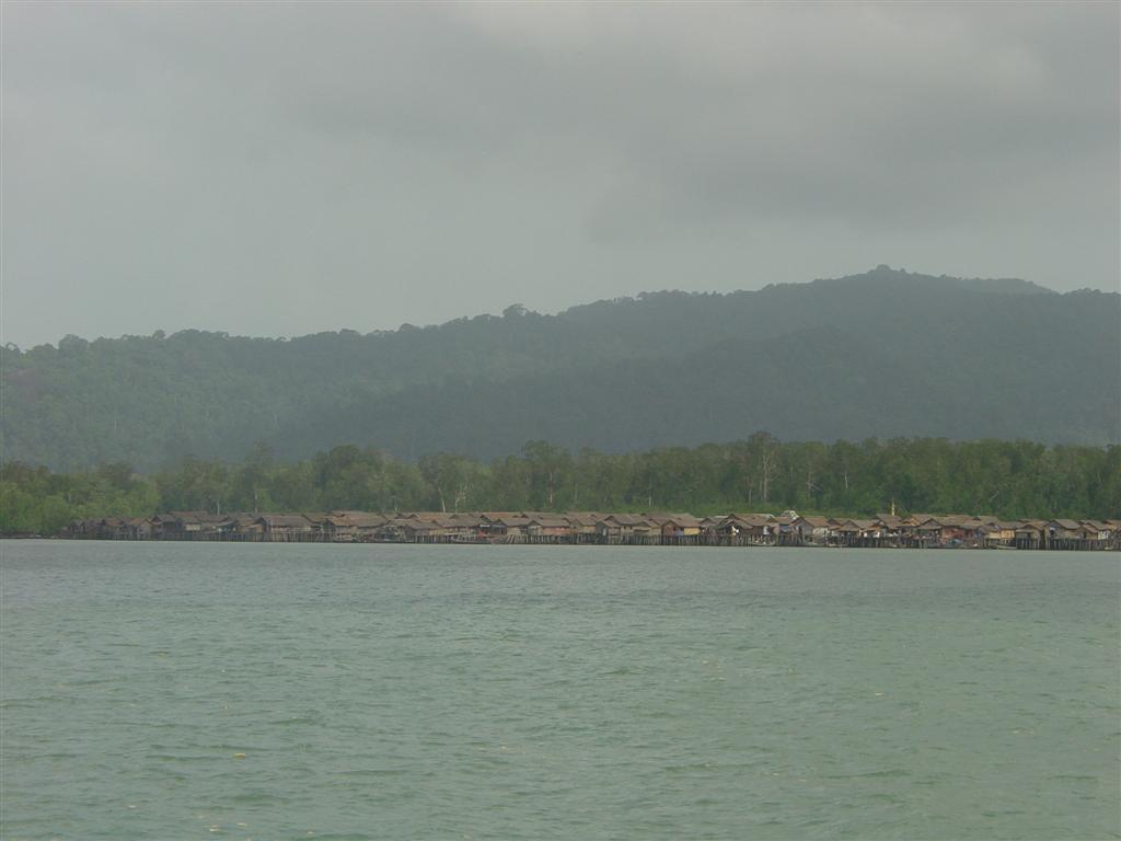
The Sea People's Refuge
The Moken arrived before anyone thought to keep records. An ethnic minority sometimes called Sea Gypsies - though that term covers several distinct groups across Southeast Asia - they are a sea-dwelling people who have lived among these islands for centuries, fishing and building boats in ways that have barely changed. During the dry season, many Moken families still live aboard their traditional vessels, kabang boats built without nails, moving between islands as fish and weather dictate. In the rainy season, they come ashore.
The Moken's oral tradition holds that their islands were once connected to the mainland and were separated after a great mythological flood. Whatever the origin story, the practical reality is that the archipelago's impossible complexity - 800 islands, uncounted channels, reefs that shift with the tides - made it a natural refuge. Pirates and slavers used these waters for the same reason: the maze was nearly impossible to control. For the Moken, that ungovernable geography meant freedom. They could live as they chose, largely ignored, in a floating world between land and sea.
Charting the Unchartable
Malay sailors likely settled the outer islands first, arriving from the south. Chinese and Malay traders used the protected inner waters to shelter from the southwest monsoon, while larger vessels avoided the archipelago entirely - the maritime geography was simply too dangerous for ships that could not navigate by local knowledge.
Accurate charts did not exist until after the British arrived in 1824. Captain Ross surveyed the outer islands in the late 1820s, followed by Captain Lloyd mapping the inner passages in the late 1830s. Between 1838 and 1840, Dr. Johann W. Helfer explored the archipelago comprehensively on behalf of the East India Company, producing a journal that remains one of the most detailed accounts of the region before the modern era. His routes through the islands can still be traced on interactive maps today. But charting the islands did not tame them. The Mergui Archipelago remained largely uninhabited by outsiders well into the twentieth century, its waters too complex and its shores too remote for the kind of colonial development that transformed the rest of Southeast Asia.
A Wilderness Below the Surface
The archipelago's long isolation from human development created an underwater world of remarkable richness. Limestone and granite islands rise from extensive coral reefs, their shorelines alternating between white sand beaches, rocky headlands, and dense mangrove swamps. The surrounding Andaman Sea waters host an extraordinary diversity of marine life, including endangered megafauna that have disappeared from more accessible coastlines.
Whale sharks and dugongs patrol these waters. The area east of Kanmaw Kyun, named Whale Bay for the historical presence of large whale populations, still hosts resident Bryde's whales alongside occasional visitors - blue whales, longman's beaked whales, strap-toothed whales, and killer whales. Dolphins and finless porpoises share the channels with the rare Irrawaddy dolphin. On the islands themselves, deer and monkeys move through thick tropical rainforest, hornbills call from the canopy, and wild swine root through the undergrowth. Kadan Kyun, the largest island, rises to 767 meters. But this wilderness faces mounting threats. Overfishing has depleted stocks in surrounding waters, and blast fishing - using explosives to stun fish - has damaged coral reef systems that took centuries to build.
Paradise Under Pressure
When the Myanmar government opened the Mergui Archipelago to foreign tourism in 1997, negotiating access with dive operators from Phuket in Thailand, the islands entered a new and uncertain chapter. Divers discovered world-class conditions from December through April, with whale sharks and manta rays visiting between February and May. A five-star casino and golf resort, the Andaman Club, now operates on Thahtay Kyun - a jarring contrast to the Moken villages scattered across neighboring islands.
But tourism is not the archipelago's most pressing concern. The Mergui Archipelago lies within Tanintharyi Region, one of the areas most heavily impacted by violence during Myanmar's ongoing civil conflict. The military regime's operations in the archipelago have targeted civilians, including documented massacres of fishermen and the killing of the entire population of Christie Island, the chain's southernmost outpost. For the Moken and the fishing communities who share these waters, the threat is not abstract. It is the sound of a military patrol boat, the uncertainty of whether tomorrow's catch will be permitted, the knowledge that eight hundred islands offer places to hide but no guarantee of safety.
From the Air
Located at approximately 12.0N, 98.0E in the Andaman Sea off the western coast of the Malay Peninsula in far southern Myanmar. The archipelago comprises roughly 800 islands stretching across a wide area of the Andaman Sea. From cruising altitude, the larger islands (Kadan Kyun at 767 m being the tallest) are visible as forested green masses rising from turquoise waters, with limestone karsts and granite formations creating dramatic silhouettes. The nearest major airfield is at Myeik (Mergui) on the mainland, directly across the inland channel from Kadan Kyun. Phuket, Thailand (VTSP) lies to the southeast. Christie Island marks the chain's southern extremity, Mali Kyun the northern. Expect tropical conditions year-round with best visibility December-April. The complex maritime geography - hundreds of islands, reefs, and channels - makes low-altitude navigation challenging.