Milford Road
Five men with picks and wheelbarrows started it. In 1935, during the Depression, they began hammering into the granite face of the Darran Mountains, opening what would become New Zealand's most audacious road tunnel. Three of their successors would die in avalanches before the Homer Tunnel was pierced in 1940 and finally opened to traffic in 1953. The road they made possible, State Highway 94, runs 119 kilometres from the lakeside town of Te Anau to Milford Sound, climbing through landscapes so varied and extreme that no other highway in New Zealand gains altitude as fast or passes through terrain as volatile. Locals call it the Milford Road. Visitors call it one of the most beautiful drives on Earth.
A Road That Almost Wasn't
The original plan would have started the highway near Lake Wakatipu and driven it northwest, a completely different route through completely different country. Planning began in 1909, though surveyors had first scouted passages as early as 1889. The challenge was always the Darran Mountains, a wall of metamorphic rock standing between the rest of Fiordland and the coast. When the Depression-era relief workers finally broke through, they did it from both sides simultaneously, meeting in the middle of the mountain in 1940. World War II halted progress, and then an avalanche in 1945 destroyed the eastern portal entirely. It was not until the 1980s that the entire road was sealed. Before that, much of it was gravel, a fact that seems impossible to drivers who now cruise the smooth tarmac past waterfalls and mirror lakes.
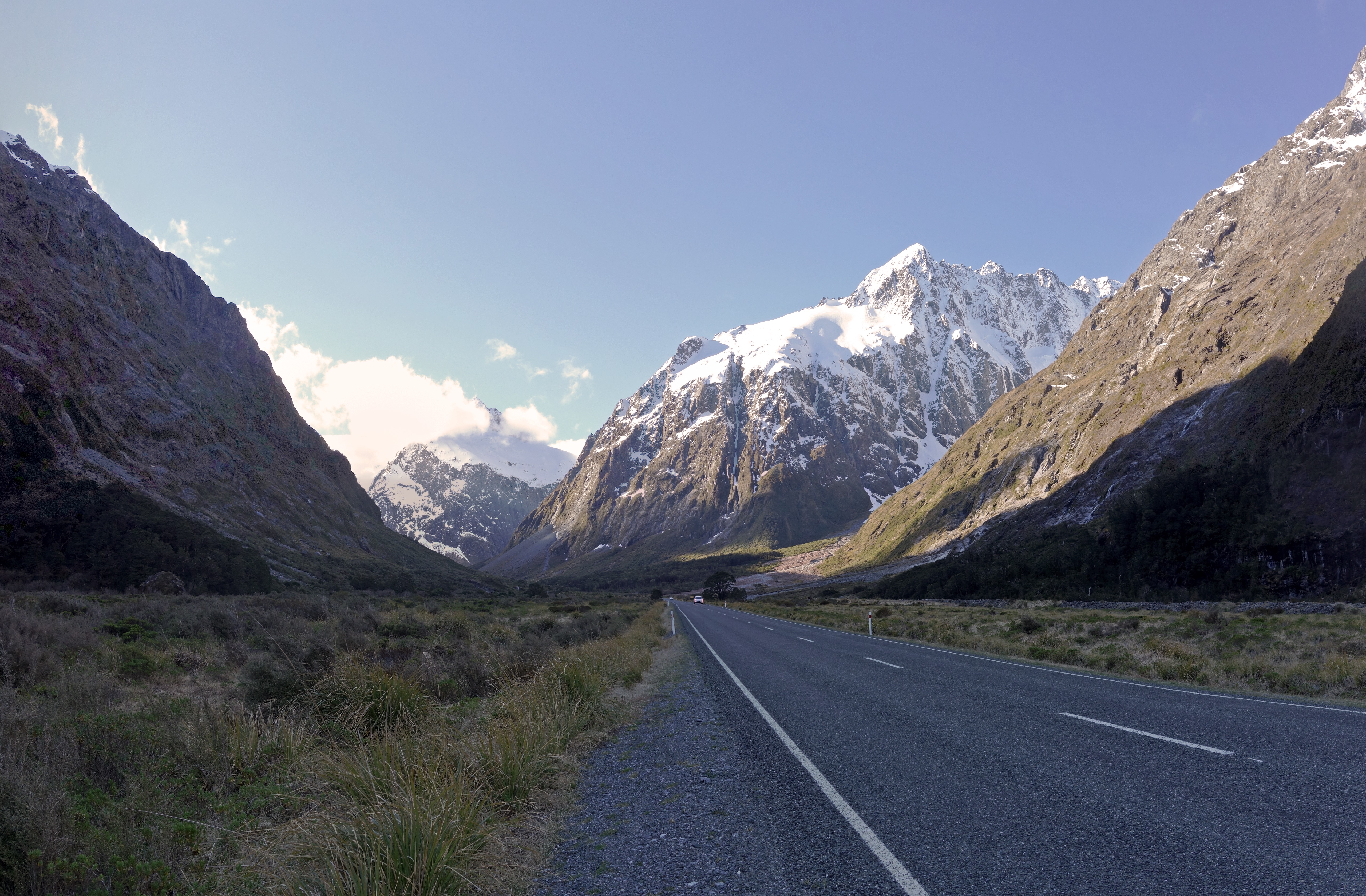
Through the Valley of Giants
Leaving Te Anau, the road skirts the lake's western shore before turning into the Eglinton Valley, a glacially carved corridor flanked by towering beech forest. The valley floor is wide and flat, its riverbed braided with milky water, the mountains rising so steeply on both sides that the sky narrows to a strip of blue. At the Mirror Lakes, the stillness on a calm day produces reflections so perfect that photographs look identical flipped upside down. The 45th parallel crosses the road here, the halfway point between the equator and the South Pole. Further on, Lake Gunn sits quietly in red beech forest, reachable by a forty-five-minute nature walk that feels centuries removed from the highway. The valley's silence is broken only by birdsong and, if you are lucky, the raucous call of a kea tearing the rubber from your windscreen wipers.
The Tunnel That Swallows Light
The Homer Tunnel is not a modern tunnel. It is 1.2 kilometres of rough-hewn rock, unlined and dripping, descending at a gradient steep enough to make your brakes work. A single lane means traffic is controlled by lights, ten minutes in each direction, and during peak season the queue can stretch for twenty minutes on the eastern approach. The tunnel's highest point sits at 940 metres above sea level, making SH94 the fastest-climbing state highway in the country. On the eastern side, avalanche defences line the road, a reminder that the same forces that killed tunnel workers Percy Overton in 1936 and engineers Donald Hulse and Thomas Smith in 1937 remain active every winter. West of the tunnel, the landscape changes abruptly. The road plunges toward the Cleddau River through terrain so steep that waterfalls appear to drop directly onto the roadway.
Where Water Falls into Chasms
The western descent is where the Milford Road earns its reputation. The Chasm, near the road's end, is a series of waterfalls that have bored smooth channels through solid rock, the water moving with such velocity that the stone has been sculpted into organic curves. It is not the size of the falls that astonishes but their force, the way the river seems to attack the rock with intent. Beyond The Chasm, the road follows the Cleddau River valley downward through increasingly lush rainforest, the canopy closing in as rainfall intensifies. Fiordland receives over six metres of rain annually, and the western side of the Homer Tunnel gets the worst of it. The result is vegetation so dense and green it borders on the surreal, every surface furred with moss, every cliff face streaming with ribbons of water. Then the valley opens, and there it is: Milford Sound, the fiord that justified the entire enterprise.
From the Air
Located at 45.20°S, 167.82°E along the length of SH94 in Fiordland National Park. The road is visible from cruising altitude in clear weather as a thin line threading through otherwise trackless mountain terrain. The Homer Tunnel entrance is identifiable on the eastern face of the Darran Mountains. Nearest airports: Milford Sound Airport (NZMF) at the western terminus, Te Anau Airport (Manapouri, NZMO) near the eastern end. Queenstown Airport (NZQN) is the nearest major airport. Weather is highly variable with frequent low cloud and rain, particularly on the western side of the divide. Best viewed in clear conditions from 5,000-8,000 feet.