Milford Track
In May 2022, every available booking for the entire summer season sold out in thirteen minutes. Not thirteen hours. Thirteen minutes. The Milford Track has been called the finest walk in the world since a London newspaper bestowed the title in 1908, and more than a century later, demand still overwhelms supply. Only forty independent walkers may begin each day, carrying their own food and sleeping bags to Department of Conservation huts spaced along the 53.5 km route. The track runs one direction only - from the head of Lake Te Anau to Sandfly Point near Milford Sound - and takes four days. There are no shortcuts, no skipped sections, no camping. You walk the whole thing or you don't walk it at all.
McKinnon's Gamble
Before the track existed, Milford Sound was reachable only by sea. The interior of Fiordland was unmapped and assumed impassable - a knot of mountains, glaciers, and rain so thick the forest floor never fully dried. In 1888, Quintin McKinnon and Ernest Mitchell set out from the Te Anau side to find an overland route. What they discovered was a saddle at 1,069 metres - high enough to cross the divide, low enough to be walkable. The pass that now bears McKinnon's name became the key to unlocking Milford Sound from the land. McKinnon became the track's first guide, leading parties through the route he had pioneered. His story ended strangely: in 1892, his boat was found empty on Lake Te Anau. His body was never recovered. A memorial cross marks the spot where the boat drifted, and walkers on the first day's boat ride to the trailhead pass it in silence.
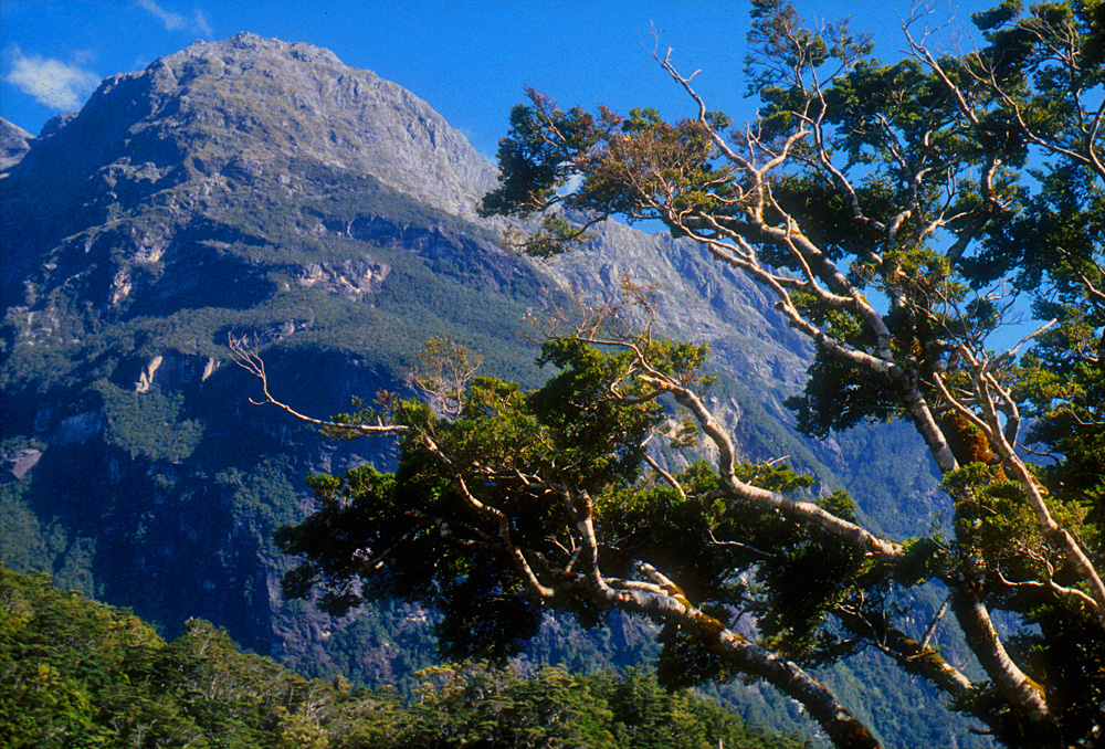
The Valley of Avalanches
Day two follows the Clinton River upstream toward Lake Mintaro, and the character of the walk changes. The gentle riverside amble of the first afternoon gives way to a corridor of avalanche paths - more than fifty of them cross this section. In the off-peak season, this stretch is simply too dangerous for recreational walkers. Even during summer, signs mark sections where stopping is forbidden. The risk isn't theoretical: avalanche damage delayed the 2025 season opening and forced cancellation of October and November bookings. Between the avalanche chutes, the forest is extraordinary - ancient beech draped in moss, ferns taller than a person, and a humidity so complete that everything glistens. Near Mintaro Hut, a short walk leads to Lake Mintaro itself, named for Frederick Mintaro Bailey Muir, the photographer who accompanied McKinnon's party. At night, a colony of glow worms illuminates the track near Clinton Hut, their bioluminescence painting the dark with points of blue-green light.
Crossing the Divide
The third day is the crux. From Mintaro Hut at roughly 500 metres, the track climbs to McKinnon Pass at 1,069 metres, then drops 970 metres to Dumpling Hut on the other side. The ascent takes about two hours and passes the McKinnon Memorial, a stone cairn perched on a cliff so sheer that, as one guide dryly notes, a dropped stone would take nearly twelve seconds to reach the bottom. At the summit, a basic shelter offers a toilet and, in summer, a cooking ring. The views - when cloud permits - stretch across the Arthur Valley toward the Tasman Sea. The descent is harder than the climb. Nearly a thousand metres of elevation loss over eight kilometres of uneven ground hammers knees and tests ankles. Early in the season, avalanche risk sometimes closes the main descent route, forcing walkers onto an even steeper emergency track. By the time you reach Dumpling Hut, your legs know they have done something.
Sandflies and Silence
The track's endpoint is called Sandfly Point, and the name is earned. The tiny biting insects are relentless along the final stretch, a fact so well known that insect repellent appears on every packing list alongside rain gear and sleeping bags. Fiordland's rainfall - among the highest in New Zealand - means walkers must prepare for wet conditions on any day of any season. The huts provide shelter, gas cookers, and mattresses, but no heating in the bunkrooms and no linens. Earplugs are recommended, because forty people in a communal bunkroom produce their own kind of weather. Guided walkers, who pay roughly five times more, stay in private lodges with hot showers, drying rooms, and meals prepared for them. Both groups walk the same trail. Both see the same waterfalls, the same forest, the same improbable pass. The difference is in what you carry - on your back, and in your memory of having carried it.
The Boat Out
The track ends but the journey doesn't. At Sandfly Point, walkers board a small boat for the short ride to Milford Sound, emerging from four days of forest and mountain into the sudden vastness of the fiord. The contrast is deliberate - the track was designed to build toward this reveal, saving the most dramatic landscape for the moment you're most ready to receive it. From Milford Sound, the only road leads back through the Homer Tunnel to Te Anau, a drive of two to three hours through scenery that would be the highlight of most trips but after the Milford Track feels almost ordinary. Fit runners occasionally attempt the entire 53.5 km in a single day, starting with a boat from Milford Sound to Sandfly Point at 7 AM and racing to reach Glade Wharf by the 4 PM cutoff. Missing that window is expensive - late boat fees climb steeply. But most walkers take the intended four days, letting Fiordland unfold at the pace it demands.
From the Air
The Milford Track runs from the head of Lake Te Anau (approximately 44.97S, 167.65E) to Sandfly Point near Milford Sound (44.68S, 167.89E), traversing 53.5 km through Fiordland National Park. The track is not visible as a continuous line from altitude, but key landmarks are identifiable: Lake Te Anau's western shore, the Clinton River valley, McKinnon Pass (1,069 m) cutting through the divide, and the Arthur Valley descending toward Milford Sound. Nearby airports include Milford Sound Airport (NZMF) at the northern terminus, Te Anau Airport (NZTZ) near the southern start, and Queenstown Airport (NZQN) as the main international gateway. The surrounding peaks of the Darran Mountains exceed 2,000 m. Weather is extremely changeable with high rainfall. Helicopter and small fixed-wing flightseeing operators run from Queenstown, Te Anau, and Wanaka, often landing on glaciers en route.