Minneapolis: The City That Turned Flour Into Fortune
Minneapolis exists because of St. Anthony Falls - the only waterfall on the Mississippi River, whose power attracted sawmills in the 1850s and flour mills in the 1870s. The milling companies that clustered at the falls - Pillsbury, General Mills, Washburn-Crosby (which became Gold Medal Flour) - made Minneapolis the flour capital of the world by 1890. The workers who ran the mills were often Scandinavian immigrants, seeking farmland or opportunity in a climate that reminded them of home. The city they built is notoriously progressive, dotted with lakes, connected by skyways that make winter walkable, and prosperous in ways that Midwest cities often aren't. Minneapolis is what happens when waterfalls meet ambition.
The Mills
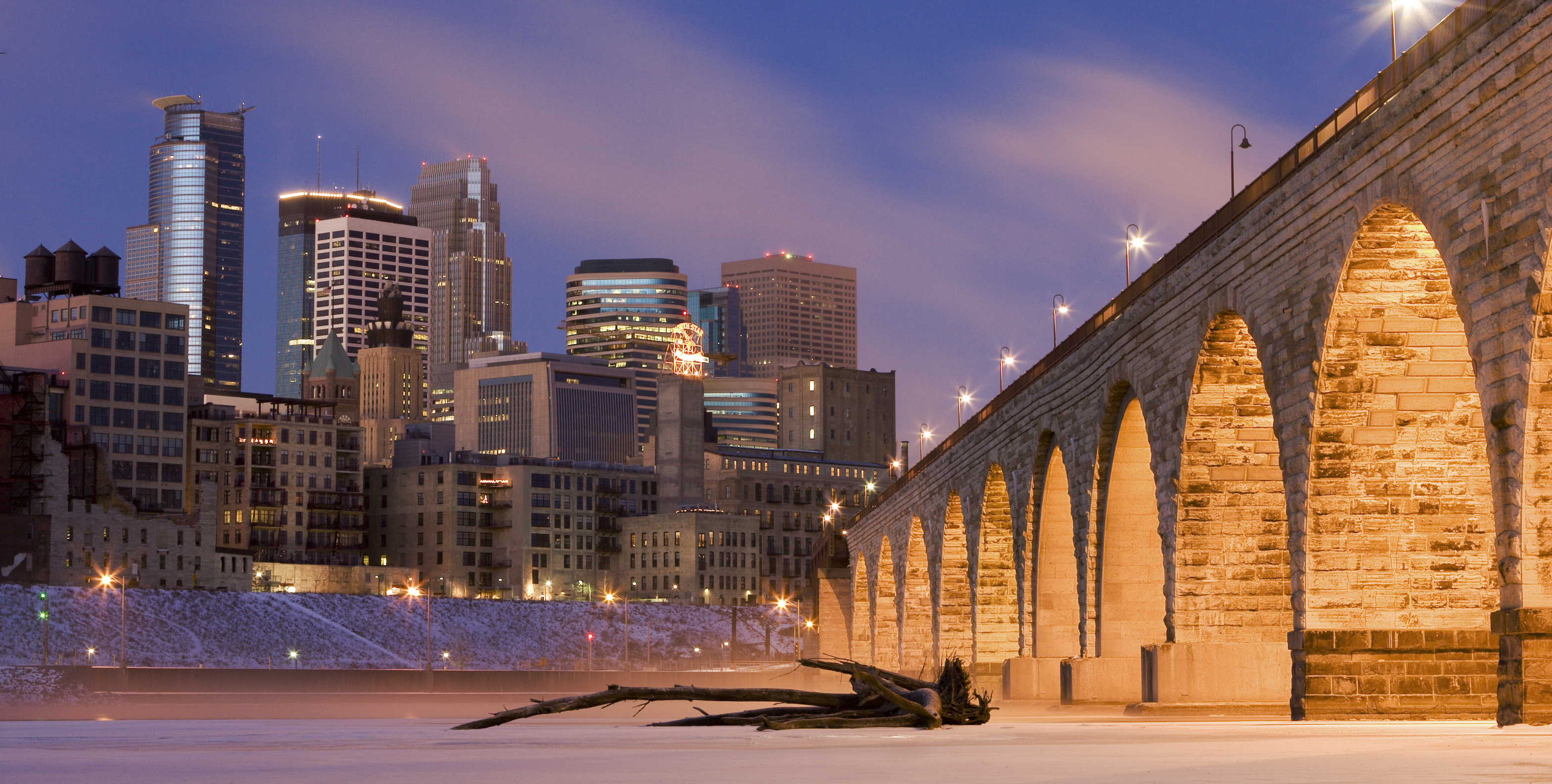
The Washburn A Mill exploded in 1878, killing 18 workers when flour dust ignited - the worst industrial accident in Minnesota history. But the milling continued, the technology improved, and Minneapolis became dominant. The Mills District on the riverfront preserves the industrial heritage: the Mill City Museum occupies the ruins of the Washburn A Mill, its exhibits explaining how wheat became flour became wealth. General Mills and Cargill remain headquartered here, though the milling operations that made them moved elsewhere. The falls still flow, though dammed and controlled; the industry they powered shaped the city even as it disappeared.
The Lakes
Minneapolis contains 22 lakes within city limits - a legacy of glaciers that retreated 10,000 years ago, leaving depressions that filled with water. The Chain of Lakes - Cedar, Harriet, Calhoun (now Bde Maka Ska), and Lake of the Isles - provide parkland, beaches, and recreation within the urban core. The lake names reflect the city's changing relationship with history: Lake Calhoun, named for a slave-owning senator, was officially renamed Bde Maka Ska (its original Dakota name) in 2018. The lakes define Minneapolis identity - residents claim to use them year-round, skating in winter, swimming in summer, regardless of temperatures that would terrify visitors from milder climates.
The Skyways
Minneapolis has the world's largest skyway system - 11 miles of enclosed, climate-controlled walkways connecting 80 blocks of downtown. The system began in 1962, when retailers realized that Minnesota winters kept shoppers home; enclosed bridges between buildings solved the problem. The result is a second-floor city: pedestrians move through downtown without ever going outside, navigating from office to restaurant to shop through heated corridors. The system is criticized for privatizing public space and drawing activity away from street level, but when the wind chill reaches -30°F, the criticism rings hollow. The skyways exist because winter demanded them.
George Floyd
On May 25, 2020, Minneapolis police officer Derek Chauvin knelt on George Floyd's neck for over nine minutes, killing him while bystanders filmed. The video sparked protests worldwide, a reckoning with police violence that resonated far beyond the intersection at 38th and Chicago where Floyd died. Chauvin was convicted of murder in 2021. The intersection became a memorial; the city became a symbol. Minneapolis's progressive self-image collided with evidence of systemic racism; the reckoning continues. The city that considered itself exceptional discovered it wasn't - that the problems America faces exist here too, in parks surrounded by lakes.
Visiting Minneapolis
Minneapolis is served by Minneapolis-St. Paul International Airport, shared with its twin city across the river. The Mill City Museum and Stone Arch Bridge anchor the riverfront. The Walker Art Center and Minneapolis Sculpture Garden offer contemporary art. The lakes are accessible by bike on the Grand Rounds trail system. The Warehouse District provides restaurants and nightlife; Uptown offers eclectic shopping. Prince's Paisley Park is in suburban Chanhassen, open for tours. Winter visitors should bring serious cold-weather gear; summer visitors will find perfect temperatures and long days. The experience rewards exploration - a city more interesting than its flyover reputation suggests.
From the Air
Located at 44.98°N, 93.27°W on the Mississippi River at St. Anthony Falls. From altitude, Minneapolis appears as an urban grid punctuated by lakes - the Chain of Lakes visible in the southwestern quadrant, the Mississippi curving through the center. The skyline rises from downtown; St. Paul is visible to the east, separated by the river. The flour mills that made Minneapolis are mostly gone, but the riverfront preserves their ruins. What appears from altitude as a prosperous Midwest city is built on waterpower and Scandinavian work ethic - where flour fortunes funded institutions, where lakes provide identity, and where progressive politics confront American realities.