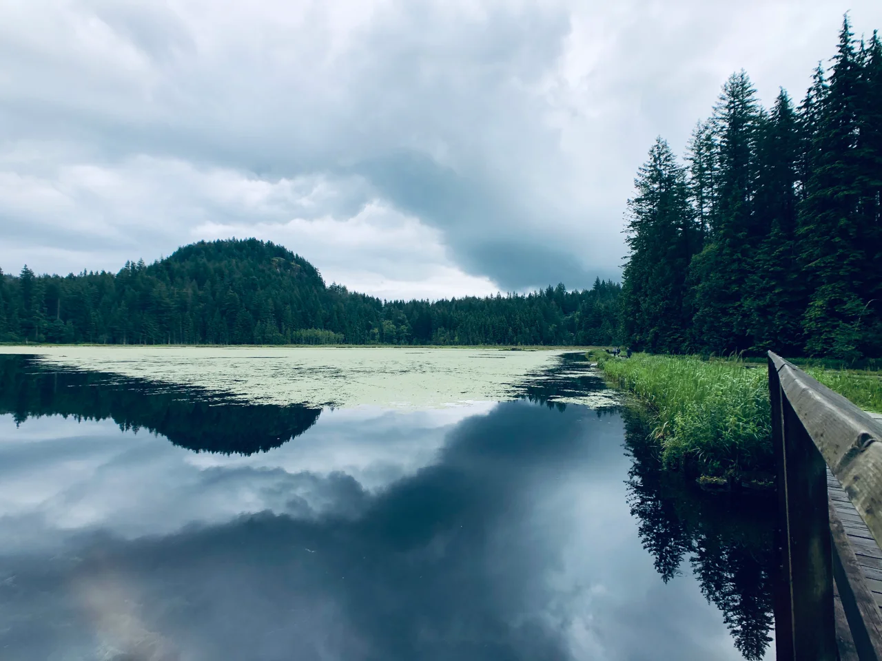

Minnekhada Regional Park
The fire started on High Knoll, and then it fell downhill. Burning branches dropped off the rock onto the forest below and lit the lower slopes, which is how a two-hectare fire inside Minnekhada Regional Park became eleven hectares in a single day and fourteen before crews contained it. That was October 2022 - October, in a coastal rainforest, at the end of a stretch of record heat and drought. Smoke hung over the Tri-Cities for days, and the same steep ground that makes the park beautiful made it dangerous to fight on. For two hundred hectares of Coquitlam marsh better known for herons and quiet trails, it was a blunt introduction to a changing climate.
Upper Marsh, Lower Marsh
The park sits in the far northeast corner of Coquitlam, up against Pitt-Addington Marsh and the Pitt River, and its heart is water. A single marsh is split into an upper and a lower half by a dike, with a small footbridge across it. Around the wetland, forested rock knolls push up out of the flat, giving the park five lookout points. Low Knoll takes in the whole lower marsh at close range. High Knoll, at about 600 feet, is the one people climb for: from the top the Pitt River spreads out below with the farmland of Pitt Meadows beyond it, and on a clear day the mountains stack up to the north. Three main trails - Quarry, Mid-Marsh, and the Lodge and Fern pair - run east toward the marsh boundary, and stitched together as a full perimeter loop they make 5.2 kilometres. Parking is at the Quarry Road and Oliver Road entrances.
One Hundred Fifty-One Birds
Minnekhada is a designated Wildlife Watch site, and the numbers behind that designation are worth stating. In 1993 the Burke Mountain Naturalists compiled a list of 151 bird species observed in the park - hawks, owls, grouse, waterfowl, herons, woodpeckers, songbirds - including sixteen kinds of waterfowl, among them swans and ring-necked ducks. Down at ground level the cast is less obvious and no less interesting. Western toads breed here; the species is listed as threatened in British Columbia, its habitat steadily shrinking, and the two things most likely to hurt the population in this particular park are people and off-leash dogs. Volunteers have monitored adult toads and toadlets since at least 2010, and small bridges were built over the creek to keep boots and paws off the migration route. Western painted turtles get similar attention, as do the park's bats. In the wet months the forest floor turns into a moss and lichen exhibition - stairstep moss, lanky moss, Oregon beaked moss, reindeer lichen - and mushrooms come up everywhere.
The Hunting Lodge on Oliver Road
None of this was public land for most of its history. The valley was private property into the late 1970s, worked and built on by a series of owners who left farmhouses, stables, fenced fields and cabins scattered across it. Two of the earliest buildings are still standing: the farm, and the lodge. Minnekhada Lodge went up in 1934 as a country retreat for hunting, built by Eric Hamber, the Vancouver businessman who would be appointed the province's lieutenant governor two years later and serve until 1941. The province handed it to the Greater Vancouver Regional District in 1984, and it has been in public hands since, opened up for visitors on the first Sunday of most months.
Whose Land, and Who Decides
The Kwikwetlem and the Katzie occupied the Coquitlam Lake and Pitt River watersheds for thousands of years before any of the farmhouses went up, and the honest thing to record is that neither nation was involved when the property became a regional park, nor has had much formal role in running it since. That gap is starting to be named rather than ignored. In July 2023 the regional district signed a funding agreement with the Minnekhada Park Association worth $45,000 over three years, and among the association's stated priorities are improving public understanding of the cultural history of this ground and creating ways for people to contribute ideas about the park's future. It is a small sum for a large question. Visitors should note that access is disrupted at present: Cedar Drive is closed from May 2026 into the autumn of 2027, and construction traffic is heavy on Oliver Road near the lodge entrance, so check the route before driving out.
From the Air
Minnekhada Regional Park lies at 49.3015 N, 122.695 W on the west bank of the Pitt River in northeast Coquitlam, British Columbia. From the air the park is easy to identify: an irregular patch of dark forest and open marsh set between the hard geometry of the diked Pitt River farmland to the east and the rising slopes of Burke Mountain to the west, with the bright split marsh and its dividing dike at the centre. High Knoll is the bare rock high point on the northern side; a burn scar from the October 2022 fire may still be visible on that flank. Fly it at 1,500 to 3,000 feet. Pitt Lake opens to the north, the Pitt River joins the Fraser about 6 nm south, and the Golden Ears peaks stand on the northeast horizon. Pitt Meadows Airport (CYPK) is only about 4 nm south-southwest and is one of Canada's busiest general aviation fields, with dense circuit and helicopter traffic, so monitor its frequency and stay clear of the pattern. Vancouver International (CYVR) is about 20 nm southwest, Abbotsford (CYXX) 22 nm southeast and Boundary Bay (CZBB) 22 nm southwest. This is a wildlife area with heavy waterfowl movement - be alert for birds at low level, especially at dawn and dusk during migration. Valley fog is common on autumn and winter mornings.
Nearby Stories
- Burrard Dry Dock 2.3 km away
- Tsawwassen 4 km away
- Britannia Mine and the Mountain That Bleeds 12 km away
- Matsqui Institution 16 km away
- Lower Mainland 30 km away
- Mount Baker 32 km away
- Manning Provincial Park 92 km away
- Okanagan 165 km away