Mishmi Hills
Somewhere in the Mishmi Hills, a flying squirrel the size of a house cat launches itself between trees that no botanist has yet catalogued, in a mountain range that cartographers have never properly mapped. This is not the nineteenth century. The Mishmi Hills giant flying squirrel was described by science only in 2009, one of several species discovered in a place where 90 percent humidity, near-vertical terrain, and the densest rainfall in the Himalayas conspire to keep secrets.
The Hinge of the Himalayas
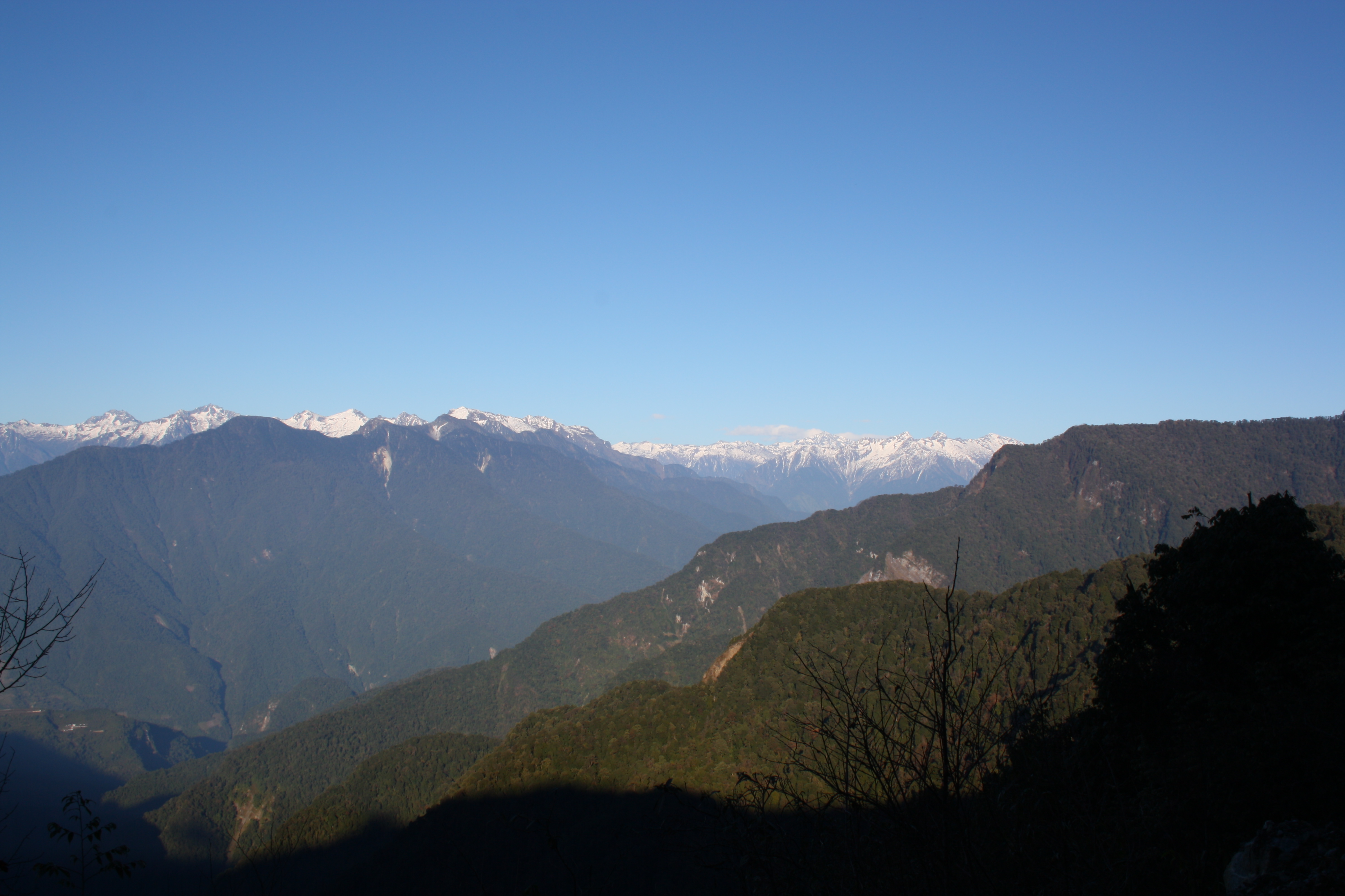
The Mishmi Hills occupy the spot where the Himalayan arc takes a sharp turn and collides with the Indo-Burma ranges, a geological hinge between two of Earth's great mountain systems. Located at the northeastern tip of India in Arunachal Pradesh, with their Chinese flank administered as part of Nyingchi Prefecture in Tibet, the hills are geologically part of the Shan-Malaysia tectonic plate. Lohitang Peak, the highest point at 5,256 meters, is the last great summit of eastern India. The central hills wrap around both sides of the Dibang Valley, where the Brahmaputra's tributaries drain slopes so steep that the terrain resists mapping even with modern technology. In 1950, these hills were the epicenter of the most powerful onshore earthquake ever recorded.
Seven Cats and a Takin
The species list reads like a fever dream of evolutionary experimentation. Eight species of wild cat prowl the Mishmi Hills: tiger, common leopard, clouded leopard, snow leopard, golden cat, jungle cat, marbled cat, and leopard cat. The endangered red panda inhabits the northern reaches while the hoolock gibbon swings through the lower canopy, including a subspecies, Hoolock hoolock mishmiensis, found nowhere else. Then there is the Mishmi takin, a muscular ungulate that looks like it was designed by committee, alongside Himalayan serow, musk deer, and Himalayan black bear. Roughly 6,000 plant species, 100 mammal species, and 700 bird species share these slopes, numbers that would be remarkable for a region ten times the size.
Rain Without Mercy
Pre-monsoon showers begin in March and hardly let up. Humidity hovers near 90 percent, and the rainfall is among the heaviest anywhere in the Himalayan system. This deluge feeds sub-tropical evergreen forests at lower elevations, which give way to temperate conifers, sub-alpine shrubs, alpine meadows, and finally bamboo and grasslands higher up. The vertical climate gradient is extreme, with temperatures dropping below 5 degrees Celsius in winter at elevation and climbing to 38 degrees in summer in the valleys. The Dihang-Dibang Biosphere Reserve encompasses the major part of the hills, while the Dibang Wildlife Sanctuary protects the interior. Together they shelter one of the last stretches of the eastern Himalayas where human footprint remains light enough for new species to emerge from the fog.
Frontier Lines and Shifting Borders
Administratively, the Mishmi Hills have been carved and recarved by changing political realities. On the Indian side, they were declared a district in 1948 after splitting from the Sadiya Frontier Tract. By 1954, when the North-East Frontier Agency was formed, the area became Lohit Frontier Division, with headquarters shifted from Sadiya to Tezu. On the Chinese side, the western hills fall under Medog County and the eastern slopes under Zayu County, both in Nyingchi Prefecture. The McMahon Line, drawn in 1914 and never recognized by China, cuts through this landscape, making the Mishmi Hills not just an ecological frontier but a geopolitical one. The same remoteness that protects its wildlife has made it a contested margin between the two most populous nations on Earth.
From the Air
Located at 28.37N, 95.80E at the northeastern tip of India in Arunachal Pradesh. Lohitang Peak (5,256m) is the highest point, visible from cruising altitude as a snow-capped summit at the eastern terminus of the Himalayas. The hills wrap around the Dibang Valley, which serves as a visual reference. Nearest airports include Tezu Airport (VETX) to the south and Dibrugarh Airport (VEMN) in Assam. Expect persistent cloud cover and heavy precipitation, especially from March through October. The dramatic bend where the Himalayas meet the Indo-Burma ranges is visible from high altitude.