Moeraki Boulders
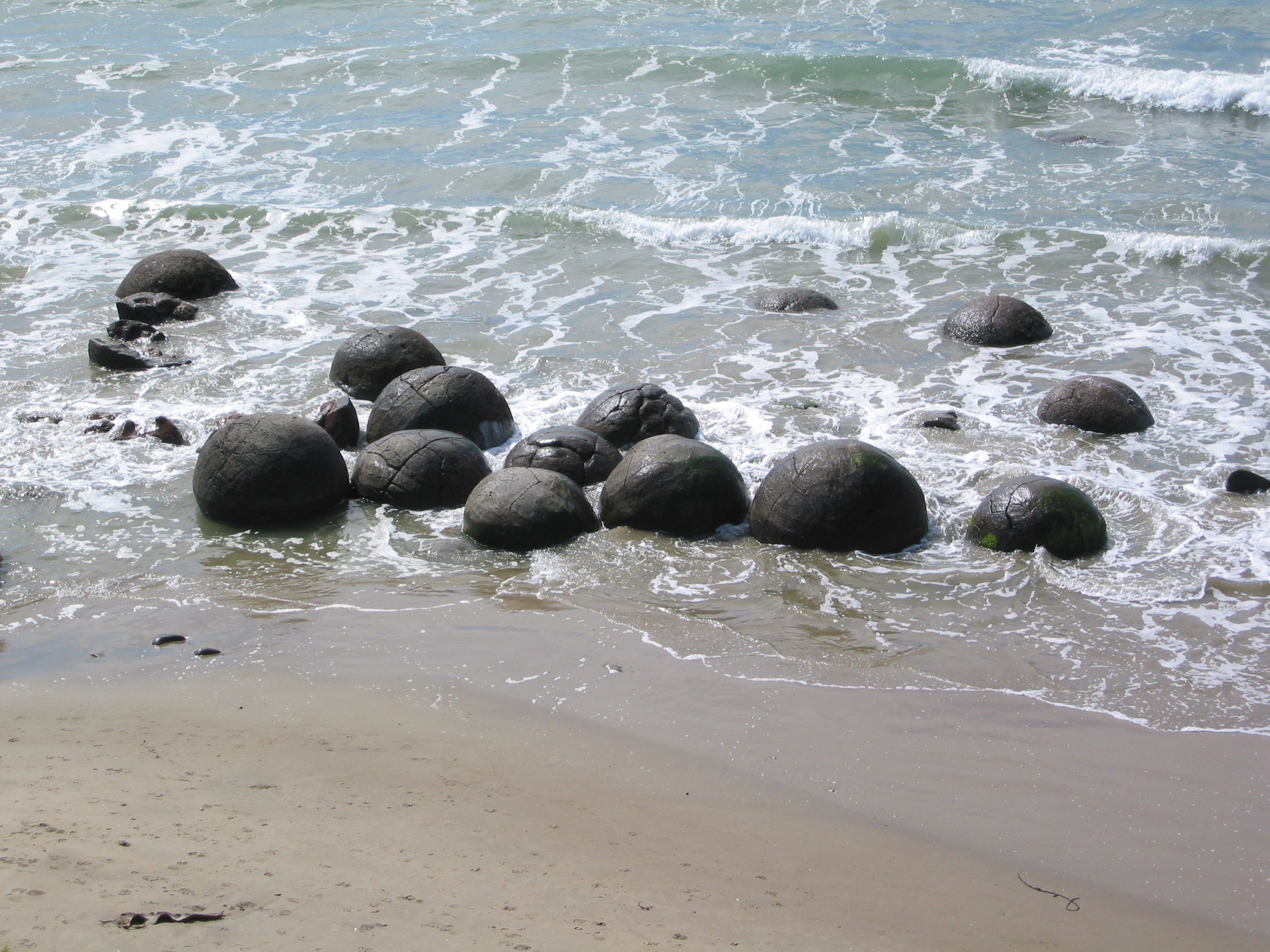
They look like they were placed here. Dozens of grey spheres, some taller than a person, sit on the wet sand of Koekohe Beach as if a giant had abandoned a game of marbles at low tide. The Moeraki Boulders invite explanation, and every culture that has encountered them has offered one. Kai Tahu tradition says they are the cargo of a wrecked voyaging canoe. Geologists say they grew, grain by grain, on a seafloor that no longer exists. Both stories are true in their own way, and both require millions of years or a single catastrophic night to be properly told.
The Wreck of the Araiteuru
For Kai Tahu, the boulders are not geological curiosities but evidence of a specific event. The Araiteuru, a great ocean-going waka, was sailing south along the coast in search of precious greenstone when it foundered near what is now Shag Point, known in Maori as Matakaea. The cargo washed ashore: eel baskets, calabashes, and kumara scattered along the beach. The rocky shoals extending seaward from Shag Point are understood to be the petrified hull of the canoe, and a nearby rocky promontory represents the body of the captain. The cracked, web-like patterns visible on many of the boulders are the remains of the canoe's fishing nets. This stretch of the Otago coastline carries the name Te Tai-o-Araiteuru, the Araiteuru coast, and each boulder on the beach represents a specific item lost in the wreck. The boulders are called Te Kaihinaki in Kai Tahu tradition, a name that connects them to the round food baskets and gourds that were the canoe's provisions.
Sixty Million Years in the Making
The geological explanation requires a different kind of patience. During the Paleocene epoch, roughly sixty million years ago, the seafloor where these boulders now sit was covered in marine mud. Calcium carbonate began to crystallize around nuclei in the sediment, growing outward by mass diffusion rather than fluid flow, which is why the boulders are so remarkably spherical. The process was extraordinarily slow. The largest boulders, measuring up to two metres in diameter, are estimated to have taken four to five and a half million years to reach their full size, accumulating layer upon layer of calcite while ten to fifty metres of additional mud settled on the seafloor above them. After the concretions had fully formed, large internal cracks called septaria developed, radiating outward from hollow cores. When a drop in sea level allowed fresh groundwater to penetrate the surrounding mudstone, these cracks filled with brown calcite, yellow calcite, and traces of dolomite and quartz, creating the honeycomb patterns visible in eroded boulders today.
Emerging from the Cliff
The boulders did not arrive on the beach. The beach came to them. Coastal erosion has been slowly eating into the mudstone bluffs behind Koekohe Beach, freeing the concretions from the sedimentary rock that enclosed them for tens of millions of years. As the softer mudstone weathers away, the harder boulders emerge and eventually tumble to the shore, where waves roll and polish them. The process is ongoing; new boulders continue to appear from the eroding cliff face. About one-third of the boulders on the beach range from half a metre to a metre in diameter, while the remaining two-thirds measure between 1.5 and 2.2 metres across. A few are slightly elongated, stretched parallel to the bedding plane of their former mudstone prison. Similar septarian concretions exist elsewhere in the world, in the Kimmeridge Clay and Oxford Clay formations of England, and at scattered sites across several continents, but few match the size, concentration, and dramatic coastal setting of the Moeraki Boulders.
A Sketch and a Shrinking Collection
In 1848, geologist and politician Walter Mantell sketched Koekohe Beach and its boulders. His drawing, now held in the Alexander Turnbull Library in Wellington, shows considerably more boulders than visitors find today. Some have been broken apart by the sea. Others have been carried off by souvenir hunters or damaged by visitors over the decades. The boulders that remain are now protected within a scientific reserve, and the site has become one of the most visited natural attractions on the South Island. Tourists arrive at all hours, though sunrise draws the largest crowds, when the low-angle light turns the grey spheres golden against the dark sand and the Pacific stretches flat to the horizon. The cracked-open boulders are the most photographed, their septarian interiors exposed like the cross-section of some alien fruit. Stand among them at dawn, with the tide pulling back, and the Araiteuru story feels less like legend than memory.
From the Air
The Moeraki Boulders sit on Koekohe Beach at 45.35S, 170.83E, on the Otago coast between the small settlements of Moeraki and Hampden. From the air, the beach is a narrow strip at the base of eroding mudstone bluffs, and the boulders are visible as dark dots on the sand at low tide from altitudes below 3,000 feet AGL. The nearest airport is Oamaru (NZOU), approximately 35 km to the north. Dunedin Airport (NZDN) is about 75 km to the south. Shag Point, the rocky headland associated with the Araiteuru legend, is visible a few kilometres to the south. Morning flights along the coast offer the best light for spotting the boulders against the wet sand.