Mokuʻula
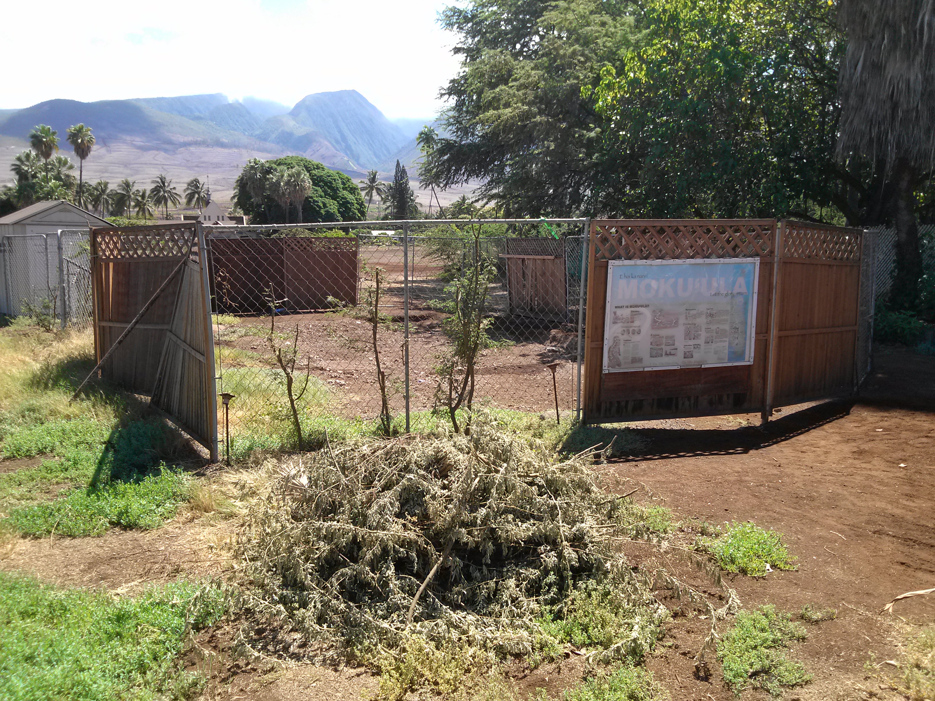
Somewhere beneath the infield dirt of a municipal baseball diamond in Lahaina lies a sacred island. Mokuʻula -- a one-acre island once surrounded by the 17-acre spring-fed pond of Mokuhinia -- was the private residence of King Kamehameha III from 1837 to 1845, the burial site of Hawaiian royals, and a place Hawaiians consider a piko: a symbolic center of energy and power. In 1919, the county buried it under a park. For over a century, one of the most significant sites in Hawaiian history has been invisible.
The Home of Kihawahine
Before it was a royal residence, Mokuhinia pond was sacred for other reasons. According to Hawaiian tradition, the pond was the home of Kihawahine, a powerful moʻo -- a lizard goddess. The moʻo was said to be a reincarnation of Kalaʻaiheana, the daughter of the great Maui chief Piʻilani. Hawaiians cultivated loʻi (taro patches) and fishponds within Mokuhinia, and Lahaina was once known as the Venice of the Pacific for its network of ponds and waterways. The sacred status of the water and the island within it made Mokuʻula a natural seat of chiefly power -- a place where spiritual authority and political authority were inseparable, anchored in the landscape itself.
A Moated Palace in the Whaling Era
Author P. Christiaan Klieger described Mokuʻula as "a place of the Sacred Red Mists, an oasis of rest and calm during the raucous, rollicking days of Pacific whaling." While Lahaina's waterfront seethed with sailors drinking grog and clashing with missionaries, Kamehameha III governed from his compound on the island, separated from the chaos by a moat of spring water. He lived here from 1837 until 1845, during the years when Lahaina served as the capital of the Hawaiian Kingdom. The island was added to the Hawaii State Register of Historic Places on August 29, 1994, and to the National Register of Historic Places on May 9, 1997, officially recognized as King Kamehameha III's Royal Residential Complex. But by the time those designations arrived, the island had been underground for decades.
Draining the Sacred
The decline began when the capital moved to Honolulu in 1845. Without the royal court, Mokuʻula lost its political purpose. Then the sugar cane industry arrived and diverted water from the mountain streams that fed Mokuhinia, drying up the pond. The wetlands that had sustained taro cultivation and fishponds for generations were engineered away in the service of plantation agriculture. By the early twentieth century, the once-sacred site was dry ground. In 1919, the county of Maui completed the transformation: they filled in what remained and built a park with a baseball field on top. Mokuʻula, the island where a king had governed and royals had been buried, vanished beneath the base paths.
Unearthing What Was Hidden
The nonprofit Friends of Mokuʻula worked from 1990 to 2011 to promote restoration of the site. Between 1992 and 1999, archaeologists from the Bishop Museum and Heritage Surveys documented the buried features and boundaries. They confirmed what oral tradition and historical records had preserved: the island was there, beneath the fill. The 2023 Lahaina wildfires, which devastated the town, brought unexpected momentum to the restoration effort. Governor Josh Green and Maui mayor Richard Bissen committed to bringing water back to the site and restoring both Mokuʻula and Mokuhinia. For many Native Hawaiians, the fire -- which stripped away the modern town that had been built over the old one -- created a rare opportunity: a chance to uncover what had been deliberately hidden, to restore the wetlands the sugar industry drained, and to return a sacred landscape to something closer to its original purpose. The piko of Lahaina, buried for a century, may yet resurface.
From the Air
Mokuʻula is at 20.873N, 156.678W in central Lahaina, at the site of Maluʻulu o Lele Park. From the air, the site appears as a flat recreational field south of Front Street. There are no visible above-ground features of the buried island. The adjacent Waiola Church cemetery and King Kamehameha III Elementary School site provide orientation. Kapalua Airport (PHJH) is 7 nm northwest; Kahului Airport (PHOG) is 23 nm east. Best viewed at 1,000-2,000 feet.