Moneron Island
The Ainu called it Todomoshiri, the island of sea lions. They had good reason. Moneron Island, a volcanic speck roughly seven kilometers long and five wide, rises from the northeastern end of the Sea of Japan surrounded by steep cliffs where Steller sea lions haul out by the hundreds. It sits 30 nautical miles southwest of Sakhalin, the only landmass in the entire Tatar Strait, with no permanent population and no regular ferry service. On a clear day, Japan's Rishiri Island is visible to the south. Most of the world knows Moneron, if at all, for what fell from the sky here on September 1, 1983.
Three Names, Three Masters
Moneron has been renamed with each change of sovereignty. The Ainu, its earliest known inhabitants, called it Todomoshiri. Under the Matsumae clan in the eighteenth century, it became Ishiyokotan. The French navigator Jean-Francois de Galaup, comte de Laperouse, gave it the European name it carries today when he explored these waters in 1787. By 1907, Japan had claimed the island as part of the Karafuto Agency, calling it Kaibato, a Sino-Japanese transliteration of the Ainu word for sea lion. Active Japanese settlement began in the 1910s. A meteorological station was built that still operates today. In 1914, a lighthouse was erected on the cliffs; it too still functions, more than a century later, guiding ships through waters where almost no one lives.
The Rise and Exhaustion of Kaibato
Japanese colonization of Moneron was ambitious and ultimately self-defeating. By the early 1920s, up to 2,000 people lived on the island during peak season, harvesting Pacific herring and logging the lush forests. Infrastructure followed: an underwater telephone cable stretching over 50 kilometers to Sakhalin, a concrete harbor shelter in Chuprov Bay, rice paddies on the northern cape irrigated by a system whose ruins are still visible, and a small Shinto shrine nestled among old fir trees. But the exploitation was predatory. Fish catches plummeted by the mid-1920s, and most colonists abandoned the island. By 1945, fewer than 200 inhabitants remained. The herring that had drawn them were nearly gone, the forests thinned, and the brief Japanese chapter on Moneron was closing even before the Soviet army arrived.
Soviet Ghosts
After World War II, Moneron became part of the Sakhalin Oblast of the USSR. A fish factory in Chuprov Bay anchored the economy of three small settlements: Moneron, Krasny, and Bodry. According to the 1959 census, just over 500 people lived permanently on the island, with seasonal workers swelling the population to 2,000 during spring and summer. But by the late 1950s, the Sakhalin fishing industry was pivoting toward more profitable deep-ocean expeditions, and the fish factory was liquidated. Mobile mowing brigades from nearby Nevelsk continued harvesting fodder from the island's rich grasslands through the mid-1960s. Oil exploration in the early 1970s scarred the landscape further. By the end of that decade, Moneron had lost its last permanent residents and was reclassified as a closed border zone with only occasional military presence. Unmarked graves of Soviet soldiers on the island hint at wartime operations that Soviet archives never acknowledged.
The Night Flight 007 Fell
On September 1, 1983, Korean Air Flight 007, carrying 269 passengers and crew from New York to Seoul, strayed into restricted Soviet airspace. A Sukhoi Su-15 interceptor launched a single air-to-air missile that struck the Boeing 747. During a controlled twelve-minute descent, the crippled aircraft spiraled twice around Moneron Island before crashing into the Sea of Japan off the island's western coast. All 269 people on board died. The precise location of the final impact and its distance from the island remain disputed. The shoot-down became one of the defining Cold War incidents, escalating tensions between the United States and the Soviet Union. At Cape Soya in nearby Wakkanai, Japan, a Tower of Prayer now memorializes the victims, facing across the water toward the island where they perished.
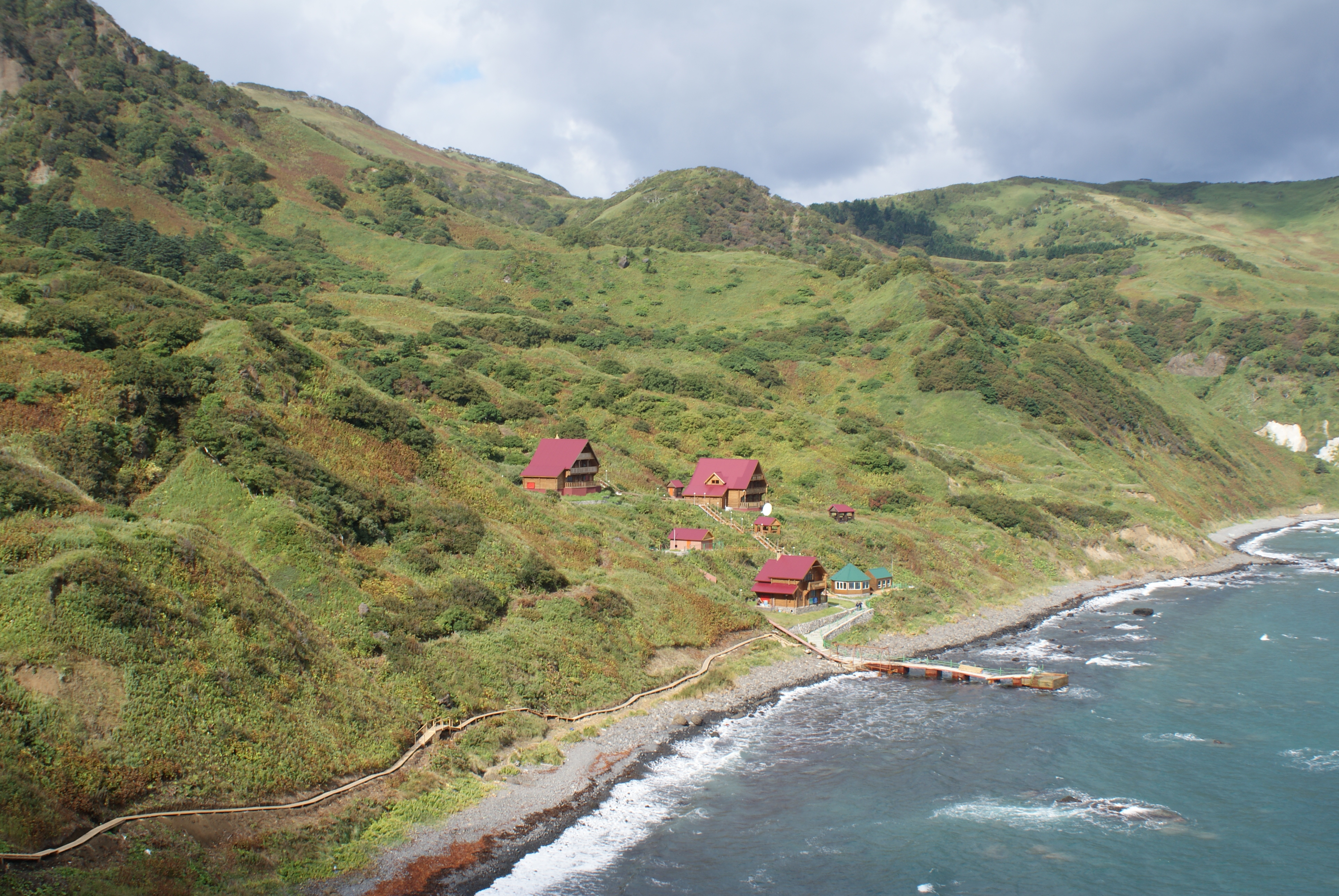
Russia's First Marine Park
Nature has reclaimed what people abandoned. The departure of Moneron's human population proved a gift to its wildlife. Sea lions again dominate the rocky shorelines. The warm Tsushima Current flowing past the island brings marine species normally found far to the south, making the surrounding waters unusually rich for this latitude. Steep cliffs and rocky islets provide nesting habitat for vast colonies of seabirds. In 2006, Russia established the Moneron National Park, the country's first marine national park, and built infrastructure to allow carefully managed tourism. Divers now come to explore underwater landscapes that decades of depopulation have allowed to recover. The island that was logged, fished, drilled, and fought over has found a second life as a sanctuary, its human history written in the ruins of harbors and shrines slowly being absorbed by the forest and the sea.
From the Air
Located at 46.25°N, 141.23°E in the Tatar Strait, approximately 30 nautical miles southwest of Sakhalin Island. The island is clearly visible from the air as the only landmass in the strait. Nearest airports: Yuzhno-Sakhalinsk (UHSS) to the northeast, Wakkanai (RJCW) to the south across La Perouse Strait. The island rises to 429 m at its highest point. Korean Air Flight 007 crashed in waters off the western coast. Recommended viewing altitude: 10,000-15,000 ft for island detail.