Montara State Beach
The lighthouse at Point Montara is a hostel now. Travelers sleep where keepers once tended the light, waking to the same view of surf and headland that guided ships along this coast for generations. Montara State Beach stretches below, eight miles north of Half Moon Bay on Highway 1, consistently rated among the cleanest beaches in California. The high bluffs and sandy shores west of the highway have drawn people to this coast since long before the lighthouse was built, long before Juan Rodriguez Cabrillo first sailed past in 1542, long before anyone thought to rate beaches for water quality.
The Chiguan Coast
Before European contact, the Chiguan tribe held this stretch of the San Mateo coast. They were part of the broader group now known as the Ohlone people, and accounts suggest they offered food to the first Europeans who arrived in their territory. Their influence on the local vegetation and wildlife was significant -- indigenous land management practices shaped the coastal prairie and scrub that still characterize the landscape. Juan Rodriguez Cabrillo sailed along this coast in 1542, and the names he and later explorers created for these headlands and creeks persist to this day. Franciscan missionary Juan Crespi recorded his observations of the area in his diary during the Portola expedition of 1769, adding another layer of documentation to a place that had been inhabited for thousands of years.
Where Mountain Meets Shore
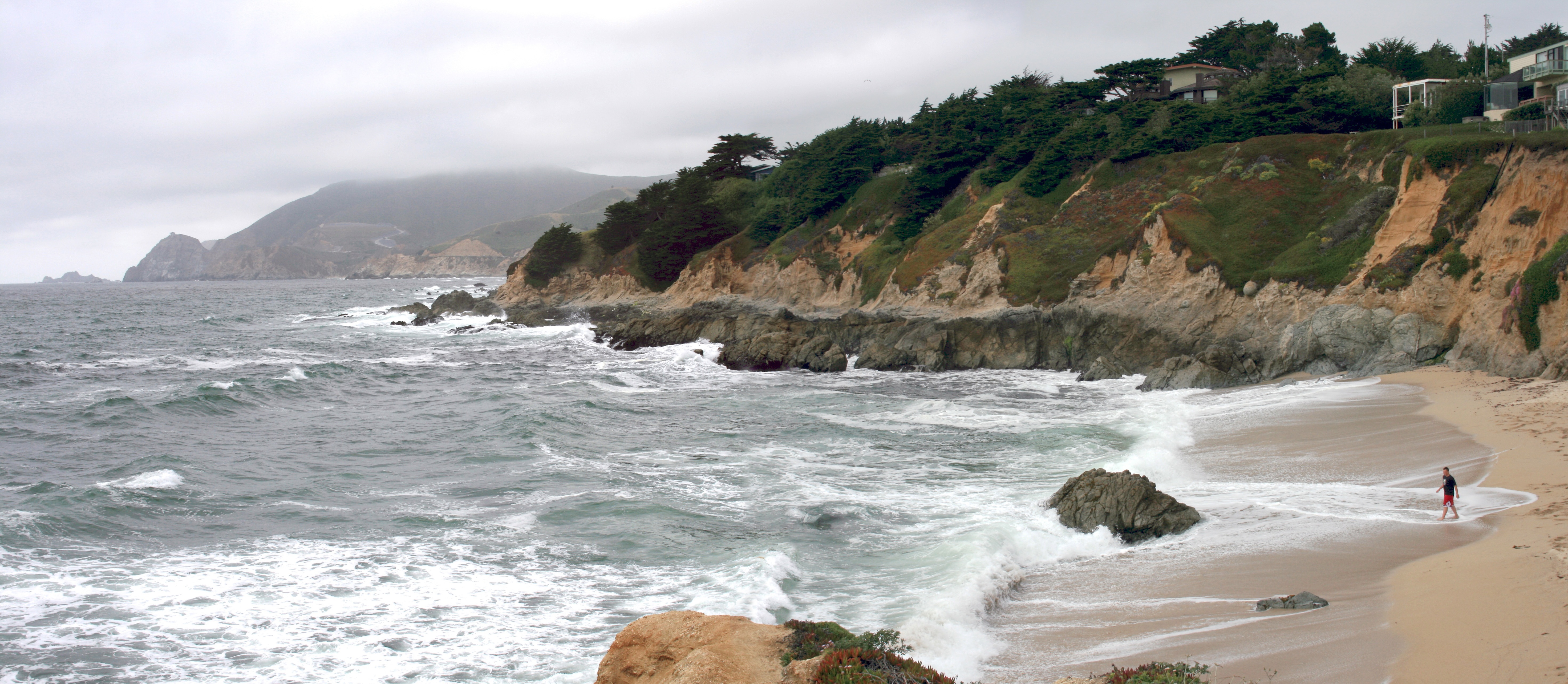
Montara State Beach is more than a beach. McNee Ranch, rising up the flanks of Montara Mountain directly behind the shore, encompasses coastal mountain habitat with sweeping views from Mount Tamalpais to Mount Diablo. Three trails begin at the Martini Creek trailhead, and the two-mile Pedro Mountain Trail connects to paths leading to both Montara Beach and Gray Whale Cove to the north. San Pedro Mountain Road takes visitors to viewpoints spanning the breadth of the Bay Area. The vertical range is dramatic: within a few miles, you can go from wave-washed sand to summit grassland nearly 1,900 feet above sea level. Devil's Slide, the notoriously unstable coastal cliff, anchors the beach's northern end, and the Devil's Slide Trail begins from the beach parking lot.
Native and Newcomer in the Dunes
The beach hosts both native and non-native plant communities in an ecological mosaic that reflects centuries of change. Coastal prairie, riparian corridors, and freshwater and saltwater marsh represent the indigenous vegetation, while grassland, eucalyptus groves, and alder stands arrived with European settlement. Along the low dunes, beach burr and prostrate coyote brush share space with non-native iceplant. The marine life offshore draws visitors year-round to explore the reefs and tide pools, and the lighthouse at Point Montara -- operated as a hostel since 1980 -- gives the beach an anchor point that is both functional and romantic. Sleeping in a lighthouse on this coast, with surf audible through the walls, is one of those California experiences that sounds too good to be real but turns out to be exactly as advertised.
From the Air
Located at 37.55°N, 122.51°W along Highway 1 between Pacifica and Half Moon Bay. The beach is visible as a sandy stretch west of the highway, backed by the steep rise of Montara Mountain. Point Montara Lighthouse is visible on the headland. Half Moon Bay Airport (KHAF) is approximately 5 nm south. San Francisco International (KSFO) is 11 nm north-northeast. The Devil's Slide area is visible to the north along the cliffs.