Montserrat
Montserrat's passport stamp is a shamrock. Its national dish is goat water stew. Its residents carry surnames like Sweeney and Riley, speak English with a lilt that visitors sometimes mistake for Irish, and celebrate St. Patrick's Day as a national holiday -- though not for the reasons you might expect. This 39-square-mile speck in the Leeward Islands once marketed itself as "the way the Caribbean used to be," and for decades, it delivered on that promise: quiet beaches, lush volcanic hillsides, a recording studio where the Rolling Stones and Elton John laid down tracks, and a pace of life that resisted modernization. Then Hurricane Hugo smashed 90 percent of the island's structures in 1989. Six years later, the Soufrière Hills volcano woke up and buried the capital.
Two Islands in One
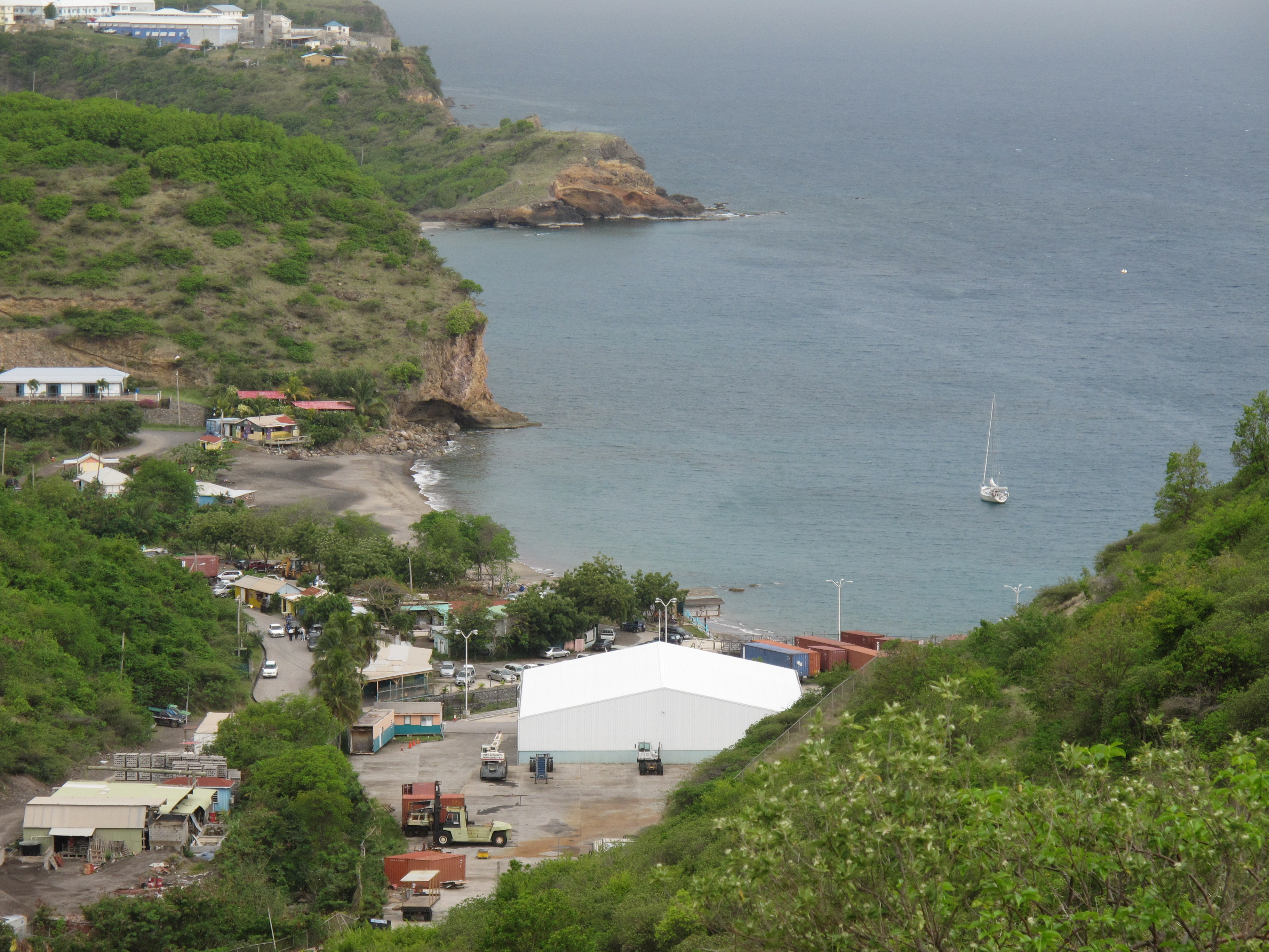
From the air, Montserrat looks like a before-and-after photograph split down the middle. The northern third is everything a Caribbean island should be -- green hillsides, tropical forest, villages with tin roofs glinting in the sun. The southern two-thirds is a grey wasteland. Plymouth, once the capital, sits under 40 feet of volcanic ash, earning comparisons to Pompeii that are not exaggerated. Pyroclastic flows carved channels down the mountainside to the coast. The old W. H. Bramble Airport, which once connected Montserrat to the world, was directly in the path of the main flow and was obliterated. Government offices relocated to Brades in the northwest. A new town is slowly rising at Little Bay, where the island's only functioning port handles the ferry from Antigua. The population, which peaked above 12,000 before Hurricane Hugo and the eruption, has partially recovered to around 4,500.
An Irish-African Inheritance
Anglo-Irish Catholics arrived in the 1630s, pushed out of nearby St. Kitts by tensions with English Protestants. They brought their culture, their calendar, and their plantation ambitions. Beginning in 1650, they imported enslaved Africans to work the sugarcane, cotton, and tobacco fields that made the island profitable. The collision of these two cultures -- one displaced, the other enslaved -- produced something unique. Montserrat's St. Patrick's Day celebrations honor both the Irish heritage and the 1768 rebellion in which enslaved people chose that holiday to rise against their captors. The Irish influence persists in place names (Cork Hill, Kinsale, Galway's Estate), in the cross on the island's flag, and in an accent that linguists have studied for its unusual blend of Irish English and West African speech patterns. It is a complicated inheritance, shaped by colonization and bondage alike.
The Studio in the Jungle
In 1979, Beatles producer George Martin opened AIR Studios Montserrat in the hills above Salem. The idea was irresistible: a world-class recording facility on a tiny Caribbean island where musicians could work without the distractions of London or New York. For a decade, it worked spectacularly. The Police recorded "Ghost in the Machine" and "Synchronicity" there. Dire Straits laid down "Brothers in Arms." Elton John, Stevie Wonder, and a parade of the era's biggest acts made the pilgrimage to this improbable studio tucked into the volcanic hillsides. Hurricane Hugo ended the dream in 1989, damaging the facility beyond repair. The ruins of AIR Studios still stand in the exclusion zone, a monument to a brief golden era when the world's best musicians came to Montserrat to find inspiration in its isolation.
Living with the Volcano
The Soufrière Hills volcano has been intermittently active since 1995, with its most recent eruption in 2013. The Montserrat Volcano Observatory monitors every tremor and adjusts a color-coded hazard map that governs daily life on the island. Green zones are unrestricted. Yellow means daytime access only. Orange requires special permission. Red means no one enters. These boundaries shift as the volcano's mood changes, and Montserratians have learned to live with that uncertainty. The exclusion zone in the south is a landscape of abandoned homes, buried fields, and eerie silence. Tours into the zone require permits and depend on the current risk assessment. From Jack Boy Hill on the eastern coast, visitors can watch boulders crash down the slopes in clouds of dust. The volcano has become its own tourist attraction -- a living geological spectacle that draws visitors precisely because of the destruction it caused.
Small Island, Stubborn Survival
Montserrat has no traffic lights, no fast-food chains, and only two ATMs. The ferry from Antigua arrives on a variable schedule. Cars drive on the left along a single two-lane road that winds along the coast. Hitchhiking is normal -- point your finger in the direction you are heading, and someone will stop. Accommodation is a bargain by Caribbean standards, because the island is still rebuilding its tourism industry from the ground up. Divers come for the reefs and the barrel sponges off uninhabited Redonda island, 15 miles to the northwest. Ham radio operators treasure a Montserrat VP2M contact as one of the rarest catches in the hobby. And everywhere, iguanas bask on walls and walkways, unbothered by the humans who have persisted on their island despite wind, fire, earth, and ash. Montserrat endures because its people choose to stay.
From the Air
Located at 16.75°N, 62.20°W in the Leeward Islands of the Lesser Antilles. Montserrat is roughly 10 miles long by 7 miles wide, unmistakable from altitude for the stark contrast between its green northern half and the ash-grey devastation of the southern exclusion zone. The dome of Soufrière Hills is visible at the island's center-south, with pyroclastic flow channels extending to the coast. Plymouth, the buried capital, lies on the southwestern coast beneath thick ash deposits. The new port at Little Bay is on the northwestern coast, and the John A. Osborne Airport (TRPM) occupies a narrow strip in the north. Antigua (TAPA), the main gateway, is approximately 27nm to the northeast and clearly visible on clear days. Guadeloupe lies about 35nm to the southeast. Approach from the west for the most dramatic view of the island's volcanic profile.