Monument of the Discoveries
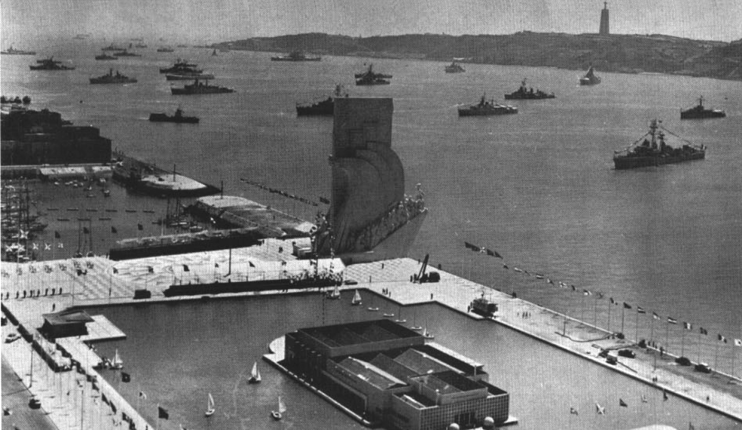
It was supposed to be temporary. In 1939, architect José Ângelo Cottinelli Telmo and sculptor Leopoldo de Almeida designed a monument shaped like a stylized caravel for the 1940 Portuguese World Exhibition — a celebration of empire organized under the Estado Novo regime of António de Oliveira Salazar. The monument stood in the Praça do Império, a romanticized idealization of Portuguese exploration rendered in perishable materials. Cottinelli Telmo himself had reservations about the project. But temporary things have a way of becoming permanent in Lisbon, and twenty years later the monument was rebuilt in concrete and stone on the northern bank of the Tagus, where ships once departed to explore and trade with India and the Orient.
Thirty-Three Figures Facing the Sea
The permanent monument, completed on 10 October 1960, rises from the riverbank like a giant stone prow cutting into the Tagus. Henry the Navigator stands at the bow, holding a small caravel. Behind him, thirty-two figures line both sides of the monument — explorers, cartographers, missionaries, monarchs, and poets who shaped Portugal's Age of Discovery during the 15th and 16th centuries. The lineup is simultaneously a history lesson and a political statement: these were the figures the Estado Novo chose to celebrate, the narrative of national greatness it wished to project. At the monument's base, a mappa mundi designed in colored marble and stone maps the routes of Portuguese explorers across the globe, a compass rose 50 meters in diameter gifted by South Africa in 1960.
A Monument Between Two Eras
The original 1940 structure was part of an urban renewal project championed by minister Duarte Pacheco, who transformed Belém's waterfront into a showcase for Salazar's vision of Portuguese identity. By the time the government decreed a permanent reconstruction on 3 February 1958, the political context had shifted but the monument's symbolism had not. It was transferred to the General Administration of the Port of Lisbon, and then largely neglected between 1960 and 1979 — a strange fate for a monument to national glory. An accord with Lisbon's municipal government in 1962 was meant to transfer responsibility, but decades of bureaucratic inertia followed before restoration and renewed public engagement gave the monument its current life as museum, viewpoint, and cultural landmark.
Glory and Its Shadows
The Monument of the Discoveries occupies complicated ground, both literally and figuratively. It celebrates an era of extraordinary maritime achievement — the voyages that connected continents, mapped oceans, and transformed global trade. But the Age of Discovery was also an age of colonization, forced labor, and cultural destruction. Modern visitors encounter the monument as both a historical document and an ongoing conversation about how nations remember their pasts. The mappa mundi at its base, tracing routes across Africa, Asia, and the Americas, tells the story from the explorer's perspective; the stories of the people encountered along those routes are told elsewhere, if at all. The monument's power lies precisely in this tension: it is magnificent, unapologetic, and incomplete.
The Belém Waterfront Today
Standing on the Tagus riverbank between the Jerónimos Monastery and the Tower of Belém, the Monument of the Discoveries anchors a stretch of Lisbon's waterfront dense with historical and cultural landmarks. Visitors can take an elevator to the top for panoramic views of the river, the 25 de Abril Bridge, and the red rooftops of Lisbon spreading inland. The area around the monument has evolved from Salazar-era grandeur into a public space where joggers, tourists, and locals mix freely. The monument itself has become enough of a global icon to feature as a challenge location on The Amazing Race, where contestants measured Ferdinand Magellan's circumnavigation route on the marble mappa mundi — exploration reduced to a game show task, which might be the most honest thing anyone has done with it.
From the Air
Located at 38.694°N, 9.206°W on the Belém waterfront along the Tagus River. The monument's distinctive caravel shape is visible from altitude along the north bank of the Tagus estuary. Look for it between the Jerónimos Monastery (large limestone complex to the north) and the Tower of Belém (small fortified tower in the river to the west). The 50-meter compass rose at its base may be visible in clear conditions. Recommended viewing altitude: 1,500-3,000 ft. Nearest airport: Lisbon/Humberto Delgado (LPPT) approximately 10 km east. The Tagus estuary provides excellent visual orientation.