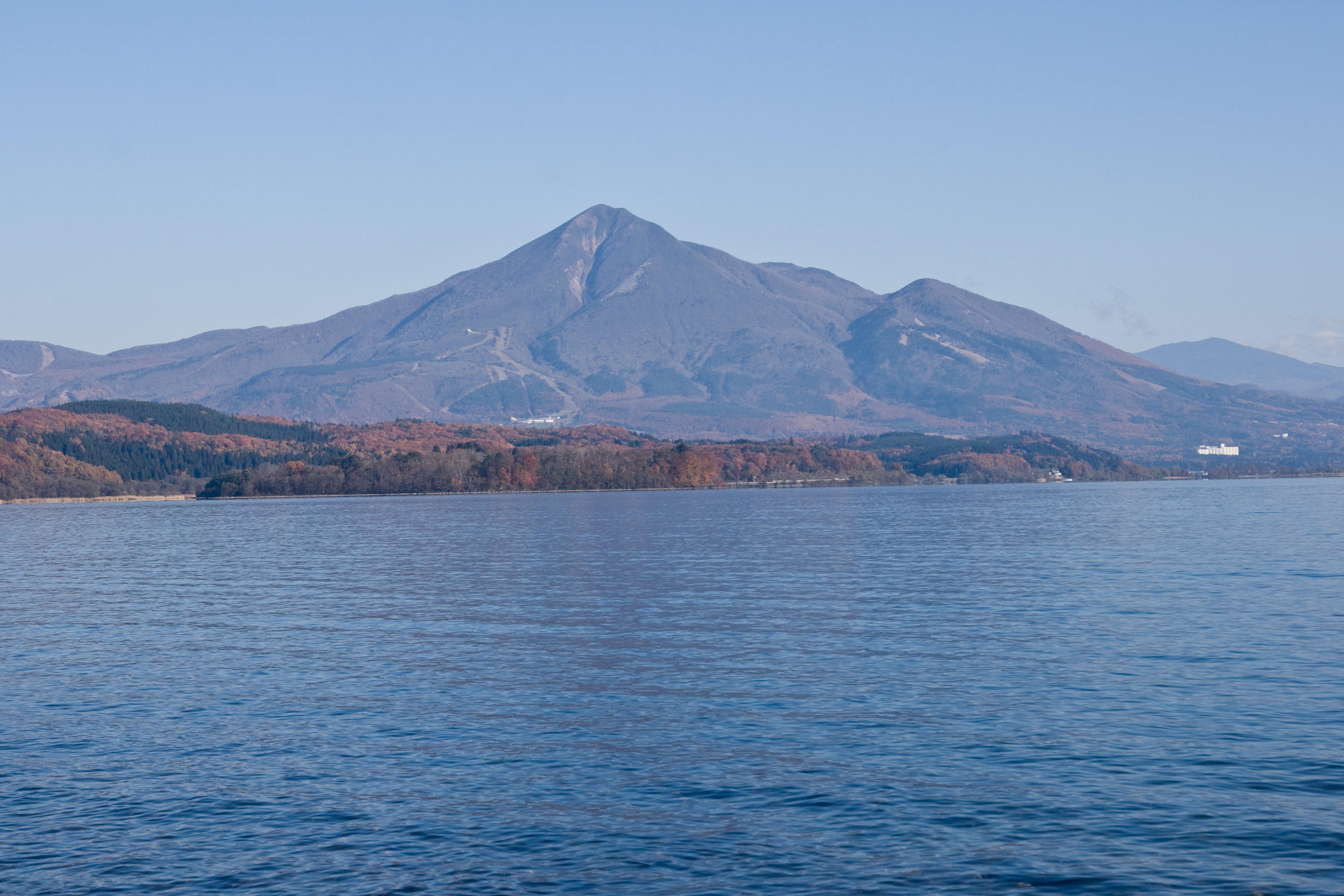
Mount Bandai
The name means "a rock ladder to the sky," and the locals call it Aizu Fuji for the way its southern profile mimics Japan's most famous peak. But walk around to the north side of Mount Bandai and the resemblance vanishes. Where the south face presents a tidy volcanic cone rising 1,816 meters above the rice paddies of Inawashiro, the north face is a torn-open wound -- the result of a catastrophic collapse in 1888 that obliterated the summit, buried five villages, and accidentally created one of the most beautiful lake districts in all of Japan.
Two Faces of a Mountain
Bandai-san sits at the heart of Fukushima Prefecture's highland country, anchoring the Bandai-Asahi National Park. The small towns of Inawashiro and Aizu-Wakamatsu spread across the lowlands to its south, looking up at what appears to be a perfectly formed stratovolcano. But the mountain has a split personality. The area called Omotebandai -- literally "front Bandai" -- is all orderly slopes and gentle treelines. Cross to Urabandai, "behind Bandai," and the landscape turns wild. Here the mountain's shattered northern flank drops into an alpine basin studded with more than 300 lakes and ponds, their waters tinted emerald, cobalt, and rust by volcanic minerals. The most famous cluster, Goshikinuma -- the Five Colored Ponds -- shifts hue with the seasons and the angle of the light, their colors produced by aluminum silicate crystals suspended in the acidic water.
The Day the Mountain Fell
On the morning of July 15, 1888, a series of earthquakes rattled through the mountain. Then came a phreatic eruption -- superheated groundwater flashing to steam -- that blew the north face of Kobandai peak apart. The entire northern slope collapsed in a debris avalanche that roared downhill, damming rivers, burying villages, and killing 477 people. It was the deadliest volcanic disaster in Japan since the Meiji government had come to power two decades earlier. The government launched an unprecedented scientific investigation, dispatching surveyors and photographers to document the destruction. The Japanese Red Cross, formed only the year before, mounted its first peacetime disaster relief operation. Where rivers once flowed, new lakes appeared: Hibara, Onogawa, Akimoto, and the jewel-toned Goshikinuma ponds. The eruption destroyed a Fuji-shaped summit that had stood for over a thousand years and left behind the ragged, asymmetrical mountain visible today.
Powder, Ponds, and Onsen
The same volcanic forces that tore Bandai apart also blessed the region with geothermal heat and five months of heavy snowfall each winter. Several ski resorts operate on the mountain's flanks, drawing powder seekers from across Tohoku. In warmer months, the hiking trails offer everything from gentle lakeside strolls through the Goshikinuma area to full summit ascents. The volcanic springs feed onsen scattered through the surrounding towns -- the Urabandai Nekoma Hotel keeps one in its basement, drawing water straight from the earth. Lake Inawashiro, Japan's fourth-largest freshwater lake, spreads across 104 square kilometers at the mountain's southern foot, hosting migrating swans each winter. Canoeing, fishing, and camping on the lake's islands round out a landscape that feels impossibly lush for a place born of destruction.
Getting Behind Bandai
Reaching the area from Tokyo involves the Tohoku Shinkansen to Koriyama, then a transfer to the Ban'etsu West Line for Inawashiro or Aizu-Wakamatsu -- both solid base towns for exploration. Urabandai, the highland basin behind the volcano, is reached by bus from Inawashiro. Its main hub goes by the confusing name Bandaikogen Eki, but don't look for a train station: "eki" here is just part of the place name, and buses are the only public transport. A slower but more scenic alternative runs the Aizu Tetsudo railway from the Nikko area, threading through alpine valleys on its way north. The region also has one of the more memorable camping options in Japan: Matsubara Camp on Lake Hibara, accessible only by boat, where the absence of road noise lets you hear nothing but water and wind.
From the Air
Located at 37.60N, 140.07E in Fukushima Prefecture, northern Honshu. Mount Bandai rises to 1,816 meters (5,959 feet) and is visually distinctive from altitude due to the dramatic asymmetry between its intact southern cone and the collapsed northern face. Lake Inawashiro, Japan's fourth-largest freshwater lake, lies immediately to the south and serves as an excellent visual landmark. The Goshikinuma lake cluster is visible on the north side of the mountain. Nearest major airport: Fukushima Airport (RJSF), approximately 50km to the south. Sendai Airport (RJSS) is approximately 130km to the northeast. Mountain weather can produce rapid cloud buildup, especially in summer. Heavy snowfall region from November through March.